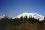






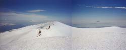


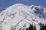
Mount Rainier is the tallest volcano and most heavily glaciated peak in the contiguous United States. The massive snowfall (averaging well over 600 inches annually) allows skiing nearly year-round on many areas of the mountain. Although about 5000 people successfully climb Rainier each year, only a few percent of them ski from the summit. The first ascent of Rainier was in 1870, but the first ski descent did not occur until 1948, many years after the descents of other volcanoes such as Mounts Adams and Baker. Many would-be summit skiers are deterred by the crevasse hazard (all summit routes are heavily glaciated), highly variable ski conditions (usually frozen on the summit with mush down below), and additional effort needed to haul skis up to the 14411 ft (4392 m) summit. However, in favorable conditions, the descent from the summit of Rainier via the Emmons-Winthrop Glacier route (the second most popular climbing route) is a reasonably safe and enjoyable ski run. The near-continuous descent of up to 10000 vertical feet (3000 m) is one of the largest possible in the contiguous United States.
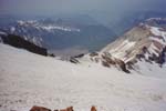
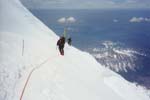
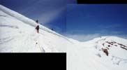
Several of us had planned to do a ski circumnavigation of Rainier in the spring of 1999, but continual foul weather postponed the trip repeatedly. By July, the crevasse conditions had become too risky to do that trip this year, but some of us felt the Emmons might still be skiable from the summit. So Jim Fahey, Tom Demshki, and I decided to try it during one of the first good weather windows. As it turned out, the extreme snowfall during the 1998-99 season (1035 inches were recorded at Paradise, the third most ever) produced a deep snowpack on the Emmons, which buried almost all of the crevasses along the route (even in July) with only a few areas of moderate risk remaining. This made for a technically simple and very enjoyable ski descent from the true summit down nearly 9000 vertical feet into the White River valley.
Click on any photo to go there, or start your tour with the first photo...


|
| Starting Elevation: | 4300 ft (1300 m) | Weather Conditions: | Clear, sunny; moderate winds | |||
| Summit Elevation: | 14410+ ft (4392+ m) | Temperature: | 20 - 70 F (-5 - 20 C) | |||
| Roundtrip Distance: | 16 miles (25 km) | Visibility: | Over 100 miles (160 km) | |||
| Total Skiable Vertical: | 8800 ft (2700 m) | Ski Conditions: | Frozen sastrugi, hardpack, trap crust; finally perfect corn snow |
This was a private trip, with a party of three (Jim Fahey, Tom Demshki, and myself).