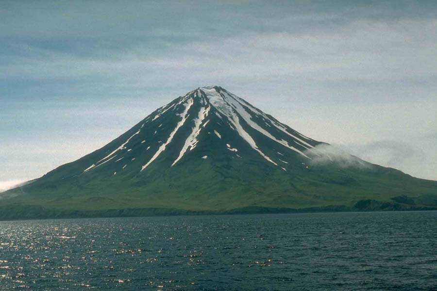
 | Carlisle Volcano from the west, July 1994 (photo by M. Harbin) <click to enlarge> |
Carlisle Volcano
5315 ft (1620 m) . |
||
| Location: | Carlisle Island in the Aleutian Islands, Alaska | ||
| Lat / Long: | 52.9° N, 170.1° W | ||
| Volcanic Type: | Stratovolcano | ||
| Volcanic Status: | Active, last eruption 1828 (possible activity in 1987) | ||
| First Ascent: | |||
| First Ski Descent: | |||
| Skiable Vertical: | over 5000 ft (1500 m) | ||
| Administration: | Alaska Maritime National Wildlife Refuge | ||
| Carlisle Volcano is a steep and spectacular cone which forms the entirety of 5 mile (8 km) wide Carlisle Island, one of the Islands of Four Mountains which are a scenic highlight of the central Aleutians. Despite its modest summit elevation, a small glacier exists high on the western slopes just below the rim of the summit crater (this is clearly visible in the photo above). A few historical eruptions of Carlisle have been recorded, but its proximity to several other neighboring volcanoes means that there has been some confusion in the older records as to which of the volcanoes was erupting. As the area is extremely remote, distant observations of volcanic plumes can not always be placed with certainty. The best access to the area is by boat or possibly floatplane, from the nearest city which is Dutch Harbor on Unalaska Island, about 150 miles (250 km) to the northeast. | |||
 |
Some useful links: Global Volcanism Program: Carlisle Volcano Alaska Volcano Observatory Alaska Maritime National Wildlife Refuge |
||
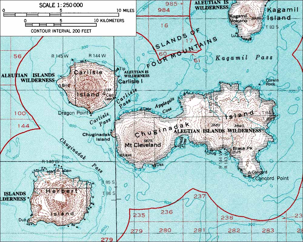
| Topographic map of Carlisle Volcano and vicinity (1:250,000 scale) from USGS Amukta and Samalga island <click to enlarge> |
|||
More photos and info about routes, access, etc. may be added in the future ... |
|||