 | Silverthrone Mountain from the northeast on the Ha-Iltzuk Icefield (photo by John Baldwin) <click to enlarge> |
Silverthrone Mountain
9400 ft (2860 m) Highest volcano in Canada (?) . |
||
| Location: | Coast Mountains, southwest British Columbia, about 75 miles (120 km) SW of Tatla Lake | ||
| Lat / Long: | 51.4° N, 126.3° W | ||
| Volcanic Type: | Eroded caldera complex? | ||
| Volcanic Status: | Dormant / extinct | ||
| First Ascent: | |||
| First Ski Descent: | |||
| Skiable Vertical: | over 5000 ft (1500 m), possibly over 9000 ft (2700 m) down to the ocean | ||
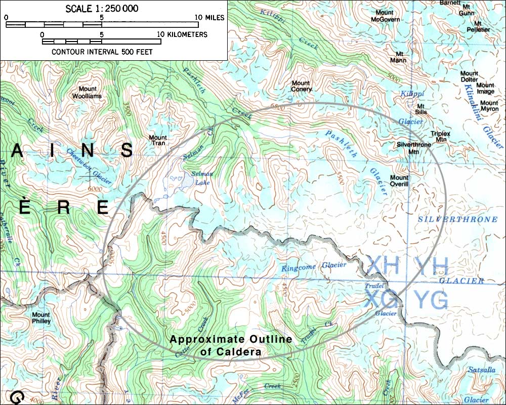
| Silverthrone Mountain is the highest point in the Ha-Iltzuk Icefield, which is the largest icefield in the Coast Mountains south of the Alaskan Panhandle and also one of the most remote, located over 200 miles (320 km) northwest of Vancouver and about 30 miles (50 km) west of Mount Waddington. Silverthrone Mountain itself is an eroded volcanic dome on the northeast edge of a large caldera complex about 12 miles (20 km) in diameter. Most of the caldera's eruptions occurred during the Ice Age and the products have since been heavily eroded, but young lava flows have erupted in post-glacial times and flowed down the Machmell River valley to the west. Volcanological references list the elevation of Silverthrone Mountain as 10360 ft (3160 m), but the current 1:50,000 scale topo map 92M/9 shows it reaching only to the 9400 ft contour line (no spot elevation is given). The shortest access to the Ha-Iltzuk Icefield region is by air from the village of Tatla Lake, landing on the main portion of the icefield which consists of the vast Klinaklini and Silverthrone Glaciers. Flights could also be made into logging camps at Owikeno Lake (Machmell River) to the west or at the head of Knight Inlet to the southwest, followed by lengthy hiking and skiing approaches. | |||
 |
Some useful links: Global Volcanism Program: Silverthrone Geological Survey of Canada: Volcanoes of Canada |
||
| Topographic map of the Silverthrone Mountain region (1:250,000 scale) from 92M Rivers Inlet <click to enlarge> |
|||
More photos and info about routes, access, etc. may be added in the future ... |
|||