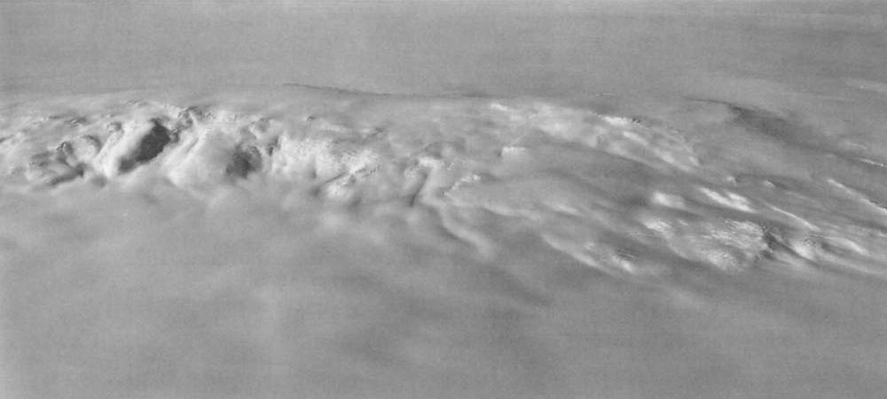
 | Aerial view of Mount Moulton from the south (U.S. Navy photo) <click to enlarge> |
Mount Moulton
10098 ft (3078 m) . |
||
| Location: | Flood Range of western Marie Byrd Land, Antarctica | ||
| Lat / Long: | 76.1° S, 135.0° W | ||
| Volcanic Type: | Shield volcano complex | ||
| Volcanic Status: | Extinct | ||
| First Ascent: | |||
| First Ski Descent: | |||
| Skiable Vertical: | over 5500 ft (1700 m) | ||
| Mount Moulton is a 15 mile (25 km) long ridge formed by two overlapping shield volcanoes, the westernmost of which is the highest summit and is located about 12 miles (20 km) east of Mount Berlin. Moulton is much older than Berlin, with lava samples dated to about 4 million years, and so it is probably long extinct. Like Mount Berlin, the base of Moulton is completely surrounded by the West Antarctic Ice Sheet, with an exposure above ice level of about 5500 ft (1700 m) on the north side and 3000 ft (900 m) on the south side. This ice sheet is over 6000 ft thick (1800 m) just to the south of the volcano, yet its ice is far younger than the ice found in the caldera of the volcano. Lengthy ice cores have recently been extracted from Moulton, yielding an age of about a half million years by dating the various tephra layers imbedded within the ice. These cores are being used to reconstruct a climatic record stretching back for 480,000 years which can be compared to that from ice cores in the main East Antarctic Ice Sheet. | |||
 |
Some useful links: United States Antarctic Resource Center USGS Atlas of Antarctic Research (online maps & photos) |
||
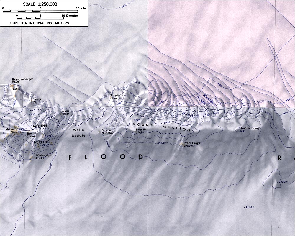
| Topographic map of Mounts Moulton and Berlin (1:250,000 scale) from USGS Mount Berlin, Hull Glacier, and Mount Kosciusko <click to enlarge> |
|||
More photos and info about routes, access, etc. may be added in the future ... |
|||