Big Sky
|
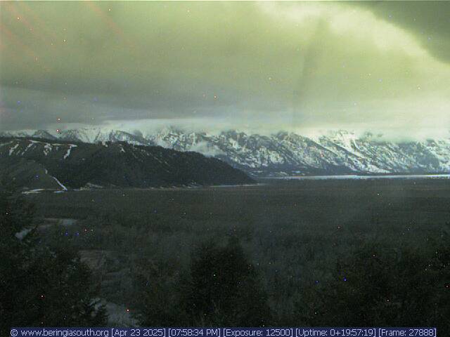
Full HD view looking east at Fan Mountain, Lone Mountain, and Sphinx Mountain,
from just south of MT 287, 5 miles SW of Ennis, 18 miles west of Lone Mountain

Elevation: 5700 ft
|
View looking SE at Fan Mountain just west of Lone Mountain,
from the north shore of Ennis Lake, 16 miles NW of Lone Mountain

Elevation: 4840 ft
|
Big Sky Resort, Interactive Tram Cam,
user-controlled movable cam atop Lone Mountain

Elevation: 11170 ft
|
Big Sky Resort, Everett's 8800 Cam atop Andesite Mountain,
looking west at Lone Mountain

Elevation: 8800 ft
|
Big Sky Resort, 18 miles NW of the NW corner of Yellowstone National Park,
Mountain Village Cam, looking west at Lone Mountain

Elevation: 7500 ft
|
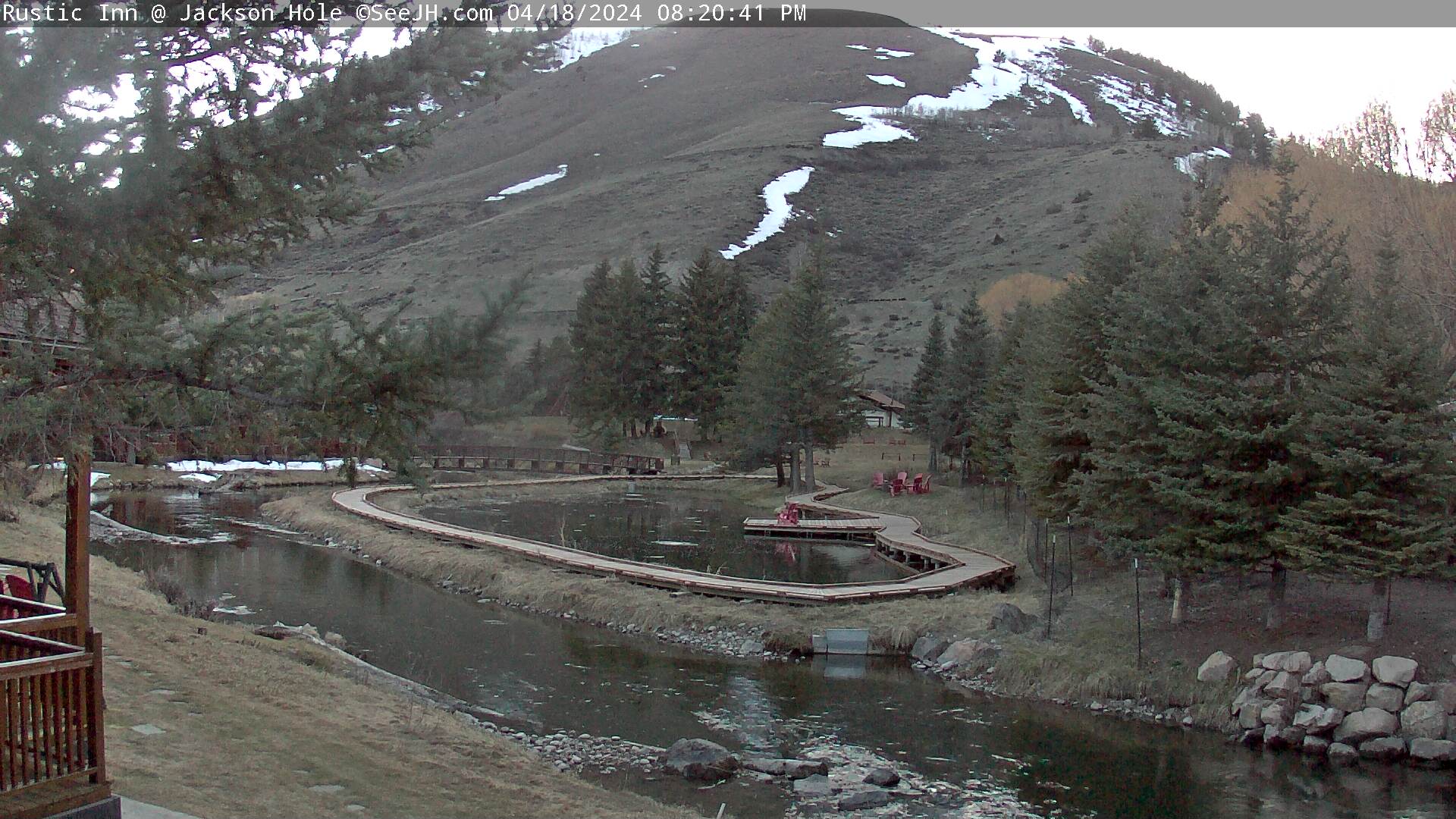
Big Sky Resort, Base Area Cam,
looking west at Lone Mountain

Elevation: 7500 ft
|
Big Sky Resort, Madison Base Area Cam, at the former
Moonlight Basin ski resort, looking south at Lone Mountain

Elevation: 7400 ft
|
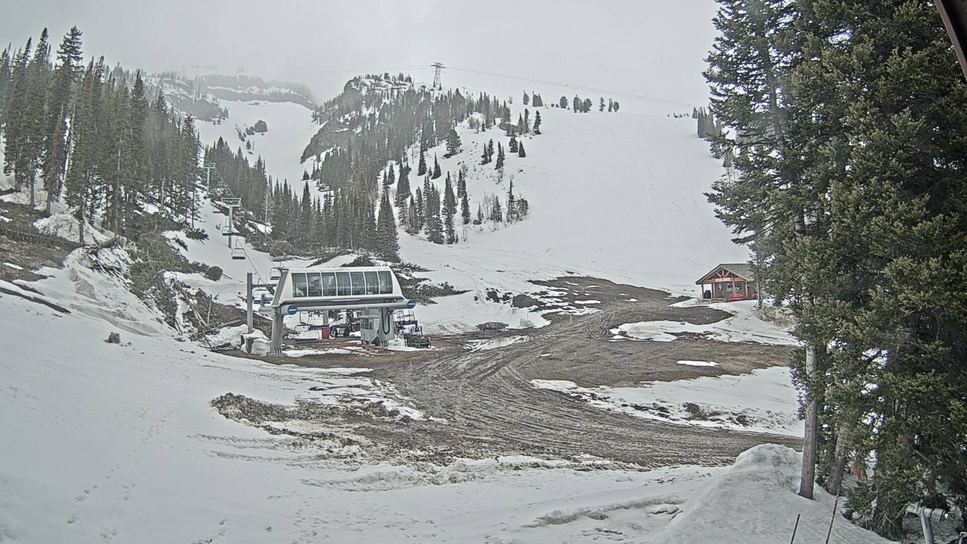
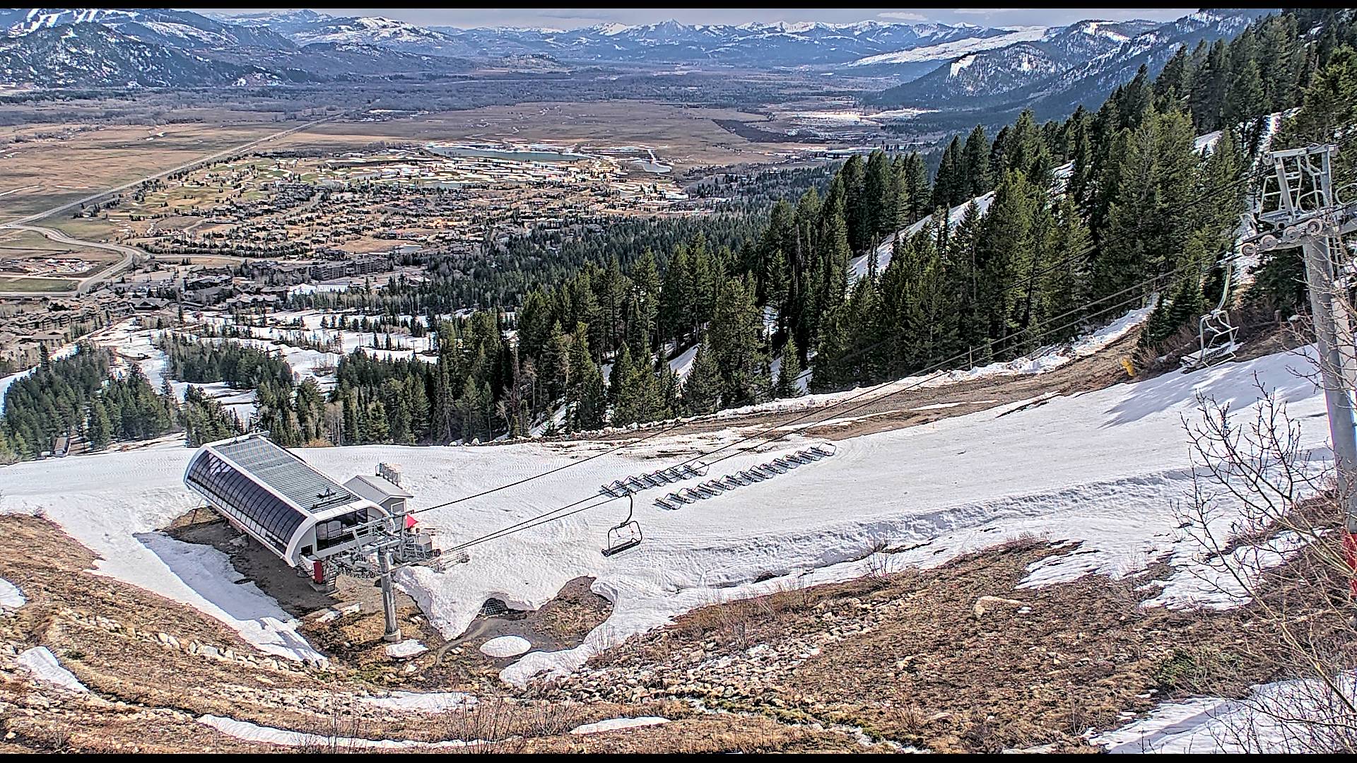
Big Sky Resort, Snowstake Cam,
located at the base of the Challenger Lift

Elevation: 8050 ft
|
Big Sky Resort,
located near the base area

Elevation: 7500 ft
|
Big Sky Town Center, east of Big Sky Resort on MT 64,
user-controlled movable cam

Elevation: 6320 ft
|
Karst on US 191 at MP 55.3, looking north,
8 miles north of MT 64 junction to Big Sky

Elevation: 5698 ft
Image modification time: Wed Dec 31, 1969 17:00 MST
|
Yellowstone National Park
|
CoolWorks Electric Peak and Yellowstone River Webcam,
looking SW at Electric Peak from US 89 NW of Gardiner, MT

Elevation: 5200 ft
|
View looking across US 89 and the Yellowstone River,
from US 89, 4 miles NW of Gardiner, MT

Elevation: 5250 ft
|
View looking south at Roosevelt Arch and the North Entrance
of Yellowstone National Park, from just north of US 89 in Gardiner, MT

Elevation: 5350 ft
|
Yellowstone National Park, North Entrance in Gardiner, MT,
looking SW at Electric Peak

Elevation: 5340 ft
|
Yellowstone National Park, North Entrance in Gardiner, MT,
looking NW at Roosevelt Arch

Elevation: 5340 ft
|
Yellowstone National Park, Mammoth Hot Springs,
Albright Visitor Center, looking south

Elevation: 6300 ft
|
Yellowstone National Park, Mammoth Hot Springs,
Albright Visitor Center, looking SW

Elevation: 6300 ft
|
Cooke City, Soda Butte Lodge, 4 miles east of
Yellowstone Park's Northeast Entrance, looking west
Elevation: 7600 ft
|
Cooke City, Soda Butte Lodge, 4 miles east of
Yellowstone Park's Northeast Entrance, looking east
Elevation: 7600 ft
|
Cooke City, 4 miles east of
Yellowstone Park's Northeast Entrance, looking south

Elevation: 7600 ft
|
Yellowstone National Park,
Mount Washburn Fire Lookout, looking NE

Elevation: 10300 ft
|
Yellowstone National Park,
Mount Washburn Fire Lookout, looking south

Elevation: 10300 ft
|
USGS Yellowstone Volcano Observatory Webcam,
view of Biscuit Basin in Yellowstone National Park

Elevation: 7300 ft
(camera location may vary)
|
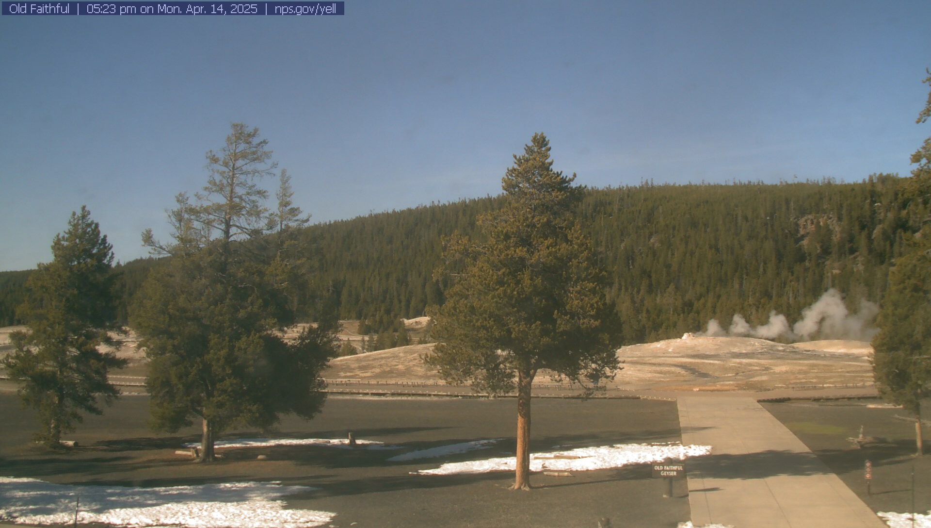
Yellowstone National Park, Old Faithful Geyser Webcam,
movable cam looking north and NW at several different geysers

Elevation: 7380 ft
Image modification time: Mon Jan 20, 2025 13:10:03 MST
|
Yellowstone National Park,
Old Faithful Geyser, looking north
Elevation: 7380 ft
|
Yellowstone National Park, Air Quality Webcam
at Old Faithful Inn Parking Lot

Elevation: 7400 ft
|
Yellowstone National Park,
West Entrance in West Yellowstone, looking west out of the park

Elevation: 6700 ft
|
Yellowstone National Park,
West Entrance in West Yellowstone, looking east into the park

Elevation: 6700 ft
|
Raynolds Pass on MT 87, camera 1 mile north of ID-MT border,
19 miles WNW of West Yellowstone, looking
Elevation: 6778 ft
Image modification time: Wed Dec 31, 1969 17:00 MST
|
Raynolds Pass on MT 87, camera 1 mile north of ID-MT border,
19 miles WNW of West Yellowstone, looking
Elevation: 6778 ft
Image modification time: Wed Dec 31, 1969 17:00 MST
|
Raynolds Pass on MT 87, camera 1 mile north of ID-MT border,
19 miles WNW of West Yellowstone, looking
Elevation: 6778 ft
Image modification time: Wed Dec 31, 1969 17:00 MST
|
Raynolds Pass on MT 87, camera 1 mile north of ID-MT border,
19 miles WNW of West Yellowstone, looking
Elevation: 6778 ft
Image modification time: Wed Dec 31, 1969 17:00 MST
|
Henrys Lake on US 20, 5 miles SW of ID-MT border,
12 miles WSW of West Yellowstone, looking north

Elevation: 6617 ft
|
Henrys Lake on US 20, 5 miles SW of ID-MT border,
12 miles WSW of West Yellowstone, looking south

Elevation: 6617 ft
|
Rendezvous Ski Trail Web Cam,
West Yellowstone, just west of the West Entrance

Elevation: 6700 ft
|
Yellowstone IMAX Theatre,
West Yellowstone, just west of the West Entrance

Elevation: 6700 ft
|
Yellowstone Kelly Inn,
West Yellowstone, just west of the West Entrance

Elevation: 6700 ft
|
West Yellowstone Grizzly & Wolf Discovery Center,
just west of the West Entrance, Bear Habitat Webcam

Elevation: 6700 ft
|
Yellowstone ClubHouse Inn,
West Yellowstone, just west of the West Entrance

Elevation: 6700 ft
|
West Yellowstone Webcam,
just west of the West Entrance

Elevation: 6700 ft
|
Grand Teton National Park & Grand Targhee
|
Distant view of Teton Range from ID 33 near Tetonia, ID,
located 25 miles WNW of the Grand Teton

Elevation: 6185 ft
|
View of Teton Range from Teton Valley north of Driggs, ID,
located 16 miles WNW of the Grand Teton
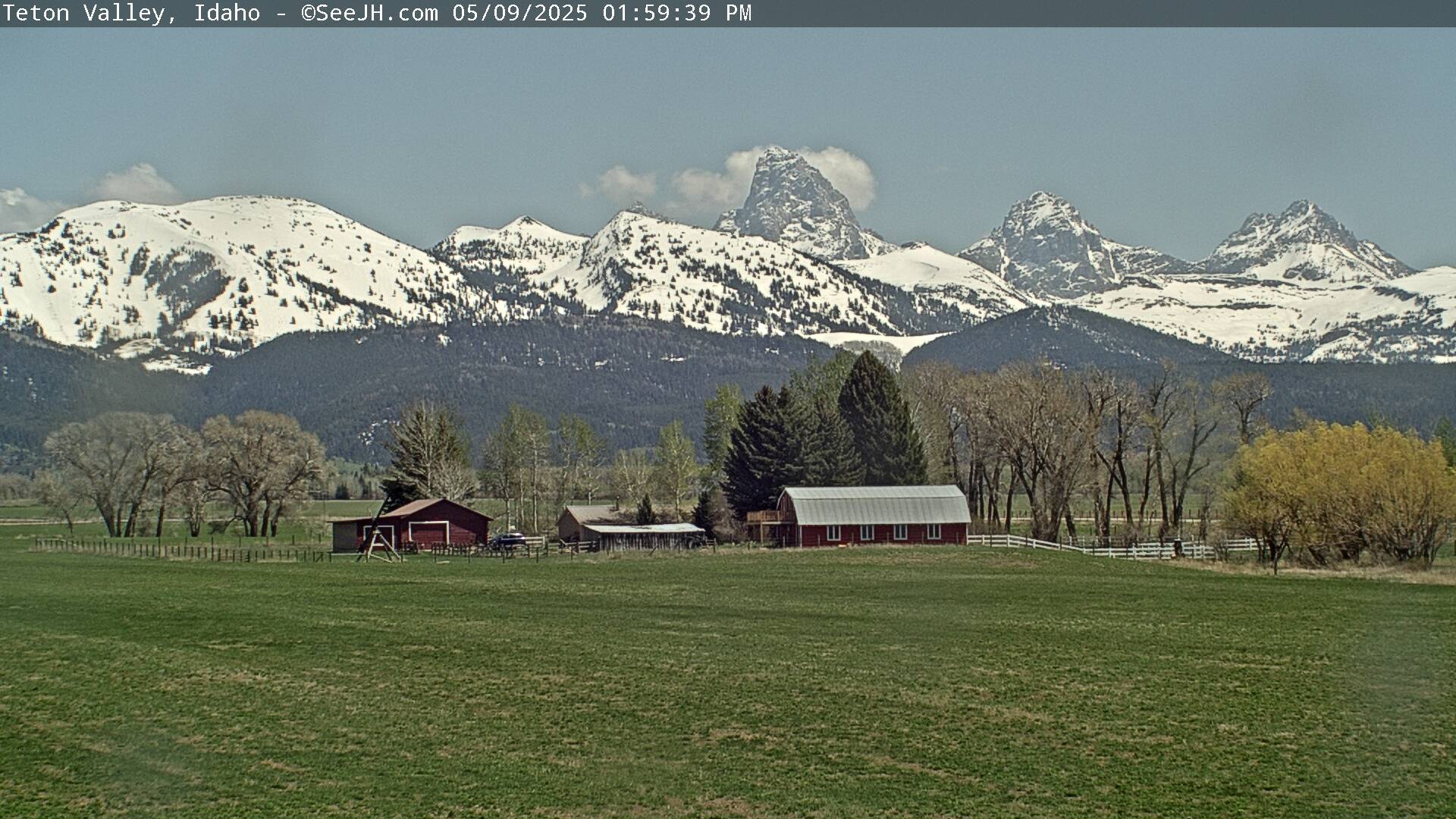
Elevation: 6260 ft
|
Zoomed view of Teton Range from Teton Valley in Driggs, ID,
located 14 miles west of the Grand Teton
(includes annual archives of saved images since Dec 2009)
![]()
Elevation: 6300 ft
|
View from the Colter Building in downtown Driggs, ID,
15 miles west of the Grand Teton

Elevation: 6150 ft
|
View from the summit of Fred's Mountain at Grand Targhee Ski Resort,
movable cam located 7 miles WNW of the Grand Teton,
view rotates every 30 seconds with a stunning closeup shot of the Tetons
Elevation: 9860 ft
|
View of Dreamcatcher Lift and Fred's Mountain at Grand Targhee Ski Resort,
8 miles WNW of the Grand Teton
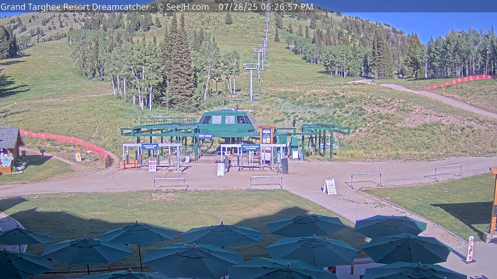
Elevation: 7980 ft
|
View of Peaked Mountain at Grand Targhee Ski Resort,
8 miles WNW of the Grand Teton

Elevation: 7980 ft
|
View of Plaza at Grand Targhee Ski Resort,
8 miles WNW of the Grand Teton

Elevation: 7980 ft
|
View of Teton Range from Grand Teton Climbers' Ranch,
located 4 miles ESE of the Grand Teton

Elevation: 6700 ft
|
View of Teton Range from Dornan's in Moose,
located 7 miles SE of the Grand Teton
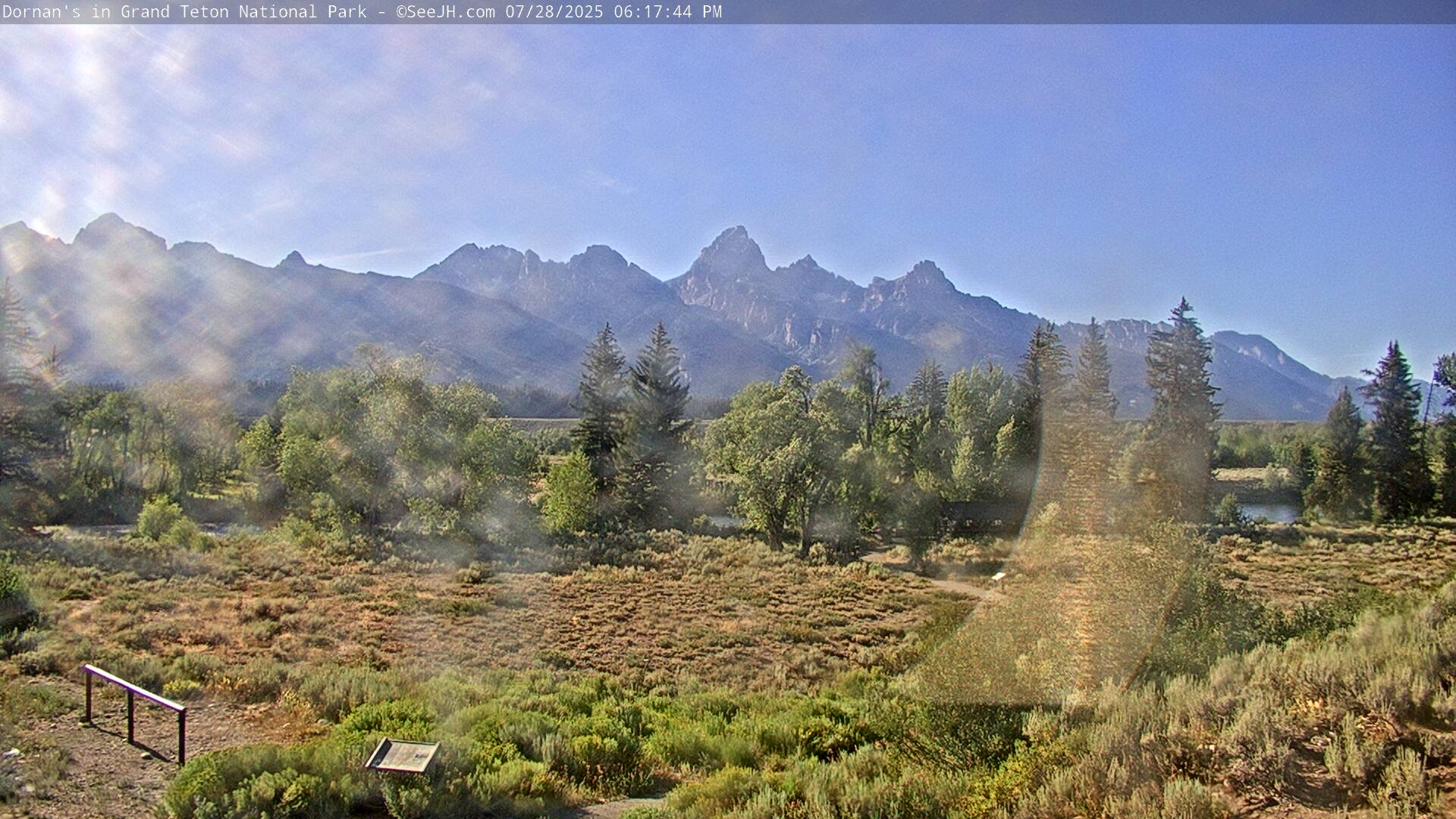
Elevation: 6500 ft
|
View of Teton Range from Jackson Hole Airport,
located 10 miles SE of the Grand Teton
Elevation: 6450 ft
|
Grand Teton National Park, Air Quality Webcam,
at Teton Science Center, 11 miles ESE of the Grand Teton

Elevation: 7000 ft
|
View of Teton Range and Gros Ventre River
from Kelly, 12 miles SE of the Grand Teton
Elevation: 6700 ft
|
View of Teton Range from Lost Creek Ranch, located on the east side
of Grand Teton National Park, 11 miles east of the Grand Teton

Elevation: 7100 ft
|
View of northern Teton Range and Mt Moran from 18 miles east in Moran,
located 20 miles ENE of the Grand Teton

Elevation: 6800 ft
|
View of Teton Range from Heart Six Ranch in Moran,
located 21 miles ENE of the Grand Teton

Elevation: 6800 ft
|
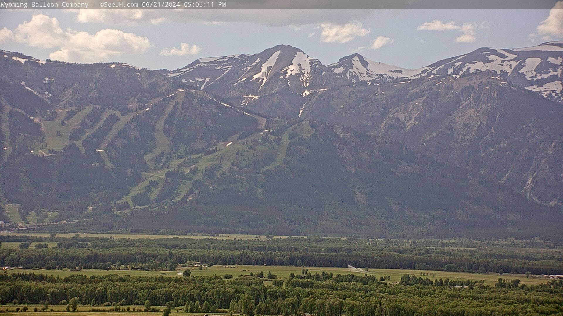
Jackson Hole Mountain Resort
|
View of Cody Bowl from just below the top of Jackson Hole Mountain Resort,
11 miles SSW of the Grand Teton, looking SW
Elevation: 10320 ft
|
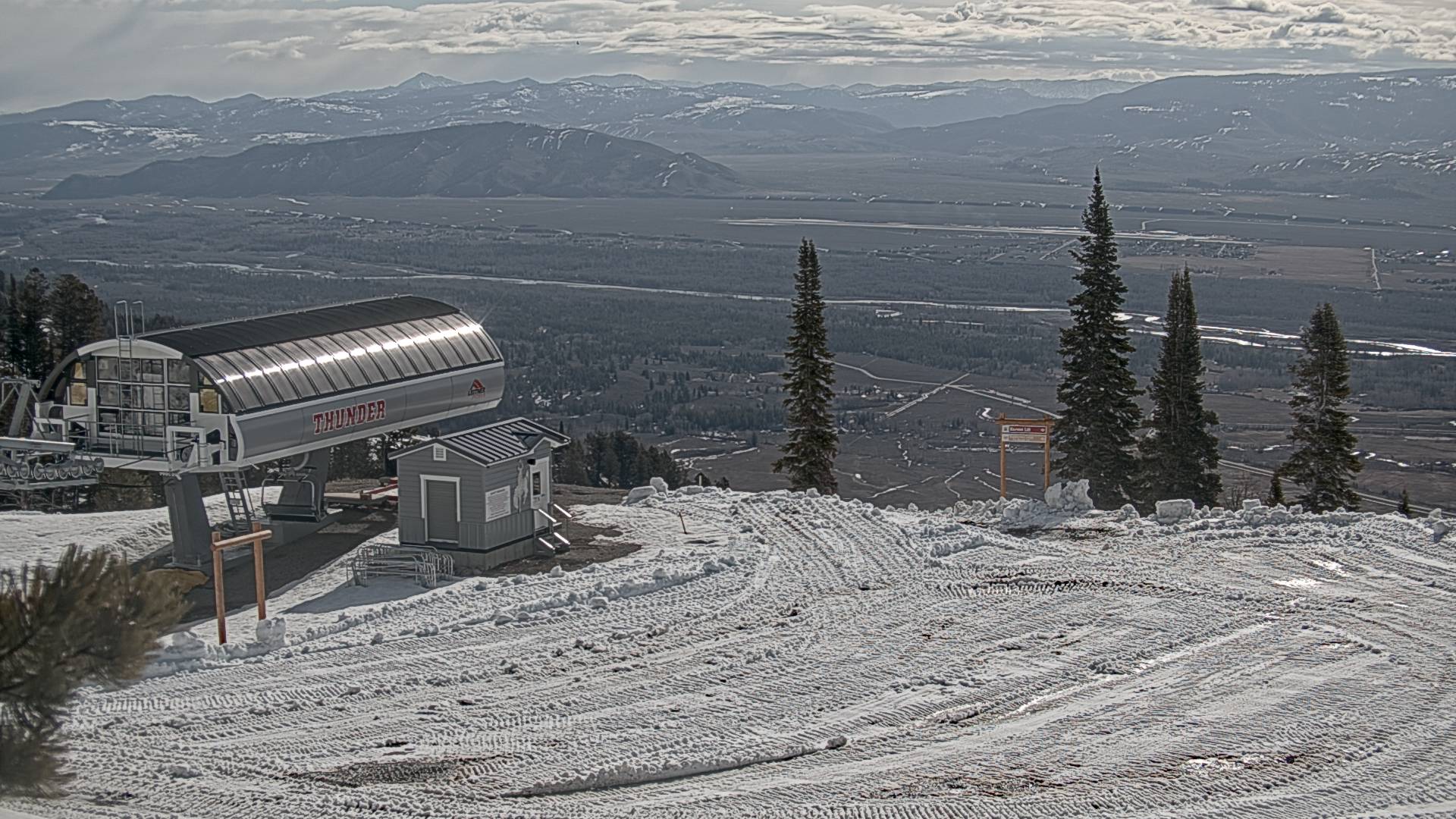
Top Of Thunder Lift at Jackson Hole Mountain Resort,
looking NE at Rendezvous Lodge and top of Bridger Gondola
Elevation: 9350 ft
|
Rendezvous Lodge, top of Bridger Gondola at Jackson Hole Mountain Resort,
10 miles SSW of the Grand Teton, looking east into Jackson Hole Valley

Elevation: 9100 ft
|
Rendezvous Lodge, top of Bridger Gondola at Jackson Hole Mountain Resort,
looking SE into Jackson Hole Valley

Elevation: 9100 ft
|
Rendezvous Lodge, top of Bridger Gondola at Jackson Hole Mountain Resort,
looking SW at summit of Rendezvous Mountain

Elevation: 9100 ft
|
Top of the Teton Lift at Jackson Hole Mountain Resort,
9 miles SSW of the Grand Teton, looking SE into Jackson Hole Valley
Elevation: 9040 ft
|
Bottom of the Teton Lift at Jackson Hole Mountain Resort,
10 miles SSW of the Grand Teton, looking south into Jackson Hole Valley
Elevation: 7320 ft
Image modification time: Wed Feb 26, 2025 16:26:35 MST
|
Thunder Chair, Tower2, at Jackson Hole Mountain Resort,
10 miles SSW of the Grand Teton, looking east into Jackson Hole Valley
Elevation: 8150 ft
|
Casper Chair at Jackson Hole Mountain Resort,
10 miles SSW of the Grand Teton, looking SE into Valley

Elevation: 7800 ft
|
Base of Bridger Gondola at Jackson Hole Mountain Resort,
11 miles south of the Grand Teton, looking west at Rendezvous Mountain
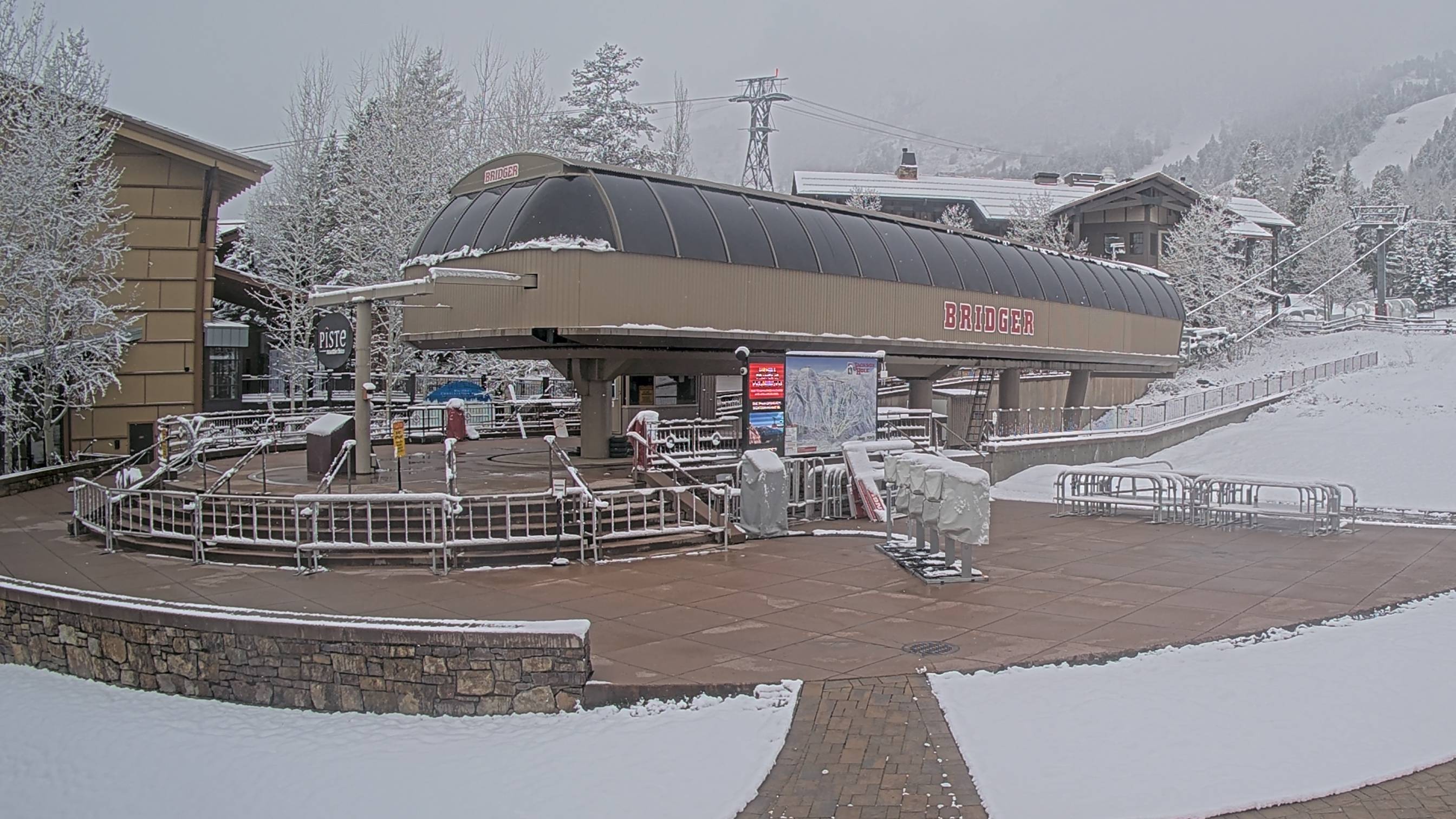
Elevation: 6350 ft
Image modification time: Wed Feb 26, 2025 16:26:34 MST
|
Base of Teewinot Chair at Jackson Hole Mountain Resort,
11 miles south of the Grand Teton, looking north at Apres Vous Mountain
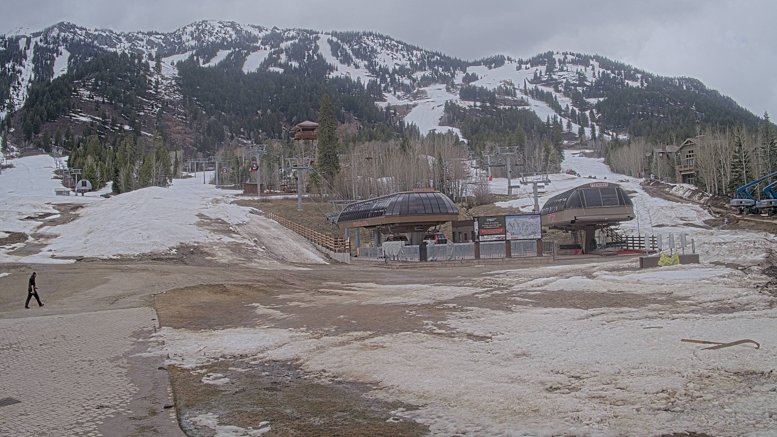
Elevation: 6350 ft
Image modification time: Wed Feb 26, 2025 16:26:35 MST
|
Base of Aerial Tram at Jackson Hole Mountain Resort,
11 miles south of the Grand Teton, looking west at Rendezvous Mountain
Elevation: 6300 ft
|
Base of Aerial Tram at Jackson Hole Mountain Resort,
11 miles south of the Grand Teton, looking SW
Elevation: 6300 ft
|
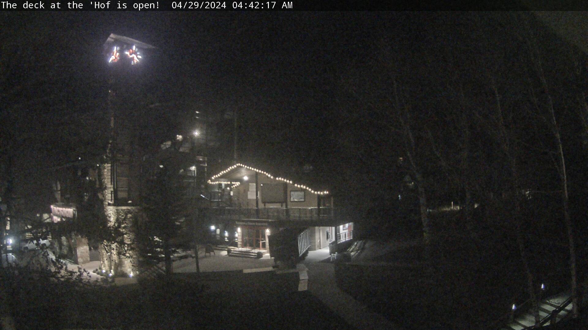
Teton Village at the foot of Jackson Hole Mountain Resort,
11 miles south of the Grand Teton, looking west at Rendezvous Mountain
Elevation: 6300 ft
|
Teton Village at the foot of Jackson Hole Mountain Resort,
11 miles south of the Grand Teton, looking west at Rendezvous Mountain

Elevation: 6300 ft
|
Teton Village at the foot of Jackson Hole Mountain Resort,
11 miles south of the Grand Teton, looking north at Apres Vous Mountain

Elevation: 6300 ft
|
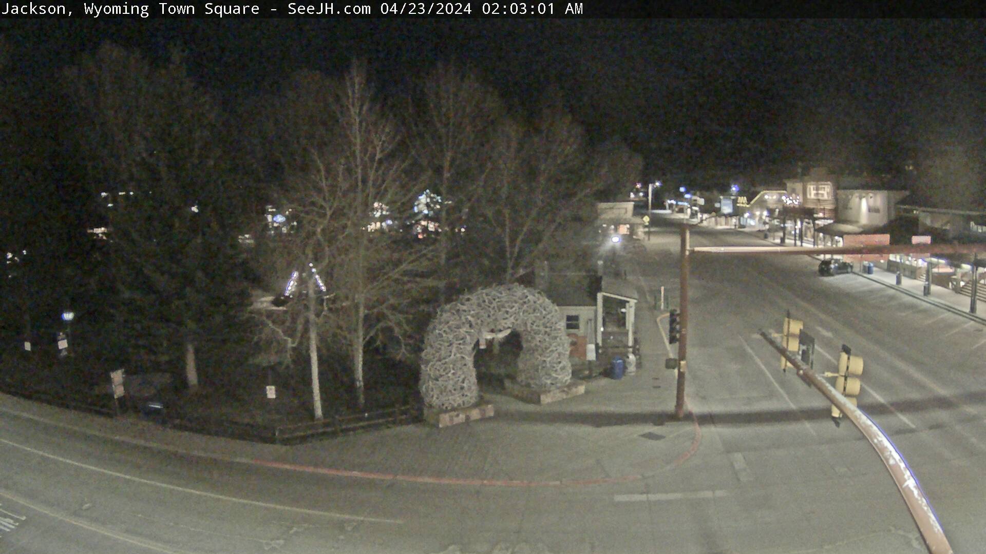
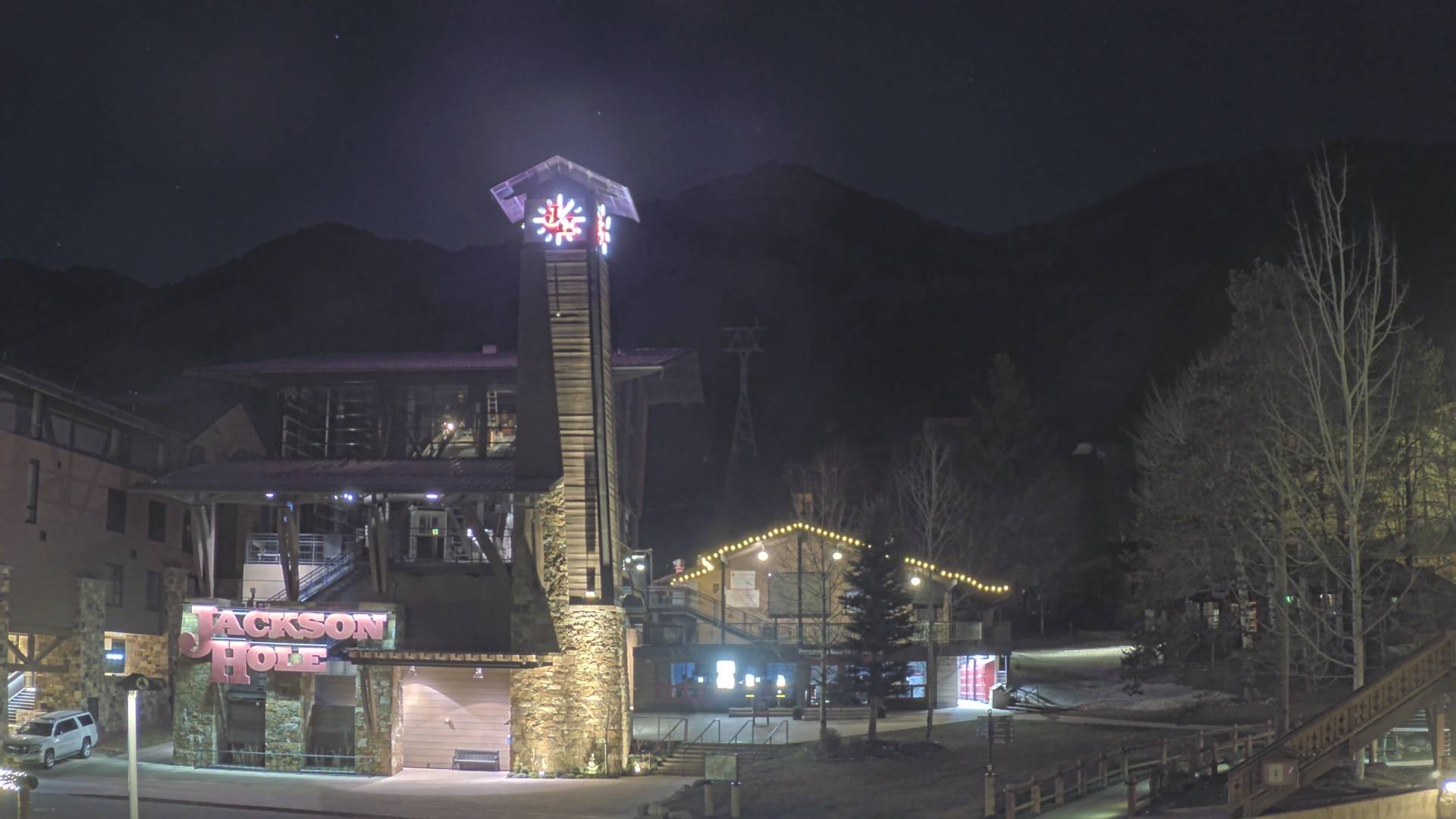
Jackson
|
View of Teton Range from East Gros Ventre Butte above Jackson,
located 15 miles SSE of the Grand Teton
Elevation: 6600 ft
|
View of Sleeping Indian (Sheep Mountain) above National Elk Refuge,
looking east from same point on East Gros Ventre Butte as previous cam

Elevation: 6600 ft
|
View of the National Elk Refuge, looking east
from Flat Creek Inn on US 89, 2 miles north of Jackson
Elevation: 6250 ft
|
View of the National Elk Refuge, looking east
from Flat Creek Inn on US 89, 2 miles north of Jackson

Elevation: 6250 ft
|
View of Teton Range from the Granary Restaurant at Spring Creek Ranch,
on East Gros Ventre Butte, 16 miles south of the Grand Teton

Elevation: 6900 ft
|
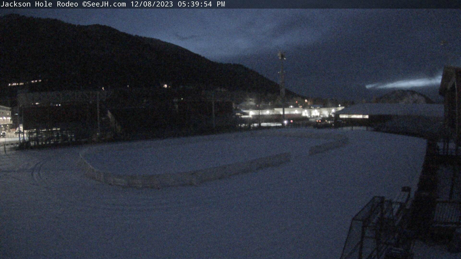
View of Teton Range and town of Jackson from top of Snow King Mountain,
just south of Jackson, 19 miles south of the Grand Teton

Elevation: 7800 ft
|
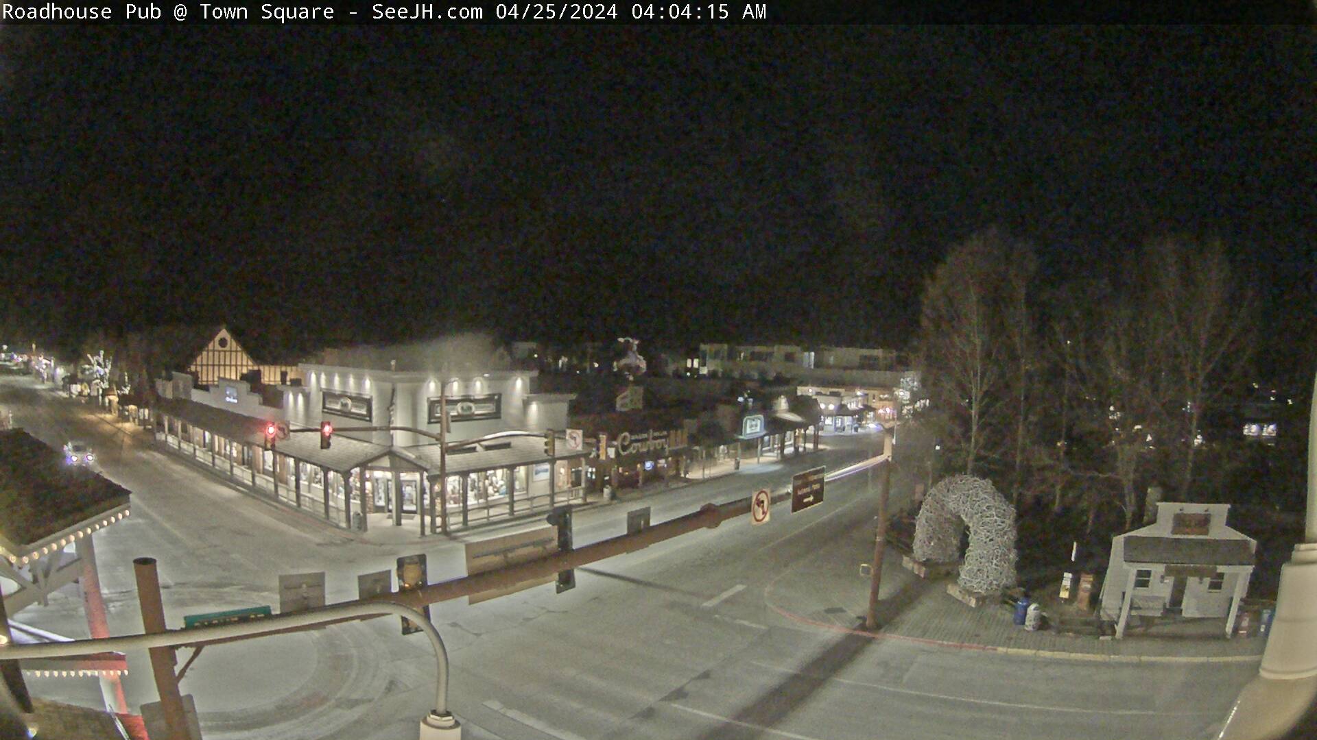
View of Snow King Mountain,
looking south from the town of Jackson
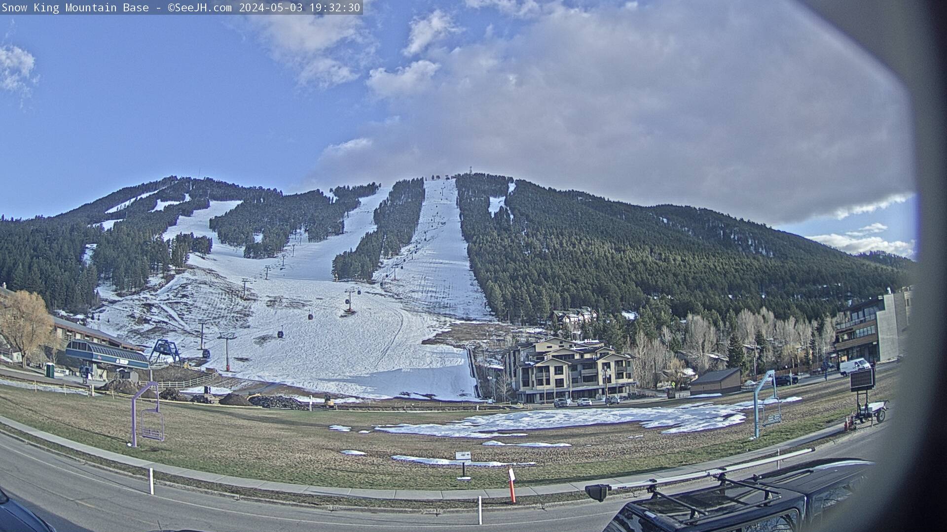
Elevation: 6250 ft
|
View of the base of Snow King Mountain,
looking east from the town of Jackson

Elevation: 6250 ft
|
Teton Pass
|
WYO 22 at Idaho State Line MP 17.3, 6 miles NW of Teton Pass,
18 miles SW of the Grand Teton, looking west

Elevation: 6700 ft
|
WYO 22 at Idaho State Line MP 17.3, 6 miles NW of Teton Pass,
18 miles SW of the Grand Teton, looking east

Elevation: 6700 ft
|
WYO 22 at Idaho State Line MP 17.3, 6 miles NW of Teton Pass,
18 miles SW of the Grand Teton, looking at roadway

Elevation: 6700 ft
|
WYO 22 at Teton Pass MP 11.2,
18 miles SSW of the Grand Teton, looking west

Elevation: 8440 ft
|
WYO 22 at Teton Pass MP 11.2,
18 miles SSW of the Grand Teton, looking east

Elevation: 8440 ft
|
WYO 22 at Teton Pass MP 11.2,
looking NE into Jackson Hole Valley

Elevation: 8440 ft
|
WYO 22 at Teton Pass MP 11.2,
looking north at Glory Peak

Elevation: 8440 ft
|
WYO 22 at Wilson MP 6.9,
17 miles SSW of the Grand Teton, looking west

Elevation: 6500 ft
|
WYO 22 at Wilson MP 6.9,
17 miles SSW of the Grand Teton, looking east

Elevation: 6500 ft
|
WYO 22 at Wilson MP 6.9,
17 miles SSW of the Grand Teton, looking at roadway

Elevation: 6500 ft
|
| Show telemetry | Hide telemetry |
|
| Page History: |
|
| November 2010 | Original version with 8 camera views,
designed based on the Mount Rainier Paradise WebCams webpage
Includes the option to show the last 24 hours of SNOTEL
telemetry data from within Yellowstone National Park below the webcams, and code to error-check for missing SNOTEL data
Discovered and fixed a minor bug in the SNOTEL data display, which only occurred between 11pm and midnight and showed the previous day's date for the 0000 hour's data row
|
| February 2012 | Updated the URLs from which to download the SNOTEL data, which had recently been changed slightly |
| April 2012 |
Update code which grabs the modification time of the Yellowstone National Park Air Quality Webcam, the source file had recently been changed slightly |
| September 2012 | Fixed 1 camera URL which had changed |
| December 2012 | Added more code to properly handle the new HTTP Status 404 errors from the SNOTEL server, and other unknown SNOTEL errors |
| March 2013 |
Forced to write a new external script to grab SNOTEL data,
after the long-existing SNOTEL data programs on the NWCC website were suddenly redirected to a beta-version report generator
The new script is a major improvement, it displays wind and solar data for any SNOTEL sites which have those sensors, mostly installed within the last few years
Added the West Yellowstone and Northeast Entrance SNOTEL sites located within the Park in Montana, plus the nearby Grassy Lake and Grand Targhee SNOTEL sites
Expanded to 12 camera views, adding several views of adjacent Grand Teton National Park, and renamed this page to reflect that
|
| August 2013 | Expanded to 15 camera views, adding 3 new Yellowstone webcams
Revised the page layout to use separate tables for each row, to better accommodate the very different widths of images
|
| October 2013 | Fixed one camera link which had changed |
| February 2014 |
Reduced to 14 camera views, adding the new Grand Teton air quality webcam,
and removing two long-defunct Yellowstone webcam images which had been permanently replaced
Reduced image sizes slightly from 480-360-240 to 440-330-220 pixels high
|
| March 2014 |
Added an option to disable the NPS Air Quality Webcams (by appending "&aq=off" to the URL) if this page is not loading properly,
as server issues on that website are often the cause of such problems
|
| April 2014 | Very small tweak to properly handle display of missing hours for SNOTEL sites with 3 hour data interval |
| November 2014 |
Expanded to 16 camera views in 4 rows, adding the Spring Creek Ranch, top of Snow King, and Teton Valley webcams,
and removing the long-defunct Yellowstone Upper Geyser Basin webcam, which appears to be permanently gone
|
| December 2014 |
Expanded to 18 camera views, adding views of the Tetons from Dornan's in Moose and Heart Six Ranch in Moran,
and also added distances from all Teton cameras to the Grand Teton
|
| January 2015 | Wind sensors added to Lewis Lake Divide SNOTEL site |
| September 2015 | Fixed one camera link which had changed |
| November 2015 |
Added 6 more SNOTEL sites located near the parks (Madison Plateau, Black Bear, Fisher Creek, White Mill, Base Camp, Phillips Bench), for a total of 18 SNOTEL sites
Reduced image sizes slightly from 440-330-220 to 400-300-200 pixels high
|
| January 2016 |
Wrote a new external script to grab data from MesoWest (such as the data from
the RAWS telemetry sites), which downloads the data as a CSV file and formats it to match the style of the SNOTEL data
Added 8 regional RAWS hourly telemetry sites in and near
Yellowstone and Grand Teton National Parks which have precip, wind, solar, and other sensors (but not snowdepth)
Reorganized the now 26 total SNOTEL and RAWS telemetry sites into a more logical geographic order, and improved the location info for several of the SNOTEL sites
|
| February 2016 |
Expanded to 26 camera views in 5 rows, adding the still image from the Old Faithful Geyser Streaming Webcam (finally found a link to it!),
the CoolWorks Electric Peak cam, and the Yellowstone North Entrance movable cam,
plus views of the Tetons from near Tetonia, Driggs, Grand Targhee, Jackson Hole Airport, and Moran
Changed the few listed image modification times to use the correct Mountain Time Zone, although many other times on this page
such as the SNOTEL telemetry data remain fixed to Pacific Time
Added the capability to display telemetry data from the Bridger-Teton Avalanche Center,
which had been on the agenda since 2013 when this page expanded to include Grand Teton,
using an internal script (based on the NWAC telemetry script) to grab their raw text files
and reformat them to match the style of the SNOTEL and RAWS data here (unfortunately their data is not fully available on Mesowest, it's missing various data columns)
Added 10 Bridger-Teton Avalanche Center telemetry sites located at Grand Targhee, Jackson Hole Mountain Resort, and Snow King Mountain
Added 4 more SNOTEL sites (Whiskey Creek, Lone Mountain, Carrot Basin, Beartooth Lake) located west, NW, and NE of Yellowstone National Park near West Yellowstone, Big Sky, and Cooke City
Added telemetry data from 11 sites run by the Gallatin National Forest Avalanche Center in those same areas to the west, NW, and NE of
Yellowstone National Park, which is readily available on Mesowest and displayed here using the same script used for RAWS data
Extended the MesoWest data script to support
HADS telemetry sites, which offer data similar to RAWS sites in some regions (such as within Yellowstone National Park)
and have a quarter-hourly data frequency (in contrast, most HADS sites in other regions appear to offer very limited data, only temperature and precip)
Added 5 HADS sites within Yellowstone National Park, most in fairly important locations, for a grand total of
56 telemetry sites (!?!) shown on this page including SNOTEL (22), RAWS (8), HADS (5), BTAC (10), and GNFAC (11)
Then massively expanded to 83 camera views in 11 rows, adding the 6 Big Sky Resort cams, Big Sky Town Center, 3 Cooke City cams, 6 cams in West Yellowstone,
4 more cams in Driggs and Grand Targhee, 16 cams at Jackson Hole Mountain Resort, 2 more cams at Snow King Mountain, 9 cams in and near Jackson including the National Elk Refuge,
and 10 Wyoming DOT cams along WYO 22 through Teton Pass
Reduced image sizes from 400-300-200 to 360-270-180 pixels high, and then later to 320-240-160 pixels high to accommodate the substantial expansion
Major internal PHP code cleanup, updating and/or deleting legacy code left over from very long ago, from the
Mount Rainier Paradise WebCams webpage (March 2009) on which all of these "Webcams + Telemetry Pages" are based,
and even from the original Washington Mountain WebCams webpage (December 2004) on which the Rainier page was based
Added descriptive dividers between major subregions of the webcam images and of the telemetry sites, to clarify the layout of this now very large and complex page
Later expanded a bit more to 95 camera views, adding 2 cams from near Ennis northwest of Big Sky, 2 cams near Gardiner,
2 Idaho DOT cams at Henrys Lake on US 20 west of Yellowstone, and 5 MDT cams at Raynolds Pass on MT 87 west of Yellowstone and Karst on US 191 near Big Sky
|
| March 2016 |
Added 2 more SNOTEL and RAWS telemetry sites just east of Yellowstone National Park, for a grand total of
telemetry sites (!!) shown on this page including SNOTEL (23), RAWS (9), HADS (5), BTAC (10), and GNFAC (11)
Fixed all Weather Underground camera URLs, which now apparently need "?time()" appended in order to update properly
|
| April 2016 | Fixed the Raynolds Pass webcams for which the MDT webpage source code had changed slightly |
| December 2016 |
Expanded to 97 camera views, adding 3 new Yellowstone National Park webcams (2 at the West Entrance and 1 at the North Entrance,
replacing a Yellowstone Association cam) plus a new Big Sky Resort cam, and fixed several camera links which had changed
Updated the Canyon and Sylvan Road SNOTEL sites, which now have the standard 1-hour data interval instead of the older 3-hour interval
|
|
|