White Pass on US 12 @ MP 151, looking west  Elevation: 4500 ft |
White Pass on US 12 @ MP 151, looking east  Elevation: 4500 ft |
White Pass Ski Area, on US 12 @ MP 151  Elevation: 4500 ft |
White Pass Ski Area, on US 12 @ MP 151  Elevation: 4500 ft |
White Pass Ski Area, on US 12 @ MP 151  Elevation: 4500 ft Image modification time: Mon Oct 30, 2023 13:10:07 |
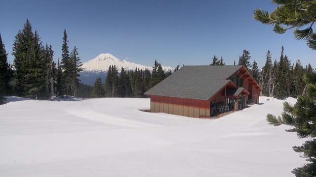
White Pass Ski Area, High Camp Lodge, with an excellent view of Mt Rainier from 24 miles SE  Elevation: 6000 ft Image modification time: Wed Jan 08, 2025 22:35:08 |
| I-5 @ MP 68, SE of Napavine, junction with US 12 @ MP 66  Elevation: 500 ft |
Morton, US 12 @ MP 97  Elevation: 950 ft |
Morton, SR 7, just off US 12 @ MP 97  Elevation: 950 ft |
Morton, SR 7, just north of US 12 @ MP 97  Elevation: 950 ft |
East of Glenoma, on US 12 @ MP 110 Elevation: 1100 ft |
Randle, near SR 131, 2 miles south of US 12 @ MP 115, looking north with a partial view of Mt Rainier  Elevation: 900 ft |
Packwood Airport, on US 12 @ MP 130, looking south  Elevation: 1080 ft |
Packwood Airport, on US 12 @ MP 130, looking SW  Elevation: 1080 ft |
Packwood Airport, on US 12 @ MP 130, looking NW with a partial view of Mt Rainier  Elevation: 1080 ft |