White Pass WebCams
        Amar Andalkar's Ski Mountaineering and Climbing Site
Ski Mountaineering Photos & Trip Reports Equipment & Info Cascade Volcanoes Ring of Fire Site Map Links

Mountain WebCams Pages:     Cascade Volcano     Ring of Fire and Beyond     |     Alaska (except SE)     SE Alaska, Yukon, & Northern BC     SW British Columbia     Washington     Oregon     N California     Sierra Nevada     S California     Hawaii     Antarctic     .
WebCams + Telemetry Pages:     Whistler    Garibaldi    BC Cascades    Baker    N Cascades    Chelan    Olympic    Stevens    Blewett    Snoqualmie    Crystal    Rainier    White Pass    Adams    St Helens    Hood    Jefferson    Santiam    Bachelor    Diamond    Crater Lake    McLoughlin    Shasta    Lassen    Feather    Donner    N Tahoe    S Tahoe    Sonora    Yosemite    Mammoth    Sequoia    Whitney    Yellowstone    .
Image Size:     Large (360 px high)     Medium (270 px high)     Small (180 px high)         Page loaded at 4:22 PM PDT on Friday, October 11, 2024 .
White Pass on US 12 @ MP 151, looking west

Elevation: 4500 ft
 
White Pass on US 12 @ MP 151, looking east

Elevation: 4500 ft
 
White Pass Ski Area, on US 12 @ MP 151

Elevation: 4500 ft
 
White Pass Ski Area, on US 12 @ MP 151

Elevation: 4500 ft
 
White Pass Ski Area, on US 12 @ MP 151

Elevation: 4500 ft
Image modification time: Mon Oct 30, 2023 13:10:07
White Pass Ski Area, High Camp Lodge,
with an excellent view of Mt Rainier from 24 miles SE


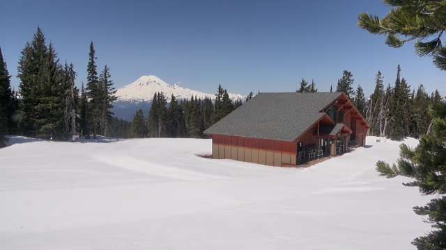
Elevation: 6000 ft
Image modification time: Fri Oct 11, 2024 16:20:14
I-5 @ MP 68, SE of Napavine,
junction with US 12 @ MP 66


Elevation: 500 ft
Morton, US 12 @ MP 97

Elevation: 950 ft
Morton, SR 7, just off US 12 @ MP 97

Elevation: 950 ft
Morton, SR 7, just north of US 12 @ MP 97
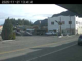
Elevation: 950 ft
East of Glenoma, on US 12 @ MP 110

Elevation: 1100 ft
Randle, near SR 131, 2 miles south of US 12 @ MP 115,
looking north with a partial view of Mt Rainier


Elevation: 900 ft
Packwood Airport, on US 12 @ MP 130, looking south

Elevation: 1080 ft
Packwood Airport, on US 12 @ MP 130, looking SW

Elevation: 1080 ft
Packwood Airport, on US 12 @ MP 130,
looking NW with a partial view of Mt Rainier