Northwestern WA: US 101 Olympic Peninsula, I-5 Hwy Corridor ..
|
View of Mt Baker from Ferndale on I-5 @ MP 262 *

Elevation: 50 ft
|
View of Mt Baker from Friday Harbor *

Elevation: 100 ft
|
I-5 at Bakerview Rd @ MP 257, looking east with distant partial view of Mt Baker

Elevation: 200 ft
|
I-5 at SR 11 Old Fairhaven Pkwy @ MP 250, looking north

Elevation: 200 ft
|
I-5 at Samish Way @ MP 246, looking north

Elevation: 200 ft
|
Lake Samish, west of I-5 @ MP 244 *

Elevation: 300 ft
|
Anacortes Middle School on SR 20, looking NE towards Mt Baker *

Elevation: 100 ft
|
|
Heckelville Shed on US 101 @ MP 214

Elevation: 930 ft
|
Lake Crescent, Olympic NP, off US 101 @ MP 232 *

Elevation: 590 ft
|
Indian Valley on US 101 @ MP 237.2

Elevation: 380 ft
|
Hurricane Ridge, Olympic NP, south of US 101 *

Elevation: 5250 ft
|
Hurricane Ridge Parking Lot, Olympic NP, south of US 101 *

Elevation: 5250 ft
|
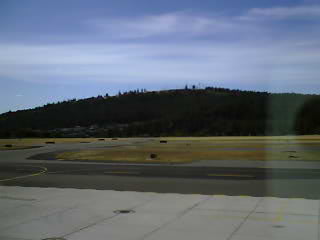
Port Angeles Airport, MP 245 on US 101, looking south

Elevation: 300 ft
|
Port Angeles Airport, MP 245 on US 101, looking west

Elevation: 300 ft
|
Port Angeles Airport, MP 245 on US 101, looking NW

Elevation: 300 ft
|
Port Angeles Airport, MP 245 on US 101, looking NE

Elevation: 300 ft
|
Port Angeles Inn, on US 101 @ MP 248, looking N or NE *

Elevation: 100 ft
|
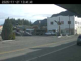
Olympic Region Clean Air Agency, Port Angeles City Hall on US 101, looking south *

Elevation: 100 ft
|
Port Angeles on US 101, looking south *

Elevation: 100 ft
|
Siebert on US 101 @ MP 256

Elevation: 290 ft
|
Sequim Valley Airport, off US 101 @ MP 260, looking south

Elevation: 150 ft
|
New Dungeness Lighthouse, north of US 101 @ MP 265, looking south *

Elevation: 20 ft
|
Diamond Point on US 101 @ MP 275

Elevation: 320 ft
|
Mt Walker, SR-101 @ MP 301.5

Elevation: 470 ft
|
Port Townsend Airport, SR 20 @ MP 7, looking SSW

Elevation: 110 ft
|
West of Hood Canal Bridge, looking east

Elevation: 220 ft
|
Hood Canal Bridge, SR 104 @ MP 14

Elevation: 40 ft
|
South of Hood Canal Bridge

Elevation: 120 ft
|
Silverdale, west of SR 3, looking west *

Elevation: 100 ft
|
Union on SR 106, looking NW *
Elevation: 400? ft
|
Hood Canal, Union on SR 106, looking NW *
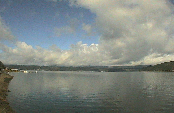
Elevation: 20 ft
|
Northern WA: SR 530, SR 20 North Cascades Hwy Corridor ..
|
Arlington Airport, I-5 @ MP 206, looking north

Elevation: 150 ft
|
Arlington Airport, I-5 @ MP 206, looking west

Elevation: 150 ft
|
Whitehorse Mtn, looking SW from Darrington, on SR 530 *

Elevation: 550 ft
|
Concrete Airport, MP 88 on SR 20, looking west

Elevation: 280 ft
|
Concrete Airport, MP 88 on SR 20, looking north

Elevation: 280 ft
|
Concrete Airport, MP 88 on SR 20, looking east

Elevation: 280 ft
|
Concrete Airport, MP 88 on SR 20, looking south

Elevation: 280 ft
|
Magic Mtn, Marblemount, on SR 20 *

Elevation: 780 ft
|
North Cascades NP, Newhalem, MP 120 on SR 20 *

Elevation: 560 ft
|
Mazama, Freestone Inn, MP 178 on SR 20 *

Elevation: 2200 ft
|
Sun Mtn Lodge, Winthrop on SR 20 *
Elevation: 2800 ft
|
View looking west from Patterson Mtn *

Elevation: 3500 ft
|
Winthrop on SR 20, looking NE from Patterson Mtn *

Elevation: 3500 ft
|
Methow Valley Airport on SR 20, looking SE from Patterson Mtn *

Elevation: 3500 ft
|
McClure Mtn and Twisp, looking SE from Patterson Mtn *

Elevation: 3500 ft
|
Methow Valley Airport, south of Winthrop on SR 20, looking west

Elevation: 1700 ft
|
Methow Valley Airport, south of Winthrop on SR 20, looking NW

Elevation: 1700 ft
|
Methow Valley Airport, south of Winthrop on SR 20, looking SE

Elevation: 1700 ft
|
Methow Valley Airport, south of Winthrop on SR 20, looking south

Elevation: 1700 ft
|

Elevation: 4020 ft
|
Loup Loup Ski Bowl Base off SR 20 *

Elevation: 4080 ft
|
Loup Loup Ski Bowl Top *

Elevation: 5250 ft
|
USFS Pasayten Cam at Loup Loup Ski Bowl *

Elevation: 5250 ft
|
VLBA Radio Telescope Site, NE of Brewster off US 97

Elevation: 850 ft
|
Mansfield on SR-17 @ MP 112

Elevation: 2160 ft
|
Riverside on US-97 @ MP 299

Elevation: 920 ft
|

Elevation: 1000 ft
|

Elevation: 1000 ft
|
Sherman Pass on SR-20 @ MP 320

Elevation: 5600 ft
|
Laurier on US-395 @ MP 275

Elevation: 1640 ft
|
Laurier on US-395 @ MP 275

Elevation: 1640 ft
|

Elevation: 1600 ft
|

Elevation: 1600 ft
|
Colville Airport on SR-20, looking SW

Elevation: 1880 ft
|
49° North Ski Area, Base, east of US 395 *

Elevation: 3950 ft
|
49° North Ski Area, Summit, east of US 395 *

Elevation: 5800 ft
|
Metaline Falls on SR 31 @ MP 16.69

Elevation: 2100 ft
|
North-Central WA: US 2 Stevens Pass, US 97/97A Hwy Corridor ..
|

Elevation: 80 ft
|

Elevation: 180 ft
|
Skykomish Airport on US 2 @ MP 49, looking east

Elevation: 1000 ft
|
Skykomish Airport on US 2 @ MP 49, looking SE

Elevation: 1000 ft
|
Skykomish Airport on US 2 @ MP 49, looking south

Elevation: 1000 ft
|
Skykomish Airport on US 2 @ MP 49, looking west

Elevation: 1000 ft
|
Old Faithful Avalanche Zone, west of Stevens Pass on US 2 @ MP 62

Elevation: 3200 ft
|
Stevens Pass on US 2 @ MP 64

Elevation: 4100 ft
|
Stevens Pass on US 2 @ MP 64

Elevation: 4100 ft
|
Stevens Pass Ski Area on US 2 @ MP 64 *

Elevation: 4100 ft
|
Stevens Pass Ski Area on US 2 @ MP 64 *

Elevation: 4100 ft
|
Lower Mill Creek on US 2 @ MP MP 70.5

Elevation: 2950 ft
|
Lake Wenatchee on SR 207 *

Elevation: 1880 ft
|
Lake Wenatchee on SR 207 *

Elevation: 1880 ft
|
Fish Lake near Lake Wenatchee on SR 207 *

Elevation: 1930 ft
|
Trinity, north of SR 207 on FR 62 *

Elevation: 2800 ft
|
Winton on US 2 @ MP 86.6

Elevation: 2050 ft
|
Leavenworth Ski Hill, north of US 2 @ MP 99 *

Elevation: 1450 ft
|
Leavenworth, Icicle River Trails, south of US 2 @ MP 99 *

Elevation: 1150 ft
|
Leavenworth, Icicle Village on US 2 @ MP 99, looking west *

Elevation: 1200 ft
|
Leavenworth, Icicle Village on US 2 @ MP 99, looking NE *

Elevation: 1200 ft
|
Leavenworth on US 2 @ MP 100, looking SW *

Elevation: 1180 ft
|
US 2 @ Riverbend Drive

Elevation: 1200 ft
|
Leavenworth, River Haus in the Pines, south of US 2 *

Elevation: 1140 ft
|
Leavenworth, Mountain Home Lodge, south of US 2 *

Elevation: 2000 ft
|
US 97 @ MP 185, at Jct with US 2

Elevation: 1080 ft
|
US 2 @ MP 105, east of Jct with US 97

Elevation: 1080 ft
|
Cashmere on US 2 @ MP 111 *

Elevation: 800 ft
|
Blewett Pass on US 97 @ MP 164

Elevation: 4100 ft
|
Mission Ridge Ski Area, MIdway Cam, south of US 2 *

Elevation: 5300 ft
|
Mission Ridge Ski Area, Summit Cam, south of US 2 *

Elevation: 6800 ft
|
Wenatchee on US 2 @ MP 119

Elevation: 750 ft
|
Wenatchee on US 97A, Odabashian Bridge North

Elevation: 700 ft
|
Wenatchee River Bridge on SR 285, looking south

Elevation: 700 ft
|
Waterville on US 2 @ MP 149

Elevation: 2650 ft
|
Knapps Tunnel on US 97A @ MP 226

Elevation: 1100 ft
|
Stehekin Landing, at NW end of Lake Chelan *

Elevation: 1120 ft
|
Lake Chelan Roving Boat Cam *

Elevation: 1120 ft
|
Lake Chelan on US 97A *

Elevation: 1120 ft
|
Chelan on US 97 @ MP 240.2

Elevation: 800 ft
|
West-Central WA: Interstate 90 Snoqualmie Pass Hwy Corridor ..
|
Seattle / Glacier Peak WebCam, looking ENE across Lake Union *

Elevation: 100 ft
|
Seattle National Weather Service WebCam, looking north across Lake Washington *

Elevation: 50 ft
|
UW Red Square Cam, looking SE at Mt Rainier from Seattle *

Elevation: 200 ft
|
UW Atmospheric Sciences Webcam, looking west from Seattle towards Olympic Mtns *

Elevation: 200 ft
|
Seattle Visibility Cam, looking SE at Mt Rainier from Queen Anne Hill *

Elevation: 500? ft
|
KIRO-TV Queen Anne Tower Cam *

Elevation: 600? ft
|
KING-TV Queen Anne Tower Cam *

Elevation: 600? ft
|
KING-TV Bellevue Tower Cam, north of I-90 @ MP 10 *

Elevation: 500? ft
|
West Lake Sammamish Parkway, I-90 @ MP 13

Elevation: 150 ft
|
SR 900 Interchange, I-90 @ MP 15

Elevation: 80 ft
|
Sunset Way, I-90 @ MP 18

Elevation: 200 ft
|
SR 18 @ MP 23: Tiger Mountain

Elevation: 1350 ft
|
I-90 @ MP 25, SR 18

Elevation: 950 ft
|
Mt Si, from Snoqualmie north of I-90 @ MP 25 *

Elevation: 420 ft
|
KIRO-TV Snoqualmie Casino Cam, just north of I-90 @ MP 27

Elevation: 600 ft
|
Meadowbrook Bridge over the Snoqualmie River, NE of I-90 @ MP 27 *

Elevation: 400 ft
|
Denny Creek on I-90 @ MP46.8

Elevation: 1800 ft
|
Franklin Falls on I-90 @ MP51.3

Elevation: 2700 ft
|
Snoqualmie Summit on I-90 @ MP52

Elevation: 3000 ft
|
Alpental Webcam, north of I-90 @ MP 52 *

Elevation: 3100 ft
|
Alpental Ski Area, top of Chair 2, north of I-90 @ MP 52 *

Elevation: 5400 ft
|
Alpental Ski Area, base area, north of I-90 @ MP 52 *

Elevation: 3150 ft
|
Summit West Ski Area, south of I-90 @ MP 52 *

Elevation: 3000 ft
|
KIRO-TV Summit West Ski Area, top of Wildside, south of I-90 @ MP 52

Elevation: 3800 ft
|
Hyak on I-90 @ MP55.2

Elevation: 2600 ft
|
Hyak Airport, I-90 @ MP 54, looking SW

Elevation: 2600 ft
|
Hyak Airport, I-90 @ MP 54, looking west

Elevation: 2600 ft
|
Hyak Airport, I-90 @ MP 54, looking WNW

Elevation: 2600 ft
|
Hyak Airport, I-90 @ MP 54, looking NW

Elevation: 2600 ft
|
Hyak Airport, I-90 @ MP 54, looking east

Elevation: 2600 ft
|
Hyak Airport, I-90 @ MP 54, looking SE

Elevation: 2600 ft
|
Price Creek on I-90 @ MP61

Elevation: 2500 ft
|
Easton Hill on I-90 @ MP67.4

Elevation: 2650 ft
|
Easton on I-90 @ MP70.6

Elevation: 2150 ft
|
Easton Airport, I-90 @ MP 71, looking west

Elevation: 2220 ft
|
Central & Eastern WA: Interstate 90 Hwy Corridor ..
|
|
Golf Course Road I-90 @ MP 77 looking west

Elevation: 2050 ft
|
Bullfrog-facing west on I-90 @ MP 79.54

Elevation: 1980 ft
|
Downtown Cle Elum, I-90 @ MP 84, user-controllable view

Elevation: 2000 ft
|
Sky Meadows Ranch, south of Cle Elum on I-90 @ MP 84, looking north *

Elevation: 2500 ft
|

Elevation: 2000 ft
|
East Cle Elum, I-90 @ MP 86, looking east

Elevation: 1900 ft
|
East Cle Elum, I-90 @ MP 86, looking west

Elevation: 1900 ft
|
Elk Heights on I-90 @ MP 92

Elevation: 2400 ft
|
Elk Heights on I-90 @ MP 93, looking west

Elevation: 2400 ft
|
Elk Heights on I-90 @ MP 93, looking east

Elevation: 2400 ft
|
Rocky Canyon on I-90 @ MP 96.2

Elevation: 1900 ft
|
CWU Stuart Range Cam, Ellensburg off I-90 @ MP 109 *

Elevation: 1600 ft
|
CWU West Campus Cam, Ellensburg off I-90 @ MP 109 *

Elevation: 1600 ft
|
CWU North Campus Cam, Ellensburg off I-90 @ MP 109 *

Elevation: 1600 ft
|
CWU South Campus Cam, Ellensburg off I-90 @ MP 109 *

Elevation: 1600 ft
|

Elevation: 1550 ft
|
Ryegrass Summit on I-90 @ MP 125

Elevation: 2400 ft
|

Elevation: 700 ft
|

Elevation: 700 ft
|

Elevation: 1480 ft
|
Silica Road on I-90 @ MP 144

Elevation: 1200 ft
|
Dodson Road on I-90 @ MP 164.5

Elevation: 1170 ft
|
Warden Interchange on I-90 @ MP 189

Elevation: 1170 ft
|
I-90/US 395 Interchange @ Ritzville

Elevation: 1800 ft
|
Tyler Interchange on I-90 @ MP 257

Elevation: 2290 ft
|
SR 902 Interchange on I-90 @ MP 272

Elevation: 2410 ft
|
Geiger Rd on I-90 @ MP 276

Elevation: 2350 ft
|
US 2 Interchange on I-90 @ MP 277

Elevation: 2250 ft
|
Felts Field, Spokane, I-90 @ MP 286, looking NNW
Elevation: 1950 ft
|
US-195 @ Spangle

Elevation: 2450 ft
|
US-195 @ Spangle

Elevation: 2450 ft
|
Little Spokane River on SR-395 @ MP 168

Elevation: 1700 ft
|
Loon Lake Summit on US-395 @ MP 188

Elevation: 2440 ft
|
Mt Spokane Ski Area, base lodge 2, NE of Spokane on SR 206 *

Elevation: 4400 ft
|
Mt Spokane Ski Area, top of chair 3, NE of Spokane on SR 206 *

Elevation: 5300 ft
|
Liberty Lake on I-90 @ MP 296

Elevation: 2060 ft
|
South-Central WA: US 12 White Pass, SR 410 Chinook Pass, I-82 Hwy Corridor ..
|
View of Mt Rainier from Maury Island, looking SE *

Elevation: 350 ft
|
West Side Tacoma Narrows Bridge, SR 16 @ MP 8, occasional view of Mt Rainier

Elevation: 200 ft
|
East of TNB, Jackson Ave, SR 16 @ MP 6

Elevation: 250 ft
|
TacomaWeatherCam, looking SE at Mt Rainier *

Elevation: 380 ft
|
TacomaWeatherCam, looking SE at Mt Rainier *

Elevation: 380 ft
|
Auburn Airport, east of SR 167 @ MP 16, looking SE at Mt Rainier

Elevation: 100 ft
|
Auburn Senior High School, east of SR 167 @ MP 16, looking SE at Mt Rainier *

Elevation: 100 ft
|
Holy Family School in Auburn, off SR 18 east of SR 167 @ MP 14, looking SE at Mt Rainier *

Elevation: 150 ft
|
Bonney Lake High School, south of SR 410, looking SE at Mt Rainier *

Elevation: 650 ft
|
Morton, just off US 12 @ MP 97 *
Elevation: 950 ft
|
Randle, near junction of SR 131 and US 12 @ MP 115, looking north towards Mt Rainier *

Elevation: 900 ft
|
Packwood Airport, on SR 12 @ MP 130, looking south

Elevation: 1080 ft
|
Packwood Airport, on SR 12 @ MP 130, looking SW

Elevation: 1080 ft
|
Packwood Airport, on SR 12 @ MP 130, looking NW, partial view of Mt Rainier

Elevation: 1080 ft
|
Packwood Airport, on SR 12 @ MP 130, looking NE

Elevation: 1080 ft
|
Packwood, on SR 12 @ MP 130
Elevation: 1080 ft
|
Ashford Wunder Cam, on SR 706 just west of Mt Rainier NP *

Elevation: 1700 ft
|
Longmire, Mt Rainier NP, looking southwest from the Administrative Building *
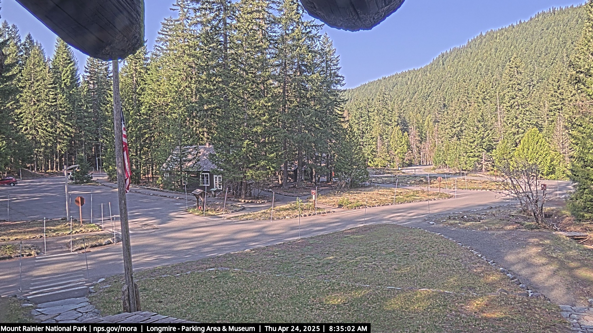
Elevation: 2750 ft
|
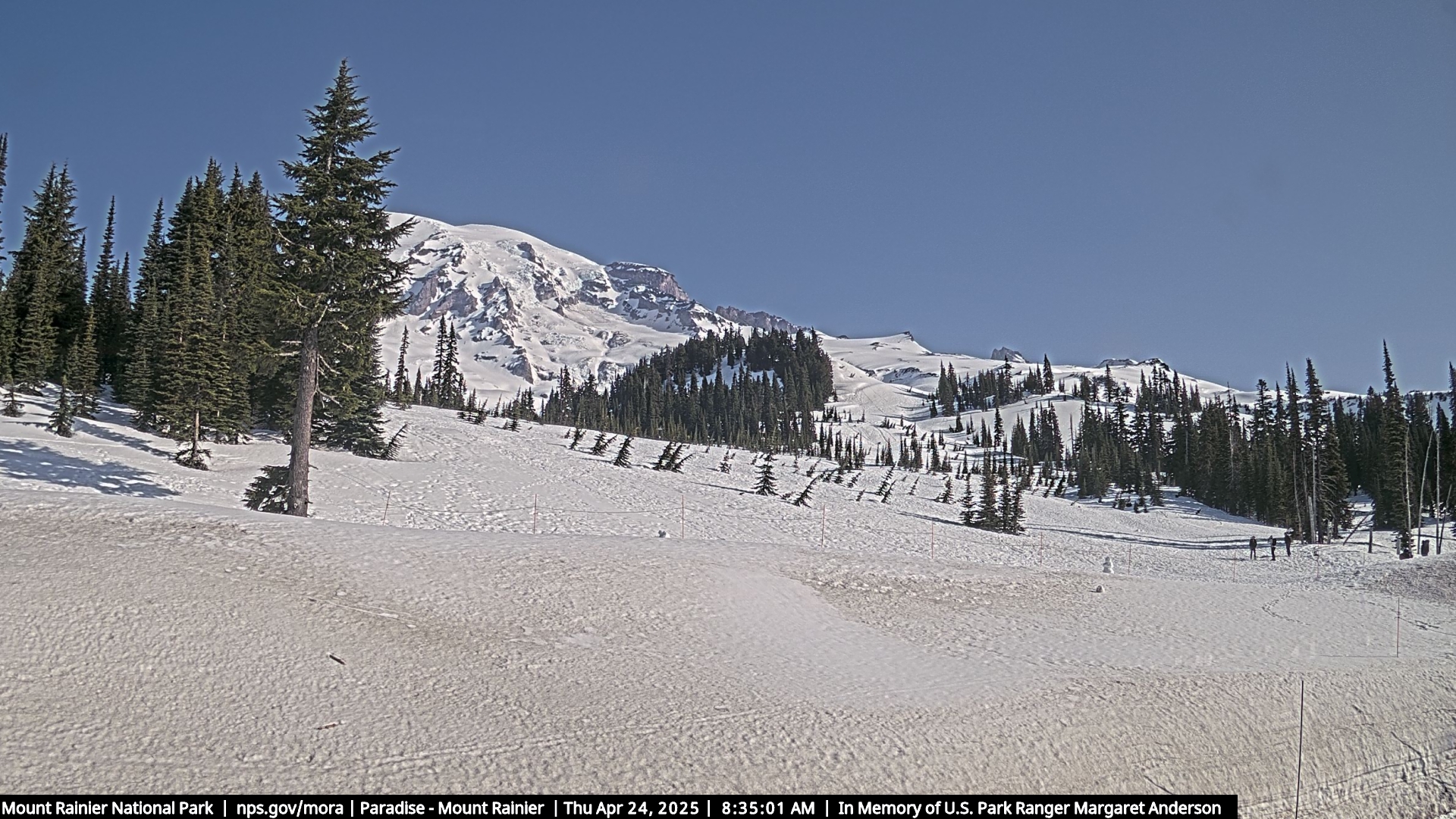
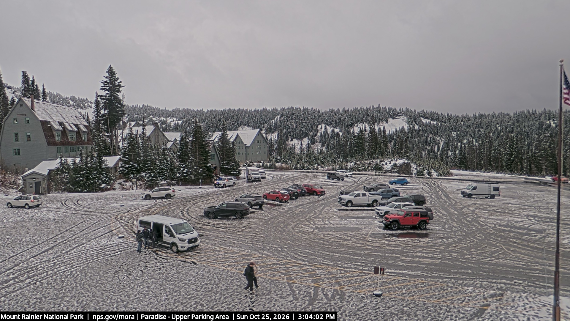
Paradise, Mt Rainier NP, on SR 706, looking SW from the ski dorm *

Elevation: 5400 ft
|
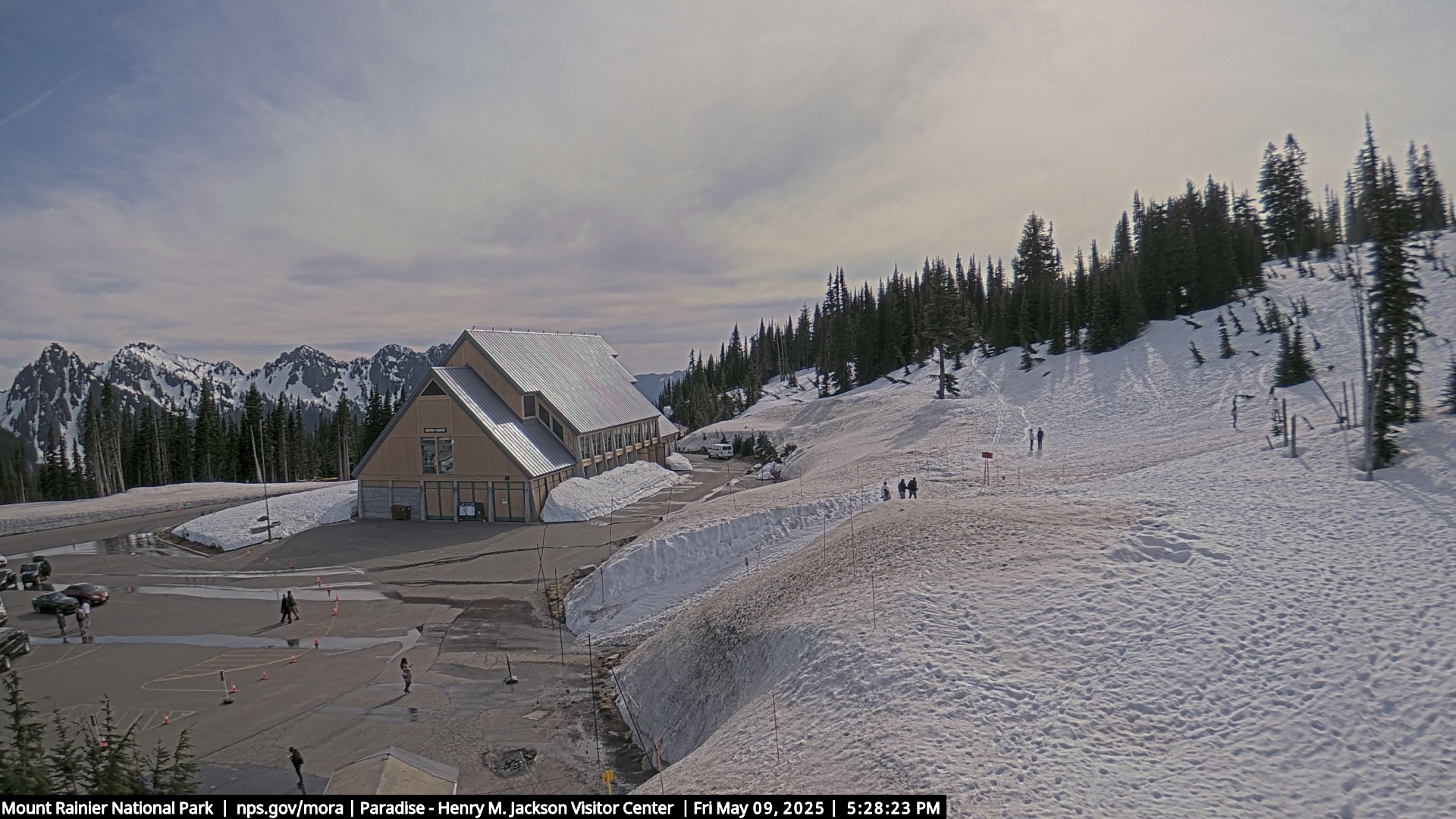
Paradise, Mt Rainier NP, on SR 706, looking north at Mt Rainier from new JVC *
Elevation: 5400 ft
|
Paradise, Mt Rainier NP, on SR 706, looking east from new JVC *
Elevation: 5400 ft
|
Paradise, Mt Rainier NP, on SR 706, looking south at Tatoosh Range from new JVC *

Elevation: 5400 ft
|
Paradise, Mt Rainier NP, on SR 706, looking west from new JVC *

Elevation: 5400 ft
|
Paradise, Mt Rainier NP, on SR 706, looking SW from Guide House *
Elevation: 5400 ft
|
Camp Muir, Mt Rainier NP, looking south at Muir Snowfield and Mt Adams *

Elevation: 10100 ft
|
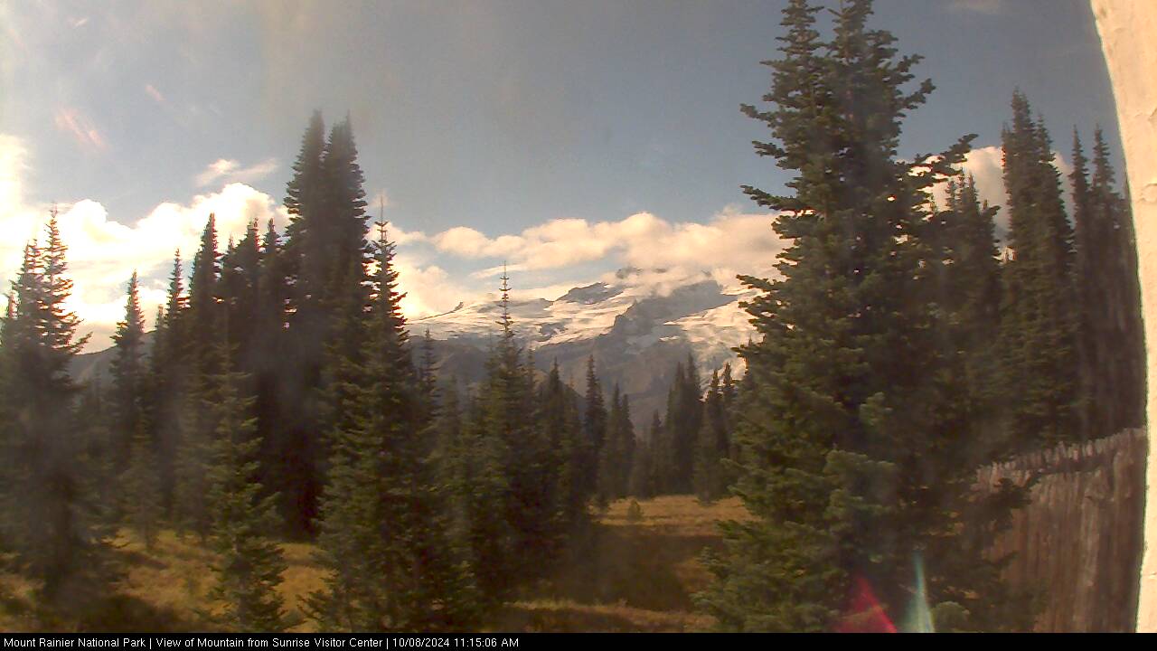
Sunrise, Mt Rainier NP, looking east from the visitor center *

Elevation: 6400 ft
|
Sunrise, Mt Rainier NP, looking southwest at Mt Rainier and Little Tahoma from the visitor center *
Elevation: 6400 ft
|
Crystal Mountain, upper gondola terminal, movable cam often looking southwest at Mt Rainier *

Elevation: 6850 ft
|
Crystal Mtn Ski Area Base, near SR 410 *

Elevation: 4400 ft
|
Crystal Mtn Ski Area, near SR 410, looking NW from Gold Hills *

Elevation: 5000 ft
|
White Pass Ski Area, on US 12 @ MP 151 *

Elevation: 4500 ft
|
White Pass on US 12 @ MP 151

Elevation: 4500 ft
|
Whistlin' Jack Lodge, Cliffdell on SR 410 @ MP 96 *

Elevation: 2500 ft
|

Elevation: 1600 ft
|
Manastash Ridge Summit on I-82 @ MP 7

Elevation: 2670 ft
|

Elevation: 1580 ft
|
KAPP-TV Yakima SkyCam, facing west with occasional view of Mt Adams *

Elevation: 1100 ft
|
Yakima Airport Webcam, west of I-82 @ MP 36 *

Elevation: 1100 ft
|

Elevation: 1020 ft
|
Union Gap on I-82

Elevation: 950 ft
|
Southern WA: SR 4, SR 504, SR 14 Columbia Gorge, US 97, I-82, US 12 Hwy Corridor ..
|
KM Mountain on SR-4 @ MP 22

Elevation: 780 ft
|
Forest Learning Rest Area on SR 504 @ MP 33, looking SE at Mount Saint Helens

Elevation: 2700 ft
|
Mount Saint Helens VolcanoCam on SR 504 @ MP 51, looking SSE from Johnston Ridge *

Elevation: 4200 ft
|
Mount Saint Helens VolcanoCamHD on SR 504 @ MP 51, looking SSE from Johnston Ridge *

Elevation: 4200 ft
|
KATU Vancouver WA Camera, atop Smith Tower at I-5 exit 1B, occasional view NE towards Mount Saint Helens *

Elevation: 200 ft
|
I-205 and SR-14 interchange in Vancouver, WA

Elevation: 170 ft
|
Cape Horn on SR 14 @ MP 25

Elevation: 750 ft
|
Stevenson Waterfront on SR 14 @ MP 44 *

Elevation: 100 ft
|
Mt Hood, looking south from Underwood on SR 14 @ MP 63 *

Elevation: 400 ft
|
Hood River Bridge on SR 14 @ MP 65

Elevation: 140 ft
|
Mt Adams, looking NE from Trout Lake off SR 141 *

Elevation: 1900 ft
|
The Dalles Airport, in Dallesport, WA, on SR 14 @ MP 82, looking WNW

Elevation: 220 ft
|
USFS Columbia Gorge Cam at Wishram on SR 14 @ MP 93, looking SW at Mt Hood *

Elevation: 400 ft
|

Elevation: 670 ft
|

Elevation: 3100 ft
|
Yakima County Line, US 97 @ MP 34

Elevation: 1880 ft
|
Richland Airport, on SR 240, looking south

Elevation: 400 ft
|

Elevation: 450 ft
|
Horse Heaven on I-82 @ MP 121.2

Elevation: 1200 ft
|
KVEW-TV Kennewick SkyCam (facing SW ?) *

Elevation: 500 ft
|

Elevation: 350 ft
|
Whitman College, Walla Walla on US 12 @ MP 337 *

Elevation: 970 ft
|
Walla Walla Airport, MP 340 on US 12, looking SW

Elevation: 1200 ft
|
Walla Walla Airport, MP 340 on US 12, looking west

Elevation: 1200 ft
|
Walla Walla Airport, MP 340 on US 12, looking north

Elevation: 1200 ft
|
Walla Walla Airport, MP 340 on US 12, looking east

Elevation: 1200 ft
|
Delaney on US 12 @ MP 381.3

Elevation: 950 ft
|
Alpowa Summit on US-12 @ MP 418

Elevation: 2760 ft
|
US-195 @ Uniontown

Elevation: 2580 ft
|
US-195 @ Uniontown

Elevation: 2580 ft
|
Pullman Moscow Regional Airport, on SR 270, looking NE

Elevation: 2600 ft
|
Pullman Moscow Regional Airport, on SR 270

Elevation: 2600 ft
|
Pullman Moscow Regional Airport, on SR 270, looking SW

Elevation: 2600 ft
|
Pullman Moscow Regional Airport, on SR 270

Elevation: 2600 ft
|
|
| Map of Camera Sites: (each corridor is enclosed in a gray box) |
 |
| Northwestern WA: US 101 Olympic Peninsula, I-5 Hwy Corridor |
|
|
|
|
|
|
|
|
|
|
|
|
|
|
|
|
|
|
|
|
|
|
|
|
|
|
|
|
|
|
|
|
31 |
| Northern WA: SR 530, SR 20 North Cascades Hwy Corridor |
|
|
|
|
|
|
|
|
|
|
|
|
|
|
|
|
|
|
|
|
|
|
|
|
|
|
|
|
|
|
|
|
|
|
|
|
|
37 |
| North-Central WA: US 2 Stevens Pass, US 97/97A Hwy Corridor |
|
|
|
|
|
|
|
|
|
|
|
|
|
|
|
|
|
|
|
|
|
|
|
|
|
|
|
|
|
|
|
|
|
|
|
|
|
|
|
|
40 |
| West-Central WA: Interstate 90 Snoqualmie Pass Hwy Corridor |
|
|
|
|
|
|
|
|
|
|
|
|
|
|
|
|
|
|
|
|
|
|
|
|
|
|
|
|
|
|
|
|
|
|
|
35 |
| Central & Eastern WA: Interstate 90 Hwy Corridor |
|
|
|
|
|
|
|
|
|
|
|
|
|
|
|
|
|
|
|
|
|
|
|
|
|
|
|
|
|
|
|
|
|
|
|
|
|
36 |
| South-Central WA: US 12 White Pass, SR 410 Chinook Pass, I-82 Hwy Corridor |
|
|
|
|
|
|
|
|
|
|
|
|
|
|
|
|
|
|
|
|
|
|
|
|
|
|
|
|
|
|
|
|
|
|
|
|
|
|
|
|
40 |
| Southern WA: SR 4, SR 504, SR 14 Columbia Gorge, US 97, I-82, US 12 Hwy Corridor |
|
|
|
|
|
|
|
|
|
|
|
|
|
|
|
|
|
|
|
|
|
|
|
|
|
|
|
|
|
|
|
|
|
|
34 |
|
|
|
| Page History: |
|
|
|
Page Statistics: |
| December 2004 | Original version with 34 camera views in 6 corridors (rows), conceived as a major expansion of the
WSDOT Mountain Pass Cameras page which showed only 5 cameras
|
Page loaded at 7:02 AM PST on Monday, January 27, 2025
Total camera images: 253
WSDOT Highway Cams: 99
WSDOT Aviation Cams: 44
National Park Service: 14
US Forest Service: 4
National Weather Service: 1
WeatherBug InstaCams: 8
Approximate page width: 13500 pixels 13440
Approximate page height: 3900 pixels 3822
|
| Feb-March 2005 | Expanded to 42 camera views |
| November 2005 | Fixed several camera links which had changed |
| March 2006 | Expanded to 45 camera views, fixed several camera links which had changed |
| January 2007 | Expanded to 56 camera views, fixed several camera links which had changed
|
| February 2007 | Expanded to 63 camera views,
added elevation data for all cameras using USGS topo maps to locate camera sites
|
| Oct-Nov 2007 | Expanded to 71 camera views, fixed several camera links which had changed |
| December 2007 | Expanded to 75 camera views, fixed several camera links which had changed
Rewrote most of the webpage as a PHP script to allow changing the image size; images can now be displayed in three sizes;
added this "Page History"
Later expanded to 99 camera views
|
| January 2008 |
Expanded to 104 camera views; added new header/footer design to match rest of website, with timestamp in page header
Added map of camera sites and corridors, stitched and modified from the sectional maps at
http://www.wsdot.wa.gov/traffic/
Added table of mini camera images beside map,
and added option to show pixel rulers along the bottom and right edges of the page
Later expanded to 136 camera views in 7 corridors (rows), with a new corridor for the Olympic Peninsula; added individual links for all WSDOT cams
|
| February 2008 | Expanded to 139 camera views, fixed some camera links which had changed |
| March 2008 | Expanded to 148 camera views |
| May 2008 | Expanded to 150 camera views, fixed some camera links which had changed |
| August 2008 | Expanded to 151 camera views, fixed some camera links which had changed |
| October 2008 | Expanded to 172 camera views, fixed some camera links which had changed;
rearranged several cameras and swapped the first two corridors (rows) |
| November 2008 | Expanded to 177 camera views, fixed some camera links which had changed
Added row counts to table of mini camera images, and "Page Statistics" to the right, plus other minor fixes |
| December 2008 | Expanded to 199 camera views,
rearranged several cameras, improved several image captions, fixed some camera links which had changed |
| January 2009 | Expanded to 202 camera views, other minor fixes |
| March 2009 | Expanded to 220 camera views, fixed some camera links which had changed, other minor fixes
Created the Mount Rainier Paradise WebCams webpage,
which displays a subset of local webcams at any of three larger sizes |
| July 2009 | Fixed some camera links which had changed, other minor fixes |
| Aug-Sept 2009 | Expanded to 222 camera views |
| October 2009 | Expanded to 229 camera views, fixed some camera links which had changed, other minor fixes |
| Nov-Dec 2009 |
Fixed some camera links which had changed, revised code to allow double-width images such as the new panoramic Hurricane Ridge cam
Created the Mount Baker WebCams
and Mount Saint Helens WebCams webpages,
which display a subset of local webcams at any of three larger sizes |
| January 2010 | Expanded to 236 camera views,
updated the site navigation bars to include the various other Mountain WebCams pages
Created the Snoqualmie Pass WebCams
and Stevens Pass WebCams webpages,
which display a subset of local webcams at any of three larger sizes |
| February 2010 | Expanded to 239 camera views |
| April 2010 | Fixed some camera links which had changed |
| June 2010 | Fixed several WSDOT camera links which had changed |
| July 2010 | Fixed several WSDOT and other camera links which had changed |
| August 2010 | Updated URLs for five NPS webcams which had moved to a new server |
| September 2010 | Fixed some camera links which had changed |
| November 2010 | Expanded to 242 camera views, fixed some camera links which had changed,
fixed aspect ratio of Hurricane Ridge cam which had changed
|
| December 2010 | Expanded to 248 camera views, rearranged a few cameras |
| October 2012 | Expanded to 253 camera views, fixed numerous camera links which had changed |
|