Stevens Pass & Lake Wenatchee WebCams
        Amar Andalkar's Ski Mountaineering and Climbing Site
Ski Mountaineering Photos & Trip Reports Equipment & Info Cascade Volcanoes Ring of Fire Site Map Links

Mountain WebCams Pages:     Cascade Volcano     Ring of Fire and Beyond     |     Alaska (except SE)     SE Alaska, Yukon, & Northern BC     SW British Columbia     Washington     Oregon     N California     Sierra Nevada     S California     Hawaii     Antarctic     .
WebCams + Telemetry Pages:     Whistler    Garibaldi    BC Cascades    Baker    N Cascades    Chelan    Olympic    Stevens    Blewett    Snoqualmie    Crystal    Rainier    White Pass    Adams    St Helens    Hood    Jefferson    Santiam    Bachelor    Diamond    Crater Lake    McLoughlin    Shasta    Lassen    Feather    Donner    N Tahoe    S Tahoe    Sonora    Yosemite    Mammoth    Sequoia    Whitney    Yellowstone    .
Image Size:     Large (320 px high)     Medium (240 px high)     Small (160 px high)         Page loaded at 4:07 AM PST on Sunday, December 29, 2024 .
SR 204 Interchange on US 2 @ MP 2.4

Elevation: 100 ft
 
View of Three Fingers Mtn from Cavelero Mid High in Lake Stevens,
just east of SR 204 interchange with US 2 @ MP 2.4


Elevation: 300 ft
 
Bickford Ave on US 2 @ MP 3.9 in Snohomish

Elevation: 150 ft
 
SR 9 Interchange on US 2 @ MP 5.0 in Snohomish

Elevation: 250 ft
 
Fryelands Blvd/ Roosevelt Rd SE
on US 2 @ MP 12.9 in Monroe


Elevation: 50 ft
 
SR 522 Interchange
on US 2 @ MP 14.3 in Monroe


Elevation: 100 ft
 
Main St on US 2 @ MP 15.3 in Monroe

Elevation: 70 ft
 
Old Owen Rd on US 2 @ MP MP 21.6 in Sultan

Elevation: 130 ft
 
Sultan Basin Rd on US 2 @ MP MP 23.2

Elevation: 200 ft
Rice Rd on US 2 @ MP MP 24.3 in Sultan

Elevation: 200 ft
Mt Index Rd, south of US 2 @ MP 36,
looking east at Skykomish River


Elevation: 700 ft
Skykomish on US 2 @ MP 48.7, at 5th St

Elevation: 950 ft
Skykomish Airport on US 2 @ MP 49, looking east

Elevation: 1000 ft
Skykomish Airport on US 2 @ MP 49, looking SE

Elevation: 1000 ft
Skykomish Airport on US 2 @ MP 49, looking south

Elevation: 1000 ft
Skykomish Airport on US 2 @ MP 49, looking west

Elevation: 1000 ft
Old Faithful Avalanche Zone,
west of Stevens Pass on US 2 @ MP 61.9


Elevation: 3200 ft
 
Big Windy,
west of Stevens Pass on US 2 @ MP 63


Elevation: 3600 ft
 
Stevens Pass Ski Area on US 2 @ MP 64,
Upper Skyline cam near bottom of 7th Heaven lift,
distant view of Glacier Peak (upper left) from 26 miles south!


Elevation: 5220 ft
 
Stevens Pass Ski Area on US 2 @ MP 64,
base area, looking SW at Skline Express


Elevation: 4100 ft
 
Stevens Pass Ski Area on US 2 @ MP 64,
base area, movable user-controlled cam


Elevation: 4100 ft
 
Stevens Pass Ski Area on US 2 @ MP 64,
base area, looking SW


Elevation: 4100 ft
 
Stevens Pass Ski Area on US 2 @ MP 64,
top of Jupiter Express, movable cam


Elevation: 5180 ft
 
Stevens Pass on US 2 @ MP 64.3

Elevation: 4100 ft
Stevens Pass on US 2 @ MP 64.6

Elevation: 4100 ft
Lower Mill Creek on US 2 @ MP 70.5

Elevation: 2950 ft
Coles Corner on US 2 @ MP 84, looking west

Elevation: 2000 ft
Coles Corner on US 2 @ MP 84, looking east

Elevation: 2000 ft
Winton on US 2 @ MP 86.6

Elevation: 2050 ft
Trinity, 28 miles north of US 2 via SR 207 and FR 62
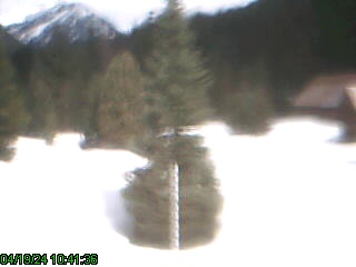
Elevation: 2800 ft
Uplake Cam, Lake Wenatchee on SR 207, north of US 2 at MP 84

Elevation: 1900 ft
 
Lake Wenatchee on SR 207, north of US 2 at MP 84

Elevation: 1900 ft
 
Lake Wenatchee on SR 207, north of US 2 at MP 84

Elevation: 1900 ft
 
Pine Cone Cabin, Lake Wenatchee on SR 207, north of US 2 at MP 84, Uplake Cam

Elevation: 1900 ft
Image modification time: Sun Dec 29, 2024 04:07:24
Midway Village, east of Lake Wenatchee,
north of US 2 at MP 84


Elevation: 1900 ft
 
Kahler Glen Ski Trails, east of Lake Wenatchee,
north of US 2 at MP 84


Elevation: 1900 ft
 
Fish Lake, northeast of Lake Wenatchee, north of US 2 at MP 84

Elevation: 1950 ft
 

Show telemetry | Hide telemetry

Page History:
January 2010Original version with 4 camera views, designed based on the Mount Rainier Paradise WebCams webpage, with cameras from the Washington Mountain WebCams webpage
Includes the option to show the last 24 hours of NWAC and SNOTEL telemetry data from near Stevens Pass below the webcams, and includes code to error-check for missing SNOTEL data
March 2010Fixed broken links to SNOTEL website
May 2010Fixed unwanted line breaks in SNOTEL telemetry dates on narrow screens
October 2010Expanded to 10 camera views, and rearranged images into 2 rows
Reduced image sizes from 480-360-240 to 360-270-180 pixels high for large-medium-small options
November 2010 Fixed a minor bug in the SNOTEL data display, which only occurred between 11pm and midnight and showed the previous day's date for the 0000 hour's data row
March 2011 Fixed a minor quirk in the SNOTEL data display, which only occurred when SNOTEL data is not available at a given site for the previous 24 hours
February 2012Updated the URLs from which to download the SNOTEL data, which had recently been changed slightly
September 2012Expanded to 11 camera views, adding a new WSDOT cam
November 2012Expanded to 18 camera views and rearranged into 3 rows, adding several cameras farther west to Sultan and east to Leavenworth
December 2012 Expanded to 26 camera views in 4 rows, adding several webcams near Lake Wenatchee, Trinity, Mt Index, and Leavenworth
Revised the page layout to use separate tables for each row, to better accommodate the very different widths of images
Reduced image sizes from 360-270-180 to 320-240-160 pixels high for large-medium-small options
Added the recently installed Berne Maintenance Station NWAC site (November 2011) and Trinity SNOTEL site (moved from Miners Ridge in August 2010)
Added more code to properly handle the new HTTP Status 404 errors from the SNOTEL server, and other unknown SNOTEL errors
January 2013 Added the Lake Wenatchee and Tumwater Mountain NWAC sites, plus the Alpine Meadows SNOTEL site, and moved all SNOTEL sites to a second row
February 2013Expanded to 27 camera views, adding another Leavenworth webcam
March 2013 Forced to write a new external script to grab SNOTEL data, after the long-existing SNOTEL data programs on the NWCC website were suddenly redirected to a beta-version report generator
The new script is a major improvement, it displays wind and solar data for any SNOTEL sites which have those sensors, mostly installed within the last few years
Added the regional Skookum Creek, Fish Lake, and Lyman Lake SNOTEL sites, since there is room in the second row and they are not included on any other of these webcams pages
May 2013Expanded to 28 camera views, adding the new WSDOT Skykomish webcam
September 2013Fixed some camera links which had changed
December 2013 Reduced to 21 camera views, moving all 7 Leavenworth cams to the Blewett Pass WebCams webpage, along with the Tumwater Mountain NWAC site
March 2014 Fixed one camera link which had changed
Added the Pope Ridge SNOTEL site, since there is room in the second row and it was the only nearby site not yet included on this page
September 2014 Expanded to 22 camera views, adding the new WSDOT Big Windy webcam, and fixed some camera links which had changed
December 2014Improved the location info for several SNOTEL sites
January 2015Fixed 2 Lake Wenatchee camera links which had changed
September 2015Fixed one camera link which had changed
November 2015Fixed Trinity camera link which had been forced to move to a new website
December 2015 Fixed one Lake Wenatchee camera link which had changed
Added the new Stevens Pass Brooks Chair NWAC site, and also the older Dirty Face Mountain NWAC site at Lake Wenatchee
January 2016 Expanded to 34 camera views rearranged into 5 rows, adding 2 new Stevens Pass cams, the new Uplake Cam and the older Pine Cone Cabin cam at Lake Wenatchee, the Cavelero Mid High cam in Lake Stevens, and 7 more WSDOT cams along US 2 farther west towards Everett
Fixed the distorted aspect ratio for all new Stevens Pass Ski Resort cams, which clearly should be 16:9 HD images and not a bizarre 3:2 ratio as displayed on their website
Added location info for all NWAC sites, and updated the external script which grabs NWAC data to generate an HTML table which matches the style of the SNOTEL and MesoWest data, so these WebCams pages can now show an arbitrary mix of NWAC, SNOTEL, and MesoWest telemetry sites in any order
Wrote a new external script to grab data from MesoWest (such as the data from the RAWS telemetry sites), which downloads the data as a CSV file and formats it to match the style of the SNOTEL data
Added 2 RAWS hourly telemetry sites north of Skykomish and near Lake Wenatchee which have precip, wind, solar, and other sensors (but not snowdepth)
Removed the fairly distant Fish Lake and Pope Ridge SNOTEL sites, which are now shown on the Lake Chelan WebCams and Snoqualmie Pass WebCams pages instead
Updated the page title to include "Lake Wenatchee", which perhaps should have been done sometime earlier as numerous webcams there were added to this page over the last few years
February 2016 Major internal PHP code cleanup, updating and/or deleting legacy code left over from very long ago, from the Mount Rainier Paradise WebCams webpage (March 2009) on which all of these "Webcams + Telemetry Pages" are based, and even from the original Washington Mountain WebCams webpage (December 2004) on which the Rainier page was based
March 2016Fixed all Weather Underground camera URLs, which now apparently need "?time()" appended in order to update properly
November 2016Fixed one camera link which had changed
December 2016Expanded to 36 camera views, adding 2 new WSDOT cams at Coles Corner, and rearranged several images
October 2017 Expanded to 37 camera views, adding the new Stevens Pass Upper Skyline cam, and fixed several WSDOT camera URLs which had changed
Ski Mountaineering Photos & Trip Reports Equipment & Info Cascade Volcanoes Ring of Fire Site Map Links

Amar Andalkar   Seattle, WA, USA   <About the Author / Contact Me>
All material on this website is ©1997-2024 by Amar Andalkar unless otherwise noted.
Last modified Sunday, May 23, 2021