Alpental Alpcam, north of I-90 @ MP 52

Elevation: 3100 ft
|
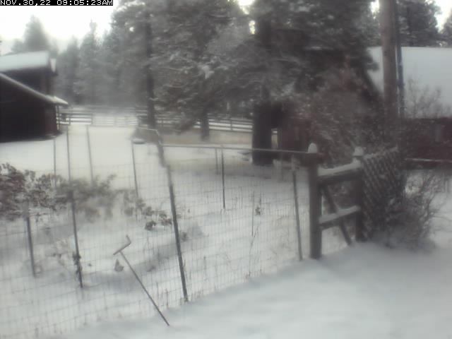
Alpental Ski Area, base area,
north of I-90 @ MP 52, looking NW

Elevation: 3150 ft
|
Alpental Ski Area, Mid-Mountain, north of I-90 @ MP 52,
looking NE at Snoqualmie Mtn and the top of Armstrong Express

Elevation: 4350 ft
|
Alpental Ski Area, top of Chair 2,
north of I-90 @ MP 52, looking SE

Elevation: 5400 ft
|
Summit Central Ski Area, south of I-90 @ MP 53, top of Central Express,
looking NE at Snoqualmie Mtn, Red Mtn, and Kendall Peak

Elevation: 3880 ft
|
Summit Central Ski Area base, south of I-90 @ MP 53, looking south

Elevation: 3000 ft
|
Summit Central Ski Area, Silver Fir base, south of I-90 @ MP 54, looking west

Elevation: 2800 ft
|
Hyak Aviation Cam, I-90 @ MP 54, looking SW

Elevation: 2600 ft
|
Hyak Aviation Cam, I-90 @ MP 54, looking west

Elevation: 2600 ft
|
Hyak Aviation Cam, I-90 @ MP 54, looking WNW

Elevation: 2600 ft
|
Hyak Aviation Cam, I-90 @ MP 54, looking NW

Elevation: 2600 ft
|
Hyak Aviation Cam, I-90 @ MP 54, looking east

Elevation: 2600 ft
|
Hyak Aviation Cam, I-90 @ MP 54, looking SE

Elevation: 2600 ft
|
Hyak on I-90 @ MP 55.2

Elevation: 2600 ft
|
Old Keechelus Snow Shed on I-90 @ MP 57.7

Elevation: 2600 ft
|
| Show telemetry | Hide telemetry |
|
| Page History: |
|
| January 2010 | Original version with 18 camera views,
designed based on the Mount Rainier Paradise WebCams webpage,
with cameras from the Washington Mountain WebCams webpage
Includes the option to show the last 24 hours of NWAC and
SNOTEL telemetry data from near Snoqualmie Pass below the webcams
Includes code to error-check for missing SNOTEL data
|
| February 2010 |
Added new cameras at top of Alpental and Wildside lift at Summit West, temporarily removed two of the WSDOT cams which have a long-term outage
|
| March 2010 | Fixed broken links to SNOTEL website |
| May 2010 | Fixed unwanted line breaks in SNOTEL telemetry dates on narrow screens |
| November 2010 |
Expanded to 19 camera views, re-activating the Franklin Falls cam which had been offline for most of 2010
Fixed a minor bug in the SNOTEL data display, which only occurred between 11pm and midnight and showed the previous day's date for the 0000 hour's data row
|
| December 2010 | Added an Alpental webcam and removed the long-defunct Hyak East webcam, keeping the total at 19 camera views |
| March 2011 |
Fixed a minor quirk in the SNOTEL data display, which only occurred when SNOTEL data is not available at a given site for the previous 24 hours |
| February 2012 | Updated the URLs from which to download the SNOTEL data, which had recently been changed slightly |
| April 2012 | Updated several WSDOT camera URLs, which had recently been changed |
| October 2012 | Added name and milepost info for several WSDOT camera views which had been missing them |
| November 2012 | Expanded to 21 camera views, adding 2 WSDOT camera farther east of the pass
Revised the page layout to use separate tables for each row, to better accommodate the very different widths of images
|
| December 2012 | Added more code to properly handle the new HTTP Status 404 errors from the SNOTEL server, and other unknown SNOTEL errors |
| January 2013 | Expanded to 26 camera views and rearranged images into 4 rows, adding 3 more WSDOT cams, 2 views of Mount Si,
and KING-TV Snoqualmie Pass cam, removing the Summit West KIRO-TV cam (which had switched to an annoying variable URL since September 2011)
|
| March 2013 |
Forced to write a new external script to grab SNOTEL data,
after the long-existing SNOTEL data programs on the NWCC website were suddenly redirected to a beta-version report generator
The new script is a major improvement, it displays wind and solar data for any SNOTEL sites which have those sensors, mostly installed within the last few years
Added the nearby Mount Gardner SNOTEL site
|
| September 2013 | Fixed one camera link which had changed |
| November 2013 | Expanded to 27 camera views, reinstating the Summit West KIRO-TV cam with code to detect its annoying variable URL |
| December 2013 |
Expanded to 29 camera views, adding the WSDOT West Nelson and KCDOT Meadowbrook Bridge in Snoqualmie cams
Added the 4 other SNOTEL sites near Snoqualmie Pass (Cougar Mountain, Rex River, Meadows Pass, Sawmill Ridge),
along with the Mt Washington NWAC site (which is not linked from the NWAC website, available in the text data folder only)
|
| July 2014 | Expanded to 36 camera views and rearranged images into 5 rows, adding the new Silver Fir cam
and the new WSDOT North Bend, Tinkham Road, Asahel Curtis, Rockdale, East Snoqualmie Summit, and Old Keechelus Snow Shed cams
|
| September 2014 | Expanded to 42 camera views and rearranged images into 6 rows,
adding the WSDOT Sunset Way, East Easton, Bullfrog East, Indian John Hill, Rocky Canyon, and Thorp cams,
plus fixed one camera link which had changed
|
| November 2014 | Expanded to 43 camera views, adding the KIRO-TV Snoqualmie Casino Cam,
fixed two camera links which had changed, updated several URLs |
| December 2014 |
Expanded to 45 camera views, adding the WSDOT Ellensburg and Manastash Ridge cams
Added the Lynn Lake SNOTEL site, since it was the only nearby site not yet included on this page, plus improved the location info for several SNOTEL sites
|
| April 2015 |
Expanded to 46 camera views, adding the Suncadia Lodge cam |
| December 2015 |
Expanded to 52 camera views and rearranged images into 7 rows,
adding 5 more WSDOT cams on I-90 (2 near and west of the SR 18 interchange, 1 east of Cle Elum, and 2 more at Elk Heights), the Cle Elum Lake cam,
and the Upper Kittitas County cam with a distant view of the Stuart Range, while removing the long-defunct Mount Si High School cam
|
| January 2016 |
Expanded to 58 camera views, adding the new Alpental Mid-Mountain cam, a view of Tiger Mountain, a cam on Teanaway Rd,
2 WSDOT cams at Ryegrass Summit, and nice view from the Wild Horse Renewable Energy Center
Added location info for all NWAC sites, and
updated the external script which grabs NWAC data to generate an HTML table
which matches the style of the SNOTEL and MesoWest data, so these WebCams pages can now show an arbitrary mix of NWAC, SNOTEL, and MesoWest telemetry sites in any order
Wrote a new external script to grab data from MesoWest (such as the data from
the RAWS telemetry sites), which downloads the data as a CSV file and formats it to match the style of the SNOTEL data
Added 2 RAWS hourly telemetry sites on the west and east sides of
Snoqualmie Pass near North Bend and Cle Elum which have precip, wind, solar, and other sensors (but not snowdepth)
Added the Fish Lake and Sasse Ridge SNOTEL sites east of Snoqualmie Pass, which were already included on the Stevens Pass and Blewett Pass WebCams pages,
but are located in an area along the Cle Elum River normally accessed from the I-90 corridor
Removed the fairly distant Lynn Lake and Sawmill Ridge SNOTEL sites located well to the south, which are now shown on the Crystal Mountain WebCams page instead
|
| February 2016 |
Major internal PHP code cleanup, updating and/or deleting legacy code left over from very long ago, from the
Mount Rainier Paradise WebCams webpage (March 2009) on which all of these "Webcams + Telemetry Pages" are based,
and even from the original Washington Mountain WebCams webpage (December 2004) on which the Rainier page was based
|
| March 2016 |
Added the RAWS hourly telemetry site at Lester
and the regionally-important Stampede Pass ASOS NWS/FAA telemetry site
(back online as of March 3 after a 3 month outage and numerous other lengthy outages the past several years),
rearranged several telemetry sites into more logical geographic order, and improved the location info for several of the SNOTEL sites
Fixed all Weather Underground camera URLs, which now apparently need "?time()" appended in order to update properly
|
| October 2017 |
Reduced to 52 camera views, removing 4 defunct WSDOT and 2 KIRO-TV cameras, and fixed 1 WSDOT and the Tiger Mountain Launch camera URL which had changed |
| November 2017 |
Expanded to 53 camera views, adding the new Central Express Top cam |
|
|
100
 |
200
 |
300
 |
400
 |
500
 |
600
 |
700
 |
800
 |
900
 |
1000
 |
1100
 |
1200
 |
1300
 |
1400
 |
1500
 |
1600
 |
1700
 |
1800
 |
1900
 |
2000
 |
2100
 |
2200
 |
Amar Andalkar Seattle, WA, USA
<About the Author / Contact Me>
All material on this website is ©1997-2025 by Amar Andalkar unless otherwise noted.
Last modified Sunday, May 23, 2021
|
|
| 100 |
 |
| 200 |
 |
| 300 |
 |
| 400 |
 |
| 500 |
 |
| 600 |
 |
| 700 |
 |
| 800 |
 |
| 900 |
 |
| 1000 |
 |
| 1100 |
 |
| 1200 |
 |
| 1300 |
 |
| 1400 |
 |
| 1500 |
 |
| 1600 |
 |
| 1700 |
 |
| 1800 |
 |
| 1900 |
 |
| 2000 |
 |
| 2100 |
 |
| 2200 |
 |
| 2300 |
 |
| 2400 |
 |
| 2500 |
 |
| 2600 |
 |
| 2700 |
 |
|


