SR 168 Corridor via Shaver Lake and Huntington Lake, Sierra National Forest
|
Sierra Remote Observatories, Alder Springs north of SR 168
(boring buildings by day, but roofs roll off at night to reveal telescopes)

Elevation: 4610 ft
|
Sierra Remote Observatories, Alder Springs north of SR 168
(boring buildings by day, but roofs roll off at night to reveal telescopes)

Elevation: 4610 ft
|
Sierra Remote Observatories, Alder Springs north of SR 168
(boring building by day, but roof rolls off at night to reveal telescopes)

Elevation: 4610 ft
|
Sunrock at Shaver Lake, just west of SR 168,
1.3 miles SW of Shaver Lake, looking south

Elevation: 5600 ft
|
Sierra Marina at northernmost end
of Shaver Lake on SR 168

Elevation: 5400 ft
|
Sierra Marina at northernmost end
of Shaver Lake on SR 168

Elevation: 5400 ft
|
Sierra Marina at northernmost end
of Shaver Lake on SR 168

Elevation: 5400 ft
|
China Peak Mountain Resort, bottom of Summit lift,
on SR 168, just SE of Huntington Lake

Elevation: 7030 ft
|
SR 180 Corridor, Sequoia National Forest and Kings Canyon National Park
|
Sierra Wildland Fire Cam, Delilah Lookout,
north of SR 180, looking north

Elevation: 5150 ft
|
Sierra Wildland Fire Cam, Delilah Lookout,
north of SR 180, looking east

Elevation: 5150 ft
|
Sierra Wildland Fire Cam, Delilah Lookout,
north of SR 180, looking SE

Elevation: 5150 ft
|
Sierra Wildland Fire Cam, Delilah Lookout,
north of SR 180, looking SE

Elevation: 5150 ft
|
Hume Lake, south of SR 180 and NE of Grant Grove Village, looking NE

Elevation: 5200 ft
|
Hume Lake, south of SR 180 and NE of Grant Grove Village

Elevation: 5200 ft
|
Hume Lake, south of SR 180 and NE of Grant Grove Village

Elevation: 5200 ft
|
Sierra Wildland Fire Cam, Park Ridge Lookout,
SE of Grant Grove Village on SR 180, looking east

Elevation: 7550 ft
|
Sierra Wildland Fire Cam, Park Ridge Lookout,
SE of Grant Grove Village on SR 180, looking SE

Elevation: 7550 ft
|
Sierra Wildland Fire Cam, Park Ridge Lookout,
SE of Grant Grove Village on SR 180, looking west

Elevation: 7550 ft
|
Sierra Wildland Fire Cam, Buck Rock Lookout,
NE of the Generals Highway, looking NE

Elevation: 8500 ft
|
Sierra Wildland Fire Cam, Buck Rock Lookout,
NE of the Generals Highway, looking NW

Elevation: 8500 ft
|
Sierra Wildland Fire Cam, Buck Rock Lookout,
NE of the Generals Highway, looking north

Elevation: 8500 ft
|
Sierra Wildland Fire Cam, Buck Rock Lookout,
NE of the Generals Highway, looking east

Elevation: 8500 ft
|
Sierra Wildland Fire Cam, Buck Rock Lookout,
NE of the Generals Highway, looking SE

Elevation: 8500 ft
|
SR 198 Corridor, Sequoia National Park
|
Sequoia NP, Air Quality Webcam,
looking SW from Giant Forest on SR 198
![]()
Elevation: 6400 ft
|
Sierra Wildland Fire Cam, Milk Ranch Peak,
SE of SR 198, looking NNE to Moro Rock

Elevation: 6250 ft
|
Sierra Wildland Fire Cam, Milk Ranch Peak,
SE of SR 198, looking ENE to Castle Rocks

Elevation: 6250 ft
|
Silver City Webcam, Sequoia NP,
21 miles east of SR 198 on Mineral King Rd

Elevation: 6950 ft
|
Mineral King, Faculty Flat Webcam,
Sequoia NP, 24 miles east of SR 198

Elevation: 7440 ft
|
Mineral King Webcam, Sequoia NP,
25 miles east of SR 198, looking north

Elevation: 7830 ft
|
Mineral King, Farewell Gap Webcam, Sequoia NP,
25 miles east of SR 198, looking south
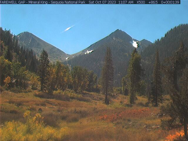
Elevation: 7830 ft
|
Kaweah Kam, on hillside west of Three Rivers on SR 198,
looking ENE at Moro Rock & Alta Peak in Sequoia NP

Elevation: 960 ft
|
Kaweah River Hi-Rez Cam,
Pumpkin Hollow on SR 198 outside Sequoia NP, looking north
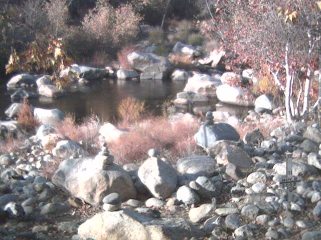
Elevation: 1250 ft
|
Kaweah River Cam, Pumpkin Hollow
on SR 198 outside Sequoia NP, looking north
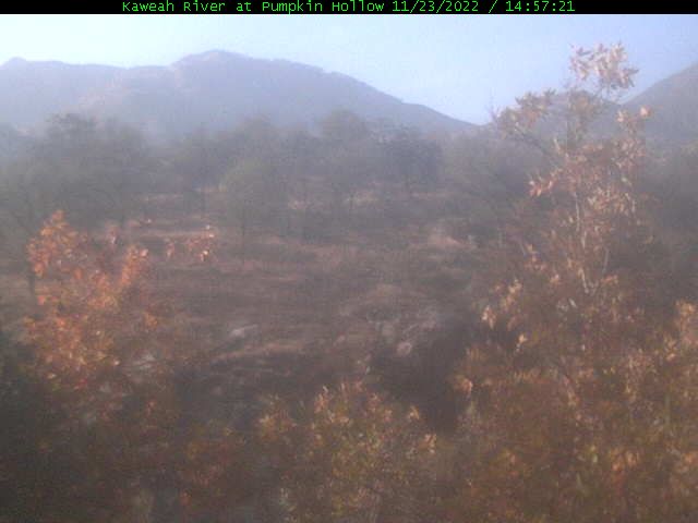
Elevation: 1250 ft
|
Ash Peaks Webcam,
Pumpkin Hollow on SR 198 outside Sequoia NP, looking north
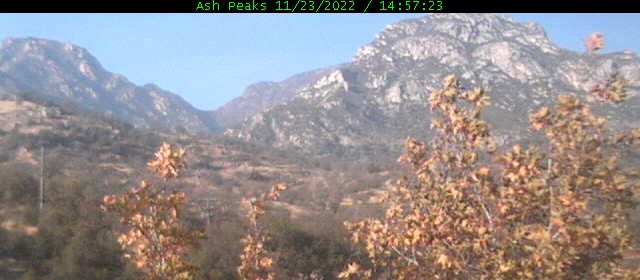
Elevation: 1250 ft
|
Moro Rock Webcam, Pumpkin Hollow on SR 198 outside Sequoia NP,
looking NE at Moro Rock & Alta Peak in Sequoia NP
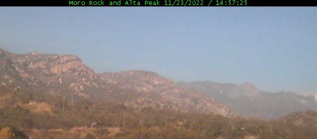
Elevation: 1250 ft
|
California Buckeye Webcam, Foothills Visitor Center on SR 198,
looking NE at Moro Rock in Sequoia NP

Elevation: 1720 ft
|
SR 190 and Sherman Pass Road Corridor, Sequoia National Forest and Giant Sequoia National Monument
|
Alpine Village NetCam, on the SW slopes of Jordan Peak,
north of Camp Nelson on SR 190, looking south at Slate Mtn

Elevation: 6600 ft
|
Sierra Wildland Fire Cam, Jordan Peak,
north of Camp Nelson on SR 190, looking north

Elevation: 9120 ft
|
Sierra Wildland Fire Cam, Jordan Peak,
north of Camp Nelson on SR 190, looking east

Elevation: 9120 ft
|
Sierra Wildland Fire Cam, Jordan Peak,
north of Camp Nelson on SR 190, looking SE

Elevation: 9120 ft
|
Sierra Wildland Fire Cam, Jordan Peak,
north of Camp Nelson on SR 190, looking west

Elevation: 9120 ft
|
Sierra Wildland Fire Cam, Jordan Peak,
north of Camp Nelson on SR 190, looking west

Elevation: 9120 ft
|
Sierra Wildland Fire Cam, Jordan Peak,
north of Camp Nelson on SR 190, looking NW

Elevation: 9120 ft
|
Sierra Wildland Fire Cam, Jordan Peak,
north of Camp Nelson on SR 190, looking NW

Elevation: 9120 ft
|
Sierra Wildland Fire Cam, Mule Peak,
south of SR 190, looking west

Elevation: 8150 ft
|
Sierra Wildland Fire Cam, Mule Peak,
south of SR 190, looking NW

Elevation: 8150 ft
|
Sierra Wildland Fire Cam, Mule Peak,
south of SR 190, looking SE

Elevation: 8150 ft
|
Sierra Wildland Fire Cam, Mule Peak,
south of SR 190, looking SW

Elevation: 8150 ft
|
Sierra Wildland Fire Cam, Sherman Peak,
west of US 395, looking NW

Elevation: 9920 ft
|
Sierra Wildland Fire Cam, Sherman Peak,
west of US 395, looking north

Elevation: 9920 ft
|
Sierra Wildland Fire Cam, Sherman Peak,
west of US 395, looking NE

Elevation: 9920 ft
|
Sierra Wildland Fire Cam, Sherman Peak,
west of US 395, looking east

Elevation: 9920 ft
|
Sierra Wildland Fire Cam, Sherman Peak,
west of US 395, looking SE

Elevation: 9920 ft
|
Sierra Wildland Fire Cam, Sherman Peak,
west of US 395, looking SW

Elevation: 9920 ft
|
Sierra Wildland Fire Cam, Sherman Peak,
west of US 395, looking west

Elevation: 9920 ft
|
Sierra Wildland Fire Cam, Bald Mtn Lookout,
west of US 395, looking NW

Elevation: 9380 ft
|
Sierra Wildland Fire Cam, Bald Mtn Lookout,
west of US 395, looking NE

Elevation: 9380 ft
|
Sierra Wildland Fire Cam, Bald Mtn Lookout,
west of US 395, looking east

Elevation: 9380 ft
|
Sierra Wildland Fire Cam, Bald Mtn Lookout,
west of US 395, looking south

Elevation: 9380 ft
|
Sierra Wildland Fire Cam, Bald Mtn Lookout,
west of US 395, looking west

Elevation: 9380 ft
|
Sierra Wildland Fire Cam, Tobias Peak,
north of SR 155, looking SE

Elevation: 8300 ft
|
Sierra Wildland Fire Cam, Tobias Peak,
north of SR 155, looking south

Elevation: 8300 ft
|
Sierra Wildland Fire Cam, Tobias Peak,
north of SR 155, looking SW

Elevation: 8300 ft
|
Sierra Wildland Fire Cam, Tobias Peak,
north of SR 155, looking NW

Elevation: 8300 ft
|
Sierra Wildland Fire Cam, Tobias Peak,
north of SR 155, looking NE

Elevation: 8300 ft
|
SR 155 and SR 178 Corridor, Alta Sierra Ski Area, Isabella Lake, Sequoia National Forest
|
Alta Sierra on SR 155, NW of Isabella Lake,
1 mile SE of Greenhorn Summit

Elevation: 5700 ft
|
Alta Sierra Ski Area at Shirley Meadows,
2 miles south of SR 155, Ridge Cam

Elevation: 6700 ft
|
Alta Sierra Ski Area at Shirley Meadows,
2 miles south of SR 155, Lake View Cam

Elevation: 6700 ft
|
Alta Sierra Ski Area at Shirley Meadows,
2 miles south of SR 155, WebCam

Elevation: 6700 ft
|
Alta Sierra Ski Area at Shirley Meadows,
2 miles south of SR 155, WebCam

Elevation: 6700 ft
|
Alta Sierra Ski Area at Shirley Meadows,
2 miles south of SR 155, WebCam

Elevation: 6700 ft
|
Kernville CabinCam, along Kern River Canyon,
north of SR 155 & Isabella Lake, looking NW

Elevation: 2760 ft
|
Sierra Wildland Fire Cam, Kernville,
north of SR 155 & Isabella Lake, looking NW

Elevation: 2700 ft
|
Sierra Wildland Fire Cam, Kernville,
north of SR 155 & Isabella Lake, looking NE

Elevation: 2700 ft
|
Sierra Wildland Fire Cam, Kernville,
north of SR 155 & Isabella Lake, looking south

Elevation: 2700 ft
|
Sierra Wildland Fire Cam, Kernville,
north of SR 155 & Isabella Lake, looking SW

Elevation: 2700 ft
|
Bodfish Canyon, SE of SR 155 junction on SR 178 @ MP 42,
4 miles south of Isabella Lake, looking north

Elevation: 3100 ft
|
Mountain Mesa, 1 mile south of SR 178
& Isabella Lake, looking north

Elevation: 2900 ft
|
Weldon, 2 mile SE of SR 178
& Isabella Lake, looking north

Elevation: 3200 ft
|
Sierra Wildland Fire Cam, Oakflat Lookout,
north of SR 178, looking NE towards Kern River

Elevation: 4950 ft
|
Sierra Wildland Fire Cam, Oakflat Lookout,
north of SR 178, looking E just N of Democrat

Elevation: 4950 ft
|
Sierra Wildland Fire Cam, Oakflat Lookout,
north of SR 178, looking SE towards Breckenridge

Elevation: 4950 ft
|
Sierra Wildland Fire Cam, Breckenridge Mtn Lookout,
south of SR 178, looking NW

Elevation: 7550 ft
|
Sierra Wildland Fire Cam, Breckenridge Mtn Lookout,
south of SR 178, looking north

Elevation: 7550 ft
|
Sierra Wildland Fire Cam, Breckenridge Mtn Lookout,
south of SR 178, looking NE

Elevation: 7550 ft
|
Sierra Wildland Fire Cam, Breckenridge Mtn Lookout,
south of SR 178, looking east

Elevation: 7550 ft
|
Sierra Wildland Fire Cam, Breckenridge Mtn Lookout,
south of SR 178, looking east

Elevation: 7550 ft
|
Sierra Wildland Fire Cam, Breckenridge Mtn Lookout,
south of SR 178, looking south

Elevation: 7550 ft
|
Mountainbase Webcam in Tehachapi on SR 58,
at the southernmost end of the Sierra Nevada

Elevation: 3900 ft
|
| Show telemetry | Hide telemetry |
|
| Page History: |
|
| January 2016 |
Original version with 74 camera views in 8 rows,
designed based on the Donner Summit WebCams page,
with some cameras from the long-unmaintained Sierra Nevada Mountain WebCams page
Includes the option to show the last 24 hours of data from several regional
California Cooperative Snow Surveys hourly telemetry sites below the webcams
Includes a script to convert the Tamarack Summit and Huntington Lake sites' quarter-hourly precip "event" data into an hourly data column
(it's unclear why the CDEC website can't simply copy the "event" data into the hourly data, it does so for some sites already but not others)
Later wrote a new external script to grab data from CDEC (such as the
California Cooperative Snow Surveys telemetry sites), which downloads the data and formats it to match the style of the SNOTEL data, the script makes maintenance of these
pages much easier by moving all CDEC telemetry code into a single location instead of separate code on each individual California Mountain WebCams page
Expanded to 86 camera views in 11 rows, adding 2 more Kaweah Cams, the 4 Delilah Lookout cams (which may be offline), Alpine Village,
and several more cams near Alta Sierra / Isabella Lake
Added an option to disable the NPS Air Quality Webcam (by appending "&aq=off" to the URL) if this page is not loading properly,
as server issues on that website are often the cause of such problems
|
| February 2016 |
Expanded to 87 camera views, adding a new cam southwest of Shaver Lake
Major internal PHP code cleanup, updating and/or deleting legacy code left over from very long ago, from the
Mount Rainier Paradise WebCams webpage (March 2009) on which all of these "Webcams + Telemetry Pages" are based,
and even from the original Washington Mountain WebCams webpage (December 2004) on which the Rainier page was based
Added descriptive dividers between major subregions of the webcam images, to clarify the layout of this fairly large and complex page
|
| March 2016 |
Added 24 RAWS hourly telemetry sites
across the very large region included on this webpage which have precip, wind, solar, and other sensors (but not snowdepth), with data available from
MesoWest
Added descriptive dividers between major subregions of the much-expanded telemetry section, which now includes telemetry sites,
as had been done earlier for the webcam images
Fixed all Weather Underground camera URLs, which now apparently need "?time()" appended in order to update properly
|
| December 2016 |
Expanded to 89 camera views, adding 2 more new webcams at Oakflat Lookout, and fixed one camera URL which had changed |
|
|
100
 |
200
 |
300
 |
400
 |
500
 |
600
 |
700
 |
800
 |
900
 |
1000
 |
1100
 |
1200
 |
1300
 |
1400
 |
1500
 |
1600
 |
1700
 |
1800
 |
Amar Andalkar Seattle, WA, USA
<About the Author / Contact Me>
All material on this website is ©1997-2025 by Amar Andalkar unless otherwise noted.
Last modified Sunday, May 23, 2021
|
|
| 100 |
 |
| 200 |
 |
| 300 |
 |
| 400 |
 |
| 500 |
 |
| 600 |
 |
| 700 |
 |
| 800 |
 |
| 900 |
 |
| 1000 |
 |
| 1100 |
 |
| 1200 |
 |
| 1300 |
 |
| 1400 |
 |
| 1500 |
 |
| 1600 |
 |
| 1700 |
 |
| 1800 |
 |
| 1900 |
 |
| 2000 |
 |
| 2100 |
 |
| 2200 |
 |
| 2300 |
 |
| 2400 |
 |
| 2500 |
 |
| 2600 |
 |
| 2700 |
 |
| 2800 |
 |
| 2900 |
 |
| 3000 |
 |
| 3100 |
 |
| 3200 |
 |
| 3300 |
 |
| 3400 |
 |
| 3500 |
 |
| 3600 |
 |
| 3700 |
 |
| 3800 |
 |
| 3900 |
 |
| 4000 |
 |
|


