Sea to Sky Hwy 99 Corridor: Whistler and Blackcomb Alpine ..
|
Whistler Peak, looking SW at Black Tusk *

Elevation: 2180 m / 7150 ft
|
Whistler Peak, looking west *

Elevation: 2180 m / 7150 ft
|
Whistler Peak, looking NW *

Elevation: 2180 m / 7150 ft
|
Whistler Peak, looking WNW at Mt Cayley and Powder Mtn *

Elevation: 2180 m / 7150 ft
|
Whistler Peak, looking north *

Elevation: 2180 m / 7150 ft
|
Whistler Peak, looking NNE *

Elevation: 2180 m / 7150 ft
|
Whistler Peak, looking NE *

Elevation: 2180 m / 7150 ft
|
Whistler Peak, looking ENE *

Elevation: 2180 m / 7150 ft
|
Whistler Mtn Roundhouse, looking SSW *

Elevation: 1850 m / 6070 ft
|
Whistler Mtn Roundhouse, looking SW *

Elevation: 1850 m / 6070 ft
|
Whistler Mtn Roundhouse, looking WSW *

Elevation: 1850 m / 6070 ft
|
Whistler Mtn Roundhouse, looking west *

Elevation: 1850 m / 6070 ft
|
Whistler Mtn Roundhouse, looking WNW *

Elevation: 1850 m / 6070 ft
|
Whistler Mtn Roundhouse, looking NW *

Elevation: 1850 m / 6070 ft
|
Whistler Mtn Roundhouse, looking north *

Elevation: 1850 m / 6070 ft
|
Whistler Mtn Roundhouse, looking NE *

Elevation: 1850 m / 6070 ft
|
Whistler Mtn Roundhouse, looking east *

Elevation: 1850 m / 6070 ft
|
Blackcomb Mtn Rendezvous, looking SE *

Elevation: 1860 m / 6100 ft
|
Blackcomb Mtn Rendezvous, looking south *

Elevation: 1860 m / 6100 ft
|
Blackcomb Mtn Rendezvous, looking SSW *

Elevation: 1860 m / 6100 ft
|
Blackcomb Mtn Rendezvous, looking SW *

Elevation: 1860 m / 6100 ft
|
Blackcomb Mtn Rendezvous, looking WSW *

Elevation: 1860 m / 6100 ft
|
Blackcomb Mtn Rendezvous, looking west *

Elevation: 1860 m / 6100 ft
|
Blackcomb Mtn Rendezvous, looking WNW *

Elevation: 1860 m / 6100 ft
|
Blackcomb Mtn Rendezvous, looking NW *

Elevation: 1860 m / 6100 ft
|
Blackcomb Mtn Rendezvous, looking NW *

Elevation: 1860 m / 6100 ft
|
Blackcomb Mtn Rendezvous, looking NNW *

Elevation: 1860 m / 6100 ft
|
Blackcomb Mtn Rendezvous, looking north *

Elevation: 1860 m / 6100 ft
|
Sea to Sky Hwy 99 Corridor: Lillooet to Pemberton to Whistler Area ..
|
Hwy 99, near Fountain Slide, about 15km north of Lillooet, looking northeast

Elevation: 400 m / 1300 ft
|
Hwy 99 (Duffey Lake Rd) at Cayoosh summit, looking east

Elevation: 1280 m / 4200 ft
|
Pemberton Airport WeatherCam, 5 km east of Pemberton on Hwy 99, looking west

Elevation: 205 m / 670 ft
|
Pemberton Airport WeatherCam, 5 km east of Pemberton on Hwy 99, looking east
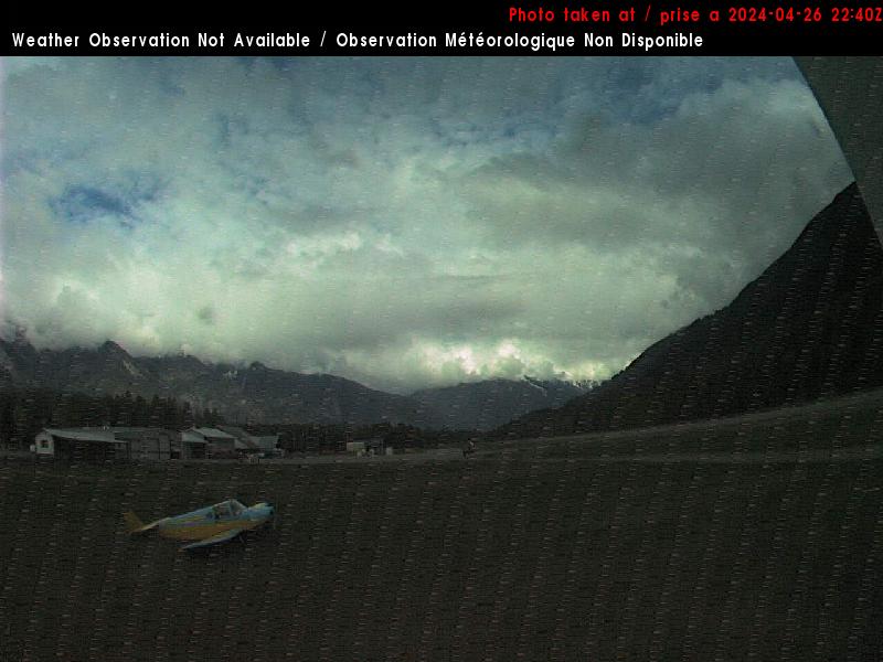
Elevation: 205 m / 670 ft
|
Rutherford Creek Power Station WeatherCam, 8 km SW of Pemberton on Hwy 99, looking NE

Elevation: 360 m / 1200 ft
|
Rutherford Creek Power Station WeatherCam, 8 km SW of Pemberton on Hwy 99, looking south

Elevation: 360 m / 1200 ft
|
Wedge, Hwy 99, about 13km north of Whistler at Riverside Drive, looking north

Elevation: 600 m / 2000 ft
|
Whistler Municipal Heliport WeatherCam, 10 km NE of Whistler on Hwy 99, looking SE

Elevation: 650 m / 2150 ft
|
Whistler Municipal Heliport WeatherCam, 10 km NE of Whistler on Hwy 99, looking SW

Elevation: 650 m / 2150 ft
|
Whistler Nesters WeatherCam, north of Whistler Village, looking south

Elevation: 670 m / 2200 ft
|
Whistler Nesters WeatherCam, north of Whistler Village, looking NE

Elevation: 670 m / 2200 ft
|
Whistler Nesters WeatherCam, north of Whistler Village, looking down at snow stake

Elevation: 670 m / 2200 ft
|
Whistler Village, looking east *

Elevation: 670 m / 2200 ft
|
Whistler Village, looking SE *

Elevation: 670 m / 2200 ft
|
Whistler Village, looking SE *

Elevation: 670 m / 2200 ft
|
Whistler Village, looking south *

Elevation: 670 m / 2200 ft
|
Horstman Glacier, looking SE *

Elevation: 2140 m / 7000 ft
|
Horstman Glacier, looking south *

Elevation: 2140 m / 7000 ft
|
Horstman Glacier, looking SW *

Elevation: 2140 m / 7000 ft
|
Horstman Glacier, looking west *

Elevation: 2140 m / 7000 ft
|
Horstman Glacier, looking west *

Elevation: 2140 m / 7000 ft
|
Horstman Glacier, looking NW *

Elevation: 2140 m / 7000 ft
|
Horstman Glacier, looking north *

Elevation: 2140 m / 7000 ft
|
Horstman Glacier, looking NE *

Elevation: 2140 m / 7000 ft
|
Whistler Mid-Station WeatherCam, looking SW

Elevation: 1300 m / 4300 ft
|
Whistler Mid-Station WeatherCam, looking north

Elevation: 1300 m / 4300 ft
|
Whistler Creekside, looking west towards Sproatt Mtn *

Elevation: 650 m / 2150 ft
|
Function Junction, Hwy 99 at Cheakamus Lake Rd, 5 km south of Whistler, looking north

Elevation: 600 m / 2000 ft
|
Sea to Sky Hwy 99 Corridor: South of Whistler to Squamish Area to West Vancouver ..
|
Whistler MSC Radar Site WeatherCam, 10 km SW of Whistler on Hwy 99, looking north
Elevation: 520 m / 1700 ft
|
Whistler MSC Radar Site WeatherCam, 10 km SW of Whistler on Hwy 99, looking NE
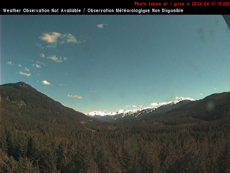
Elevation: 520 m / 1700 ft
|
Whistler MSC Radar Site WeatherCam, 10 km SW of Whistler on Hwy 99, looking south
Elevation: 520 m / 1700 ft
|
Whistler Olympic Park Webcam, in Callaghan Valley NW of Hwy 99, looking north *

Elevation: 850 m / 2800 ft
|
Whistler Olympic Park Webcam, in Callaghan Valley NW of Hwy 99, looking south *

Elevation: 850 m / 2800 ft
|
Garibaldi Tower WeatherCam, 10 miles NW of Mount Garibaldi near Hwy 99, looking NE

Elevation: 660 ? m / 2200 ? ft
|
Garibaldi Tower WeatherCam, 10 miles NW of Mount Garibaldi near Hwy 99, looking south

Elevation: 660 ? m / 2200 ? ft
|
Hwy 99, south of Garibaldi (abandoned townsite), looking south

Elevation: 310 m / 1000 ft
|
District of Squamish, Cloudburst Mtn WebCam, looking north? *

Elevation: 1500 ? m / 5000 ? ft
|
Cheakamus Canyon Tower WeatherCam, 8 miles west of Mount Garibaldi near Hwy 99, looking north

Elevation: 600 ? m / 2000 ? ft
|
Cheakamus Canyon Tower WeatherCam, 8 miles west of Mount Garibaldi near Hwy 99, looking SE

Elevation: 600 ? m / 2000 ? ft
|
BTSC Snow Cam, on Brohm Ridge, 5 km WSW of summit of Mt Garibaldi

Elevation: 1500 m / 4900 ft
|
Alice Lake, Hwy 99 at Squamish Valley Rd, about 10km north of Squamish, looking north

Elevation: 140 m / 460 ft
|
Squamish Airport WeatherCam (Nav Canada),
north of Brackendale, looking north

Elevation: 60 m / 200 ft
|
Squamish Airport WeatherCam (Nav Canada),
north of Brackendale, looking south

Elevation: 60 m / 200 ft
|
Squamish Airport WeatherCam (WeatherOffice), north of Brackendale, looking NW

Elevation: 50 m / 170 ft
|
Squamish Airport WeatherCam (WeatherOffice), north of Brackendale, looking south

Elevation: 50 m / 170 ft
|
District of Squamish, Garibaldi WebCam, looking NE at Mt Garibaldi *

Elevation: 300 ? m / 1000 ? ft
|
District of Squamish WebCam, looking SW at Squamish and Howe Sound *

Elevation: 300 ? m / 1000 ? ft
|
Skypilot Kiteboarding Squamish Webcam *

Elevation: 10 m / 30 ft
|
District of Squamish WebCam, looking south at Hwy 99, downtown and Stawamus Chief *

Elevation: 30 m / 100 ft
|
District of Squamish, Stawamus Chief WebCam, looking SE *

Elevation: 30 m / 100 ft
|
Hwy 99, 5 km south of Squamish, looking north

Elevation: 30 m / 100 ft
|
Furry Creek, Hwy 99, about 12km south of Squamish, looking south

Elevation: 100 m / 300 ft
|
Lions Bay visibility camera, off Hwy 99, looking SW

Elevation: 100? m / 300? ft
|
Lions Bay visibility camera, off Hwy 99, looking NW

Elevation: 100? m / 300? ft
|
Hwy 99, 1 km north of Horseshoe Bay, looking north

Elevation: 40 m / 130 ft
|
Pitt River Lodge, north of Pitt Lake, looking north *

Elevation: 30 m / 100 ft
|
Trans-Canada Hwy 1 Corridor: Vancouver Area ..
|
BC Ferries Horseshoe Bay Terminal, just west of Hwy 1, looking north *

Elevation: 60 m / 200 ft
|
West Vancouver WeatherCam, above Hwy 1 looking west

Elevation: 150 m / 500 ft
|
West Vancouver WeatherCam, above Hwy 1 looking east

Elevation: 150 m / 500 ft
|
Hwy 99, north end of Lions Gate Bridge, looking south

Elevation: 60 m / 200 ft
|
UBC Arts Tower Cam, looking west from Vancouver *

Elevation: 60 m / 200 ft
|
Jericho Beach Webcam, looking north at North Shore mountains *

Elevation: 20 m / 60 ft
|
Jericho Beach Webcam 2, looking north at North Shore mountains *

Elevation: 20 m / 60 ft
|
Vancouver Webcam, looking NE at downtown and North Shore *

Elevation: 30 m / 100 ft
|
Kat Kam, looking WSW from downtown Vancouver *

Elevation: 30 m / 100 ft
|
Westin Bayshore Live Cam, looking ENE from downtown Vancouver *

Elevation: 60 m / 200 ft
|
Vancouver.com Web Cam, looking north at North Shore mountains *

Elevation: 100 m / 300 ft
|
Vancouver.com Web Cam, looking NE at North Shore mountains *

Elevation: 100 m / 300 ft
|
Vancouver.com Web Cam, looking SE over downtown *

Elevation: 100 m / 300 ft
|
Port of Vancouver Harbour View Cam, looking north at North Shore mountains *

Elevation: 100 m / 300 ft
|
Vancouver Harbour visibility camera, looking NE at North Shore mountains

Elevation: 100 m / 300 ft
|
CBC Cam in Vancouver, often looking north at North Shore mountains *

Elevation: 100 ? m / 300 ? ft
|
Deep Cove Yacht Club, east of Hwy 1 in North Vancouver, looking east *

Elevation: 10 m / 30 ft
|
Simon Fraser University Library Cam, on Mt Burnaby looking WNW *

Elevation: 365 m / 1200 ft
|
Bluenose WebCam #2, New Westminster, looking SE *

Elevation: 60 m / 200 ft
|
Bluenose WebCam #3, New Westminster, looking SE *

Elevation: 60 m / 200 ft
|
Hwy 1 at SE end of Port Mann Bridge, looking NW

Elevation: 60 m / 200 ft
|
Pitt Meadows visibility camera, on Hwy 7, looking north

Elevation: 10 m / 30 ft
|
Hwy7 (Lougheed) at Kennedy Road, looking northwest at Pitt River Bridge

Elevation: 10 m / 30 ft
|
Hwy 1 at Hwy 15, east of Port Mann weigh scale, looking east

Elevation: 60 m / 200 ft
|
Redwoods Golf Course in Langley, looking north *

Elevation: 30 m / 100 ft
|
Hwy 1 at Bradner Road, west of Abbotsford, looking east

Elevation: 120 m / 400 ft
|
Abbotsford Airport visibility camera, on Hwy 1, looking SE at Mt Baker

Elevation: 60 m / 200 ft
|
BC Cascade Mountains: Trans-Canada Hwy 1, Crowsnest Hwy 3, Coquihalla Hwy 5 Corridor ..
|
Hwy 1 at Evans Road overpass near Chilliwack, looking east

Elevation: 10 m / 30 ft
|
Chilliwack visibility camera, off Hwy 1, looking south

Elevation: 10? m / 30? ft
|
Hemlock Valley Resort, north of Chilliwack off Hwy 7 *

Elevation: 980 m / 3200 ft
|
Hemlock Valley Resort, north of Chilliwack off Hwy 7 *

Elevation: 980 m / 3200 ft
|
Hope Airport WeatherCam, off Hwy 1, looking west

Elevation: 40 m / 130 ft
|
Hope Airport WeatherCam, off Hwy 1, looking east

Elevation: 40 m / 130 ft
|
Hwy 1 at Kahmoose Rd, 12 km north of Boston Bar, looking north

Elevation: 290 m / 950 ft
|
Lytton WeatherCam, off Hwy 1, looking NW

Elevation: 230 m / 750 ft
|
Lytton WeatherCam, off Hwy 1, looking south

Elevation: 230 m / 750 ft
|
Spences Bridge on Hwy 1 at junction of Hwy 8 *

Elevation: 240 m / 800 ft
|
Cache Creek, 200 m east of the intersection of Hwy 1 and 97, looking east on Hwy 1

Elevation: 480 m / 1600 ft
|
|
Coquihalla Hwy 5, Great Bear Snowshed looking north

Elevation: 980 m / 3200 ft
|
Zopkios, Hwy 5 near the Coquihalla Summit looking south

Elevation: 1220 m / 4000 ft
|
Coquihalla Lakes, Hwy 5, 61 km south of Merritt, looking north

Elevation: 1100 m / 3600 ft
|
Coquihalla Hwy 5 at Larson HIll, 36 km south of Merritt, looking north

Elevation: 1060 m / 3500 ft
|
Merritt Airport, east of Coquihalla Hwy 5, looking south *

Elevation: 640 m / 2100 ft
|
Merritt Airport, east of Coquihalla Hwy 5, looking west *

Elevation: 640 m / 2100 ft
|
Merritt Airport, east of Coquihalla Hwy 5, looking north *

Elevation: 640 m / 2100 ft
|
Coquihalla Hwy 5 at Helmer Lake, 24 km north of Merritt, looking north

Elevation: 1385 m / 4550 ft
|
Coquihalla Hwy 5 at Walloper, 23 km South of Kamloops, looking north

Elevation: 1300 m / 4270 ft
|
Manning Park, on Hwy 3, 10 km east of Allison Pass looking east

Elevation: 1200 m / 3900 ft
|
Manning Provincial Park WeatherCam, on Hwy 3, looking NW

Elevation: 1200 m / 3900 ft
|
Manning Provincial Park WeatherCam, on Hwy 3, looking east

Elevation: 1200 m / 3900 ft
|
Tulameen, off Hwy 3 north of Manning Park *

Elevation: 800 m / 2600 ft
|
Lorne Lake, off Hwy 3 SE of Princeton *

Elevation: 700 m / 2300 ft
|
Vancouver Island: Mt Washington ..
|
Mt Washington Alpine Resort, west of Hwy 19, Mile High Cam *

Elevation: 1180 m / 3870 ft
|
Mt Washington Alpine Resort, west of Hwy 19, Alpine Cam *

Elevation: 1180 m / 3870 ft
|
Mt Washington Alpine Resort, west of Hwy 19, Alpine Cam *

Elevation: 1180 m / 3870 ft
|
Mt Washington Alpine Resort, west of Hwy 19, Alpine Cam *

Elevation: 1180 m / 3870 ft
|
Mt Washington Alpine Resort, west of Hwy 19, Alpine Cam *

Elevation: 1180 m / 3870 ft
|
Mt Washington Alpine Resort, west of Hwy 19, Alpine Cam *

Elevation: 1180 m / 3870 ft
|
Mt Washington Alpine Resort, west of Hwy 19, Alpine Cam *

Elevation: 1180 m / 3870 ft
|
Mt Washington Alpine Resort, west of Hwy 19, Whiskey Jack Cam *

Elevation: 1460 m / 4800 ft
|
Mt Washington Alpine Resort, west of Hwy 19, Whiskey Jack Cam *

Elevation: 1460 m / 4800 ft
|
Mt Washington Alpine Resort, west of Hwy 19, Whiskey Jack Cam *

Elevation: 1460 m / 4800 ft
|
Mt Washington Alpine Resort, west of Hwy 19, Whiskey Jack Cam *

Elevation: 1460 m / 4800 ft
|
Mt Washington Alpine Resort, west of Hwy 19, Whiskey Jack Cam *

Elevation: 1460 m / 4800 ft
|
Mt Washington Alpine Resort, west of Hwy 19, Whiskey Jack Cam *

Elevation: 1460 m / 4800 ft
|
Mt Washington Alpine Resort, west of Hwy 19, Nordic Cam *

Elevation: 1100 m / 3600 ft
|
Mt Washington Alpine Resort, west of Hwy 19, Nordic Cam *

Elevation: 1100 m / 3600 ft
|
Mt Washington Alpine Resort, west of Hwy 19, Nordic Cam *

Elevation: 1100 m / 3600 ft
|
Mt Washington Alpine Resort, west of Hwy 19, Nordic Cam *

Elevation: 1100 m / 3600 ft
|
Mt Washington Alpine Resort, west of Hwy 19, Nordic Cam *

Elevation: 1100 m / 3600 ft
|
Mt Washington Alpine Resort, west of Hwy 19, Nordic Cam *

Elevation: 1100 m / 3600 ft
|
Vancouver Island, Coastal Inlets, Sunshine Coast: Hwy 101, Hwy 19, Hwy 4, Trans-Canada Hwy 1 Corridor ..
|
Gilford Island, looking SW across Knight Inlet to Minstrel and Turnour Islands *

Elevation: 10 m / 30 ft
|
Knight Inlet Lodge in Glendale Cove, looking SW *

Elevation: 10 m / 30 ft
|
Head of Bute Inlet on the bank of the Homathko River, looking south *

Elevation: 20 m / 60 ft
|
Powell River on Hwy 101, Peak Webcam, looking south (?) *

Elevation: 10 m / 30 ft
|
Malibu on Princess Louisa Inlet, looking south *

Elevation: 10 m / 30 ft
|
Madeira Park on Hwy 101, looking at Pender Harbour *

Elevation: 30 m / 100 ft
|
Langdale on Hwy 101, looking SE at Howe Sound *
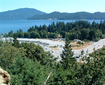
Elevation: 30 m / 100 ft
|
BC Ferries Langdale Terminal, on Hwy 101, looking east *

Elevation: 30 m / 100 ft
|
|
Village of Sayward off Hwy 19, looking north across Johnstone Strait to Hardwicke Island *

Elevation: 30 m / 100 ft
|
Village of Sayward off Hwy 19, looking east down Race and Current Passages to Helmcken Island *

Elevation: 30 m / 100 ft
|
Chatham Point WeatherCam, Rock Bay off Hwy 19, looking NW

Elevation: 30 m / 100 ft
|
Chatham Point WeatherCam, Rock Bay off Hwy 19, looking east

Elevation: 30 m / 100 ft
|
Roberts Lake, Hwy 19, 15km north of Campbell River, looking north

Elevation: 180 m / 600 ft
|
Strathcona Park Lodge and Upper Campbell Lake on Hwy 28, looking west *

Elevation: 240 m / 800 ft
|
Black Creek on Hwy 19 at Hamm Road, about 25 km north of Courtenay, looking north

Elevation: 90 m / 300 ft
|
Hwy 19 at Cook Creek Road, about 29 km north of Parksville, looking north

Elevation: 90 m / 300 ft
|
Port Alberni WeatherCam, off Hwy 4, looking NW

Elevation: 10 m / 30 ft
|
Port Alberni WeatherCam, off Hwy 4, looking east
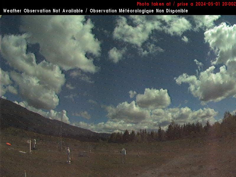
Elevation: 10 m / 30 ft
|
Port Alberni Summit, Hwy 4 about 9 km east of Port Alberni, looking west

Elevation: 410 m / 1350 ft
|
Nitinaht Lake, looking north *

Elevation: 60 ? m / 200 ? ft
|
Nanaimo Parkway, Hwy 19 at College Drive, looking north

Elevation: 135 m / 450 ft
|
Cowichan on Hwy 18, approx. 10 km west of Hwy 1, looking west

Elevation: 140 m / 460 ft
|
Hwy 18, at Skutz Falls Road, looking west

Elevation: 200 m / 650 ft
|
Malahat, Hwy 1 at South Shawnigan Lake Road, looking north

Elevation: 310 m / 1000 ft
|
Royal Roads, Victoria visibility camera, looking south at Olympic Mtns in WA

Elevation: 100 m / 300 ft
|
|
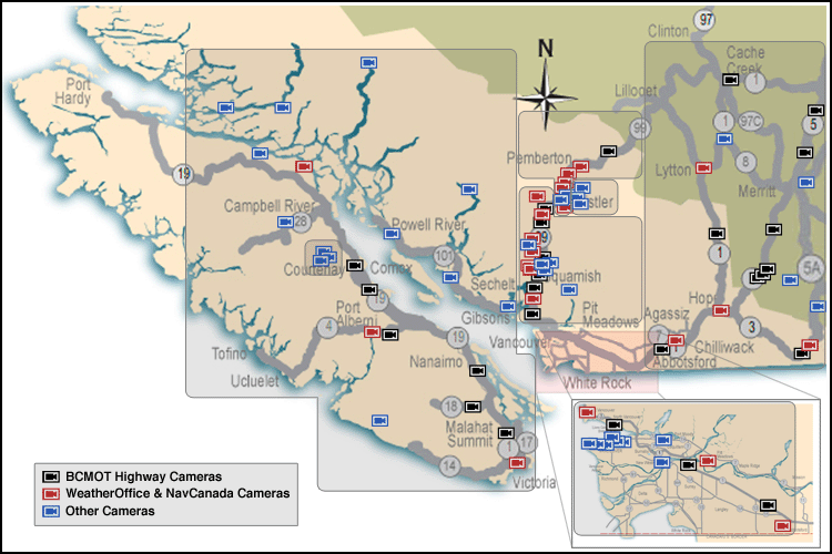
| Map of Camera Sites: (each corridor is enclosed in a gray box) |
 |
| Sea to Sky Hwy 99 Corridor: Whistler and Blackcomb Alpine |
 |
 |
 |
 |
 |
 |
 |
 |
 |
 |
 |
 |
 |
 |
 |
 |
 |
 |
 |
 |
 |
 |
 |
 |
 |
 |
 |
 |
28 |
| Sea to Sky Hwy 99 Corridor: Lillooet to Pemberton to Whistler Area |
 |
 |
 |
 |
 |
 |
 |
 |
 |
 |
 |
 |
 |
 |
 |
 |
 |
 |
 |
 |
 |
 |
 |
 |
 |
 |
 |
 |
28 |
| Sea to Sky Hwy 99 Corridor: South of Whistler to Squamish Area to West Vancouver |
 |
 |
 |
 |
 |
 |
 |
 |
 |
 |
 |
 |
 |
 |
 |
 |
 |
 |
 |
 |
 |
 |
 |
 |
 |
 |
 |
 |
28 |
| Trans-Canada Hwy 1 Corridor: Vancouver Area |
 |
 |
 |
 |
 |
 |
 |
 |
 |
 |
 |
 |
 |
 |
 |
 |
 |
 |
 |
 |
 |
 |
 |
 |
 |
 |
 |
27 |
| BC Cascade Mountains: Trans-Canada Hwy 1, Crowsnest Hwy 3, Coquihalla Hwy 5 Corridor |
 |
 |
 |
 |
 |
 |
 |
 |
 |
 |
 |
|
 |
 |
 |
 |
 |
 |
 |
 |
 |
 |
 |
 |
 |
 |
25 |
| Vancouver Island: Mt Washington |
 |
 |
 |
 |
 |
 |
 |
 |
 |
 |
 |
 |
 |
 |
 |
 |
 |
 |
 |
19 |
| Vancouver Island, Coastal Inlets, Sunshine Coast: Hwy 101, Hwy 19, Hwy 4, Trans-Canada Hwy 1 Corridor |
 |
 |
 |
 |
 |
 |
 |
 |
|
 |
 |
 |
 |
 |
 |
 |
 |
 |
 |
 |
 |
 |
 |
 |
 |
 |
25 |
|
|
|
| Page History: |
|
|
|
Page Statistics: |
| January 2008 | Original version with 60 camera views in 6 corridors (rows), based on the
Washington Mountain WebCams webpage; includes a PHP script to allow changing the image size
Note that many of these images (e.g. Whister/Blackcomb and Mt Washington) are multiple directional views from a single camera
Later expanded to 95 camera views, and added new header/footer design to match rest of website
Added map of camera sites and corridors, modified from the maps at
http://www.th.gov.bc.ca/bchighwaycam/highwayCamMaps.aspx
Added table of mini camera images beside map, and added timestamp in page header
Further expanded to 108 camera views, and added option to show pixel rulers along the bottom and right edges of the page
|
Page loaded at 6:52 AM PST on Friday, November 22, 2024
Total camera images: 180
BCMOT Highway Cams: 32
Nav Canada WeatherCams: 27
WeatherOffice WeatherCams: 7
WeatherOffice Visibility Cams: 7
Whistler Blackcomb Ski Resort: 40
Mt Washington Alpine Resort: 18
Approximate page width: 9100 pixels 9072
Approximate page height: 3500 pixels 3498
|
| February 2008 | Expanded to 110 camera views |
| May 2008 | Expanded to 114 camera views, fixed some camera links which had changed |
| June 2008 | Expanded to 115 camera views |
| November 2008 | Expanded to 149 camera views, fixed some camera links which had changed
Moved the greatly expanded number of Mt Washington webcams to a new separate corridor (row)
Added row counts to table of mini camera images, and "Page Statistics" to the right
|
| December 2008 | Expanded to 154 camera views, fixed some camera links which had changed, updated links to all BCMOT Highway Cams |
| January 2009 | Fixed some camera links which had changed |
| April 2009 | Fixed all BCMOT camera links which had changed |
| July 2009 | Expanded to 156 camera views, fixed some camera links which had changed |
| August 2009 | Fixed some camera links which had changed |
| October 2009 | Expanded to 160 camera views, fixed some camera links which had changed |
| November 2009 | Expanded to 175 camera views, fixed several camera links which had changed
Reorganized cameras in Sea to Sky Hwy 99 Corridor (first three rows), improved several photo captions
|
| January 2010 | Expanded to 177 camera views, fixed several camera links which had changed
Updated the site navigation bars to include the various other Mountain WebCams pages
Created the Mount Garibaldi WebCams webpage,
which displays a subset of local webcams at any of three larger sizes
|
| February 2010 | Reduced to 175 camera views, adding 2 new cameras and removing 4 defunct BCMOT Highway Cams |
| October 2010 | Updated all NAV Canada webcam links, which had changed over the summer (but many cameras still appear to be offline though) |
| November 2010 | Expanded to 177 camera views, adding 3 new BCMOT Highway Cams and removing 1 defunct cam |
| December 2010 | Expanded to 180 camera views (including removing 10 defunct cams), fixed many camera links which had changed,
but all NAV Canada webcam links are now broken and remain so |
|