San Francisco Bay Area: I-80, I-280, I-680, US 101, SR 1 Hwy Corridor ..
|
Point Reyes National Seashore, west of SR 1, view of Point Reyes Beach looking NNE

Elevation: 400 ft
|
Mount Vaca Camera, north of I-80 near Vacaville, looking NE towards Sacramento
Elevation: 2800 ft
|
KPIX CBS5 Mount Vaca Webcam, north of I-80 near Vacaville

Elevation: 2800 ft
|
|
Hi-Def San Francisco, looking south from Sausalito on US 101 towards San Francisco

Elevation: 500 ? ft
|
WebMarin, looking south from Sausalito on US 101 towards San Francisco

Elevation: 1000 ? ft
|
Live Sausalito Cam, looking south from Sausalito on US 101 towards San Francisco

Elevation: 30 ft
|
KPIX CBS5 Golden Gate Bridge Webcam, looking north from south end of bridge on US 101 in San Francisco

Elevation: 200 ft
|
KPIX CBS5 San Francisco Bay Webcam, usually looking east at Bay Bridge and distant hills from San Francisco

Elevation: 200 ? ft
|
KGO-TV Bay Bridge Camera, usually looking east along Bay Bridge and distant hills from San Francisco

Elevation: 250 ft
|
KPIX CBS5 Bay Bridge At Treasure Island Webcam, looking east along I-80 towards distant hills from Yerba Buena Island

Elevation: 200 ft
|
KPIX CBS5 Bay Bridge Toll Plaza Webcam, looking east along I-80 towards distant hills from Oakland

Elevation: 50 ft
|
TEA Weather Cam, in the Emerald Hills area near Redwood City east of I-280, looking north towards San Mateo Bridge
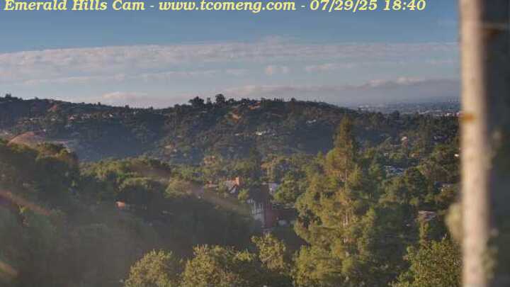
Elevation: 600 ft
|
|
Lawrence Hall of Science, in the Berkeley Hills east of I-80, looking west towards San Francisco

Elevation: 1150 ft
|
KGO-TV East Bay Camera 2, atop Vollmer Peak in the Berkeley Hills east of I-80, usually looking west towards San Francisco

Elevation: 1900 ft
|
Mt Diablo Cam, looking east towards Mt Diablo from Alamo on I-680

Elevation: 400 ? ft
|
South Bay Area, Monterey, Santa Lucia Range, Central Coast: US 101, SR 1 Hwy Corridor ..
|
Lick Observatory, Mt Hamilton on SR 130 east of San Jose, looking west

Elevation: 4200 ft
|
Lick Observatory, Mt Hamilton on SR 130 east of San Jose, looking ENE

Elevation: 4200 ft
|
Lick Observatory, Mt Hamilton on SR 130 east of San Jose, APF cam looking west

Elevation: 4200 ft
|
Morgan Hill Weather Cam, moveable view from hills east of Morgan Hill on US 101

Elevation: 600 ft
|
|
KSBW Fremont Peak Cam, NE of Salinas on US 101, looking north ?

Elevation: 3100 ft
|
La Joya Elementary School, on US 101 north of Salinas, looking north

Elevation: 150 ft
|
KSBW Salinas Cam, in Salinas on US 101, looking north ?

Elevation: 100 ? ft
|
Hastings Natural History Reservation, in Carmel Valley south of Monterey, looking south

Elevation: 1800 ft
|
|
USGS Big Sur River near Big Sur Webcam, in Pfeiffer Big Sur State Park on SR 1

Elevation: 250 ft
|
Nepenthe Restaurant Cam, Big Sur on SR 1, looking south

Elevation: 600 ft
|
|
San Luis Obispo South Higuera Street Webcam, on US 101 / SR 1, looking south

Elevation: 430 ft
|
San Luis Obispo Regional Airport Webcam, on US 101 / SR 1, looking SE

Elevation: 430 ft
|
Sierra Madre, San Emigdio and Tehachapi Mountains: SR 33, I-5, SR 14, SR 58 Hwy Corridor ..
|
USGS San Pedro Creek near Goleta Webcam, north of US 101 in Goleta, west of Santa Barbara

Elevation: 100 ft
|
USGS Ventura River near Ventura Webcam, on SR 33 north of Ventura

Elevation: 200 ft
|
San Cayetano Elementary School, on SR 126 in Fillmore, east of Ventura

Elevation: 500 ft
|
|
Pine Mountain Club Mt. Pinos Web Cam, in San Emigdio Mtns west of I-5 @ MP 205, looking south towards Mount Pinos

Elevation: 5800 ft
|
Cuddy Valley Web Cam, in San Emigdio Mtns west of I-5 @ MP 205, looking east towards Pinon Pines from Cuddy Valley

Elevation: 5600 ft
|
Polaris Observatory Web Cam in Lockwood Valley, in San Emigdio Mtns west of I-5 @ MP 205

Elevation: 5200 ft
|
Frazier Park School Weather Cam, in Frazier Park in the San Emigdio Mtns west of I-5 @ MP 205

Elevation: 4650 ft
|
Lone Juniper Ranch Grapevine Cam, looking north from Lebec on I-5 @ MP 207 north of Tejon Pass

Elevation: 3500 ft
|
|
Mountainbase Webcam in Tehachapi on SR 58, looking north

Elevation: 3900 ft
|
Tehachapi Rail Cam, east of I-5 @ MP 730 *
![]()
Elevation: 3500 ? ft
|
|
Palmdale Cam, looking north from Tenhi Mountain, 3 miles SW of Palmdale on SR 14

Elevation: 4000 ft
|
Santa Monica and San Gabriel Mountains: SR 1, US 101, I-5, I-210, SR 2 Hwy Corridor ..
|
USGS Malibu Creek at Malibu Webcam, north of SR 1 in Malibu Canyon at foot of Santa Monica Mtns

Elevation: 50 ft
|
KABC Los Angeles International Airport (LAX) Webcam, looking NW towards Santa Monica Mtns

Elevation: 200 ft
|
|
Olive Vista Middle School, on I-210 @ MP 3 in Sylmar, looking NE

Elevation: 1300 ft
|
Altadena WeatherCam, looking north from Lake Ave in Altadena, north of I-210 @ MP 27

Elevation: 1680 ft
|
Mount Wilson Observatory, 150-Foot Solar Towercam, north of Pasadena off SR 2
Elevation: 5845 ft
|
USFS Cucamonga Cam, near the Mt Wilson Observatory north of Pasadena off SR 2, looking ESE towards San Gorgonio Mountain

Elevation: 5600 ft
|
USFS San Gabriel Cam, on Josephine Peak north of Pasadena off SR 2, looking east across the San Gabriel Mountains

Elevation: 5560 ft
|
|
Mountain High Ski Resort, west of Wrightwood on SR 2

Elevation: 6600 ft
|
Mountain High Ski Resort, west of Wrightwood on SR 2

Elevation: 6600 ft
|
Mountain High Ski Resort, west of Wrightwood on SR 2

Elevation: 6600 ft
|
Mountain High Ski Resort, west of Wrightwood on SR 2

Elevation: 6600 ft
|
|
Mount Baldy Ski Area Web Cam, north of Claremont on Mount Baldy Rd

Elevation: 7800 ft
|
Cable Airport North Cam, in Upland on I-210 @ MP 52, looking north towards Mt Baldy

Elevation: 1400 ft
|
Cable Airport North Cam 2, in Upland on I-210 @ MP 52, looking north towards the San Gabriel Mtns

Elevation: 1400 ft
|
Western San Bernardino Mountains: I-15, SR 18, SR 138 Hwy Corridor ..
|
I-15 at Duncun Canyon Rd, looking NE (Caltrans)
![]()
Elevation: 1750 ft
|
I-15 south of Glen Helen, looking NE (Caltrans)
![]()
Elevation: 2000 ft
|
I-15 north of Glen Helen, looking north (Caltrans)
![]()
Elevation: 2100 ft
|
I-15 north of SR 138, looking south (Caltrans)
![]()
Elevation: 3200 ft
|
I-15 at Cajon Pass, looking west (Caltrans)
![]()
Elevation: 4200 ft
|
I-15 south of Oakhill, looking north (Caltrans)
![]()
Elevation: 4200 ft
|
|
USGS East Twin Creek near Arrowhead Springs Webcam, east of SR 18, north of San Bernardino

Elevation: 1600 ft
|
Lake Gregory Webcam, North Shore Inn in Crestline off SR 138 north of SR 18

Elevation: 4600 ft
|
Rimforest Webcam, on SR 18

Elevation: 5600 ft
|
Skyforest Webcam, at the junction of SR 18 and Kuffel Canyon Rd

Elevation: 5750 ft
|
Lake Arrowhead Country Club Webcam, north of SR 18 and SR 189, west of Lake Arrowhead

Elevation: 5200 ft
|
Blue Jay Webcam, in Blue Jay on SR 189 just west of Lake Arrowhead

Elevation: 5200 ft
|
Lake Arrowhead Village Web Cam, north of SR 18 on SR 189, looking north
Elevation: 5200 ft
|
Lake Arrowhead Lake Level Web Cam, north of SR 18 on SR 189

Elevation: 5150 ft
|
Lake Arrowhead Live Webcam, north of SR 18 on SR 189

Elevation: 5150 ft
|
|
Green Valley Lake, north of SR 18

Elevation: 6900 ft
|
Green Valley Lake, north of SR 18

Elevation: 6900 ft
|
Eastern San Bernardino Mountains: SR 18, SR 38, SR 330 Hwy Corridor ..
|
USGS City Creek near Highland Webcam, east of SR 330, north of Highland

Elevation: 1650 ft
|
|
Snow Valley Ski Resort Base Webcam, east of Running Springs on SR 18

Elevation: 6800 ft
|
Snow Valley Ski Resort Top Webcam, east of Running Springs on SR 18

Elevation: 7800 ft
|
|
Big Bear Solar Observatory, on a jetty in Big Bear Lake on SR 38, looking north toward the shore
Elevation: 6780 ft
|
Big Bear Shores Office Cam, north shore of Big Bear Lake on SR 38

Elevation: 6800 ft
|
Big Bear Shores Lookout Cam, north shore of Big Bear Lake on SR 38

Elevation: 6900 ft
|
Big Bear Shores Marina Cam, north shore of Big Bear Lake on SR 38, looking south

Elevation: 6750 ft
|
Bear Lake Web Cam West, in Big Bear Lake on SR 18, looking west

Elevation: 6760 ft
|
|
Snow Summit Ski Resort Cam, in Big Bear Lake on SR 18

Elevation: 7000 ft
|
Snow Summit Ski Resort KNBC Cam, in Big Bear Lake on SR 18

Elevation: 7000 ft
|
Snow Summit Ski Resort KTTV Cam, in Big Bear Lake on SR 18

Elevation: 7000 ft
|
Bear Mountain Ski Resort Cam 1, in Big Bear Lake on SR 18

Elevation: 7150 ft
|
Bear Mountain Ski Resort Cam 2, in Big Bear Lake on SR 18

Elevation: 7150 ft
|
Bear Mountain Ski Resort Cam 3, in Big Bear Lake on SR 18

Elevation: 7150 ft
|
Bear Mountain Ski Resort Cam 4, in Big Bear Lake on SR 18

Elevation: 7150 ft
|
Santa Ana, San Jacinto, and Santa Rosa Mountains, Mojave Desert: I-10, I-15, SR 111 Hwy Corridor ..
|
USGS Santiago Creek at Modjeska Webcam, in the Santa Ana Mtns east of SR 241

Elevation: 1200 ft
|
USGS Santa Margarita River at Fallbrook Webcam, in the Santa Ana Mtns west of I-15 @ MP 51

Elevation: 350 ft
|
USGS San Luis Rey River at Cole Grade Rd near Pauma Valley Webcam, just west of SR 76

Elevation: 750 ft
|
USGS San Luis Rey River at Valley Center Rd near Pauma Valley Webcam, south of SR 76 at Rincon

Elevation: 850 ft
|
|
USFS Agua Tibia East Cam, on Red Mountain Lookout southeast of Hemet on SR 79, looking SW

Elevation: 4600 ft
|
USFS Cucamonga South Cam, on Red Mountain Lookout southeast of Hemet on SR 79, looking NW

Elevation: 4600 ft
|
USFS San Jacinto Cam, on Red Mountain Lookout southeast of Hemet on SR 79, looking NE towards San Jacinto Peak

Elevation: 4600 ft
|
|
Palm Springs Aerial Tramway, west of Palm Springs on SR 111, looking NE at Coachella Valley from upper station on Mt San Jacinto

Elevation: 8500 ft
|
Palm Springs Aerial Tramway, west of Palm Springs on SR 111, looking west towards Long Valley from upper station on Mt San Jacinto

Elevation: 8500 ft
|
Palm Springs Weather Cam, at Palm Springs Airport east of SR 111

Elevation: 450 ft
|
Palm Springs Visitors Center Weather Cam, on SR 111 north of Palm Springs, looking west

Elevation: 650 ft
|
Indian Wells on SR 111, looking south at Eisenhower Mountain

Elevation: 200 ft
|
|
Borrego Springs High School, north of SR 78 in Borrego Springs, looking north

Elevation: 600 ft
|
|
Joshua Tree National Park, view From Belle Mountain looking SE

Elevation: 4600 ft
|
|
| Map of Camera Sites: (each corridor is enclosed in a gray box) |
|
 |
NOTE: Webcams in most of Northern California are shown on the adjacent
Northernmost California Mountain WebCams
and Sierra Nevada Mountain WebCams pages.
| San Francisco Bay Area: I-80, I-280, I-680, US 101, SR 1 Hwy Corridor |
|
|
|
|
|
|
|
|
|
|
|
|
|
|
|
|
|
15 |
|
| South Bay Area, Monterey, Santa Lucia Range, Central Coast: US 101, SR 1 Hwy Corridor |
|
|
|
|
|
|
|
|
|
|
|
|
|
|
|
12 |
|
| Sierra Madre, San Emigdio and Tehachapi Mountains: SR 33, I-5, SR 14, SR 58 Hwy Corridor |
|
|
|
|
|
|
|
|
|
|
|
![]() |
|
|
11 |
|
| Santa Monica and San Gabriel Mountains: SR 1, US 101, I-5, I-210, SR 2 Hwy Corridor |
|
|
|
|
|
|
|
|
|
|
|
|
|
|
|
|
|
14 |
|
| Western San Bernardino Mountains: I-15, SR 18, SR 138 Hwy Corridor |
![]() |
![]() |
![]() |
![]() |
![]() |
![]() |
|
|
|
|
|
|
|
|
|
|
|
|
|
17 |
|
| Eastern San Bernardino Mountains: SR 18, SR 38, SR 330 Hwy Corridor |
|
|
|
|
|
|
|
|
|
|
|
|
|
|
|
|
|
|
15 |
|
| Santa Ana, San Jacinto, and Santa Rosa Mountains, Mojave Desert: I-10, I-15, SR 111 Hwy Corridor |
|
|
|
|
|
|
|
|
|
|
|
|
|
|
|
|
|
|
14 |
|
|
|
|
| Page History: |
|
|
|
Page Statistics: |
| December 2008 | Original version with 84 camera views in 7 corridors (rows), based on the
Washington Mountain WebCams webpage; includes a PHP script to allow changing the image size
Also includes a map of camera sites and corridors, with a table of mini camera images beside the map,
and the option to show pixel rulers along the bottom and right edges of the page
Later expanded to 93 camera views
|
Page loaded at 3:39 AM PST on Tuesday, February 4, 2025
Total camera images: 98
Caltrans Highway Cams: 6
National Park Service: 2
US Geological Survey: 10
US Forest Service: 5
WeatherBug InstaCams: 5
Approximate page width: 6800 pixels 6726
Approximate page height: 3900 pixels 3898
|
| January 2009 | Expanded to 98 camera views, improved several image captions |
| January 2010 | Updated the site navigation bars to include the various other Mountain WebCams pages
|
|
