Northern Alaska: Seward Peninsula, Brooks Range, North Slope, Dalton Hwy 11 Corridor ..
|
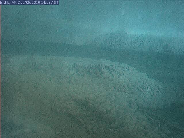
Little Diomede Webcam, looking west from Inalik School toward Big Diomede Island (Russia)
Elevation: 100 ? ft
|
|
Wales Sea Ice Webcam, westernmost point of mainland North America, looking WNW at the Bering Strait

Elevation: 100 ? ft
|
Kingikmiut School StraitCam, user controllable view from Wales, westernmost point of mainland North America

Elevation: 100 ? ft
|
Wales, westernmost point of mainland North America, at tip of Seward Peninsula, looking east (FAA)
![]()
Elevation: 26 ft
|
Wales, westernmost point of mainland North America, at tip of Seward Peninsula, looking south (FAA)
![]()
Elevation: 26 ft
|
|
City of Nome Web Cam, looking west at Norton Sound in the Bering Sea

Elevation: 50 ft
|
Nome Airport, looking west (FAA)
![]()
Elevation: 32 ft
|
Nome Airport, looking NE (FAA)
![]()
Elevation: 32 ft
|
|
Kiana Airport, looking south (FAA)
![]()
Elevation: 104 ft
|
|
Barrow Sea Ice Webcam, near the northernmost point in Alaska, looking NNW at the Arctic Ocean

Elevation: 100 ft
|
|
Bettles, 30 miles west of Dalton Hwy 11, looking north at Brooks Range (FAA)
![]()
Elevation: 633 ft
|
Anaktuvuk Pass, Brooks Range, 55 miles west of Dalton Hwy 11, looking NE (FAA)
![]()
Elevation: 2171 ft
|
Anaktuvuk Pass, Brooks Range, 55 miles west of Dalton Hwy 11, looking south (FAA)
![]()
Elevation: 2171 ft
|
Anaktuvuk Pass, Brooks Range, 55 miles west of Dalton Hwy 11, looking SW (FAA)
![]()
Elevation: 2171 ft
|
Sag River DOT Web Cam on the North Slope, Dalton Hwy 11 @ MP 305, looking south

Elevation: 800 ft
|
|
Chandalar Shelf, Brooks Range, 35 miles east of Dalton Hwy 11, looking NE (FAA)
![]()
Elevation: 3285 ft
|
Chandalar Shelf, Brooks Range, 35 miles east of Dalton Hwy 11, looking south (FAA)
![]()
Elevation: 3285 ft
|
Chandalar Shelf, Brooks Range, 35 miles east of Dalton Hwy 11, looking SW (FAA)
![]()
Elevation: 3285 ft
|
Arctic Village, Brooks Range, 100 miles east of Dalton Hwy 11, looking north (FAA)
![]()
Elevation: 2056 ft
|
Arctic Village, Brooks Range, 100 miles east of Dalton Hwy 11, looking south (FAA)
![]()
Elevation: 2056 ft
|
Arctic Village, Brooks Range, 100 miles east of Dalton Hwy 11, looking SW (FAA)
![]()
Elevation: 2056 ft
|
|
|
North Pole WebCam:
(online April-October only)
|
NOAA North Pole Web Cam 1, on the Arctic Ocean ice near the North Pole

Elevation: 20 ft
|
Central and Eastern Alaska: Alaska Range, Fairbanks, Parks Hwy 3, Steese Hwy 6, Richardson Hwy 2, Alaska Hwy 2, Taylor Hwy 5 Corridor ..
|
Knik, looking west at Mt Susitna (FAA)
![]()
Elevation: 141 ft
|
|
Parks Hwy 3 @ Hawk Lane MP 53.2, west of Wasilla, looking south (AKDOT)
![]()
Elevation: 250 ft
|
Parks Hwy 3 @ Talkeetna Road MP 98.7, looking north (AKDOT)
![]()
Elevation: 400 ft
|
View of Denali, Mt Hunter, and Mt Foraker from Talkeetna, east of Parks Hwy 3

Elevation: 400 ? ft
|
Summit, on Parks Hwy 3 @ MP 201 in the Alaska Range, looking NE (FAA)
![]()
Elevation: 2381 ft
|
Summit, on Parks Hwy 3 @ MP 201 in the Alaska Range, looking SW (FAA)
![]()
Elevation: 2381 ft
|
Lake Minchumina, NW of the Alaska Range, looking SE at Denali and Mt Foraker (FAA)
![]()
Elevation: 698 ft
|
View of Denali and Mt Foraker from Wonder Lake, 85 miles west of Hwy 3

Elevation: 2500 ft
|
McKinley Park, on Parks Hwy 3 @ MP 237 in the Alaska Range, looking north (FAA)
![]()
Elevation: 1740 ft
|
McKinley Park, on Parks Hwy 3 @ MP 237 in the Alaska Range, looking south (FAA)
![]()
Elevation: 1740 ft
|
Parks Hwy 3 @ Antler Creek MP 244, north of McKinley Park, looking south (AKDOT)
![]()
Elevation: 1700 ft
|
Parks Hwy 3 @ Antler Creek MP 244, north of McKinley Park, looking north (AKDOT)
![]()
Elevation: 1700 ft
|
Parks Hwy 3 @ Rex Bridge MP 276, north of McKinley Park, looking west (AKDOT)
![]()
Elevation: 700 ft
|
Downtown Fairbanks on Hwy 2, ArcticCam

Elevation: 500 ft
|
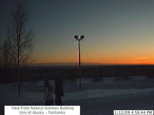
University of Alaska Fairbanks, looking south from Natural Sciences Bldg
Elevation: 650 ft
|
Alaska Climate Research Center, Geophysical Institute, University of Alaska Fairbanks, looking south

Elevation: 650 ft
|
IJIS Webcam, International Arctic Research Center, University of Alaska Fairbanks, looking ???

Elevation: 650 ft
|
Nordic Ski Club of Fairbanks, Birch Hill Recreation Area Stadium, north of Fairbanks

Elevation: 900 ft
|
Alaskan Alpine Club Ice Tower Webcam, in Fox, north of Fairbanks along Hwy 2

Elevation: 800 ft
|
Steese Hwy 6 @ Cleary Summit MP 20.9, NE of Fairbanks, looking north (AKDOT)
![]()
Elevation: 2250 ft
|
Steese Hwy 6 @ Cleary Summit MP 20.9, NE of Fairbanks, looking south (AKDOT)
![]()
Elevation: 2250 ft
|
|
Richardson Hwy 2 @ Birch Lake MP 307.2, SE of Fairbanks, looking west (AKDOT)
![]()
Elevation: 850 ft
|
Richardson Hwy 2 @ Tenderfoot MP 292.6, SE of Fairbanks, looking east (AKDOT)
![]()
Elevation: 1000 ft
|
Alaska Hwy 2 @ Dot Lake MP 1360.4, looking west (AKDOT)
![]()
Elevation: 1400 ft
|
Knob Ridge, southwest of Dot Lake on Alaska Hwy 2, looking SE (FAA)
![]()
Elevation: 2147 ft
|
Knob Ridge, southwest of Dot Lake on Alaska Hwy 2, looking NW (FAA)
![]()
Elevation: 2147 ft
|
|
Eagle, on Taylor Hwy 5 near Yukon border, looking NW (FAA)
![]()
Elevation: 898 ft
|
Eagle, on Taylor Hwy 5 near Yukon border, looking NE (FAA)
![]()
Elevation: 898 ft
|
South-Central Alaska: Interior East of Anchorage to Yukon Border, Eastern Alaska Range, Wrangell Mtns, Glenn Hwy 1, Richardson Hwy 4, Tok Cutoff Hwy 1, Alaska Hwy 2 Corridor ..
|
Birchwood, north of Glenn Hwy 1 @ MP 20, NE of Anchorage, looking NE (FAA)
![]()
Elevation: 58 ft
|
Birchwood, north of Glenn Hwy 1 @ MP 20, NE of Anchorage, looking SE (FAA)
![]()
Elevation: 58 ft
|
Glenn Hwy 1 @ Thunderbird Falls MP 24, NE of Anchorage, looking south (AKDOT)
![]()
Elevation: 200 ft
|
Glenn Hwy 1 @ Thunderbird Falls MP 24, NE of Anchorage, looking north (AKDOT)
![]()
Elevation: 200 ft
|
Palmer, on Glenn Hwy 1 @ MP 42, NE of Anchorage, looking NE (FAA)
![]()
Elevation: 243 ft
|
Palmer, on Glenn Hwy 1 @ MP 42, NE of Anchorage, looking SE (FAA)
![]()
Elevation: 243 ft
|
Chickaloon, on Glenn Hwy 1 @ MP 76, looking SW (FAA)
![]()
Elevation: 2489 ft
|
Chickaloon, on Glenn Hwy 1 @ MP 76, looking NW (FAA)
![]()
Elevation: 2489 ft
|
Chickaloon, on Glenn Hwy 1 @ MP 76, looking east (FAA)
![]()
Elevation: 2489 ft
|
Sheep Mountain, on Glenn Hwy 1 @ MP 113, north of Matanuska Glacier, looking west (FAA)
![]()
Elevation: 2228 ft
|
Sheep Mountain, on Glenn Hwy 1 @ MP 113, north of Matanuska Glacier, looking east (FAA)
![]()
Elevation: 2228 ft
|
Glenn Hwy 1 @ Gunsight Mountain MP 117, NE of Matanuska Glacier, looking NE (AKDOT)
![]()
Elevation: 3300 ft
|
Glenn Hwy 1 @ Gunsight Mountain MP 117, NE of Matanuska Glacier, looking south (AKDOT)
![]()
Elevation: 3300 ft
|
Glenn Hwy 1 @ Gunsight Mountain MP 117, NE of Matanuska Glacier, looking SW (AKDOT)
![]()
Elevation: 3300 ft
|
Tahneta Pass, on Glenn Hwy 1 @ MP 122, NE of Matanuska Glacier, looking west (FAA)
![]()
Elevation: 3422 ft
|
Tahneta Pass, on Glenn Hwy 1 @ MP 122, NE of Matanuska Glacier, looking NE (FAA)
![]()
Elevation: 3422 ft
|
Glenn Hwy 1 @ MP 176.6, 10 miles west of Glennallen, looking east at Mt Sanford and Mt Drum (AKDOT)
![]()
Elevation: 2000 ft
|
|
Richardson Hwy 4 @ MP 83, junction with Edgerton Hwy 10, looking north (AKDOT)
![]()
Elevation: 2050 ft
|
Richardson Hwy 4 @ MP 83, junction with Edgerton Hwy 10, looking east at Mt Blackburn (AKDOT)
![]()
Elevation: 2050 ft
|
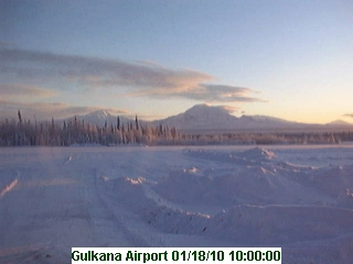
Gulkana Airport Weather Cam, at junction of Hwy 1 and 4, looking east at Mt Sanford, Drum, Wrangell, and Blackburn
Elevation: 1600 ft
|
High Frequency Active Auroral Research Program, Cam 1, north of Tok Cutoff Hwy 1 @ MP 11,looking west

Elevation: 1900 ft
|
High Frequency Active Auroral Research Program, Cam 2, north of Tok Cutoff Hwy 1 @ MP 11, looking east at Mt Sanford

Elevation: 1900 ft
|
Black Rapids, Alaska Range on Richardson Hwy 4 @ MP 227, looking north (FAA)
![]()
Elevation: 2675 ft
|
Black Rapids, Alaska Range on Richardson Hwy 4 @ MP 227, looking south (FAA)
![]()
Elevation: 2675 ft
|
Isabel Pass, Alaska Range on Richardson Hwy 4 @ MP 197 north of Paxson, looking north (FAA)
![]()
Elevation: 3619 ft
|
Isabel Pass, Alaska Range on Richardson Hwy 4 @ MP 197 north of Paxson, looking south (FAA)
![]()
Elevation: 3619 ft
|
Tok Cutoff Hwy 1 @ Mentasta Pass MP 79.2, looking SW at Mt Sanford (AKDOT)
![]()
Elevation: 2450 ft
|
Tok Cutoff Hwy 1 @ Mentasta Pass MP 79.2, looking SW at Mt Sanford (AKDOT)
![]()
Elevation: 2450 ft
|
Northway, southwest of Alaska Hwy 2 @ MP 1264, looking SE (FAA)
![]()
Elevation: 1714 ft
|
Northway, southwest of Alaska Hwy 2 @ MP 1264, looking NW (FAA)
![]()
Elevation: 1714 ft
|
Alaska Hwy 2 @ Canadian Border, historical MP 1221.8 (true MP 1189), looking west (AKDOT)
![]()
Elevation: 1900 ft
|
South-Central Alaska: West of Cook Inlet, Southern Alaska Range, Iditarod Trail Corridor ..
|
Aniak, looking east towards the Russian Mountains (FAA)
![]()
Elevation: 62 ft
|
|
McGrath Airport, looking west (FAA)
![]()
Elevation: 332 ft
|
McGrath Airport, looking NW (FAA)
![]()
Elevation: 332 ft
|
McGrath, looking NE towards Kuskokwim River and Appel Mountain

Elevation: 350 ft
|
|
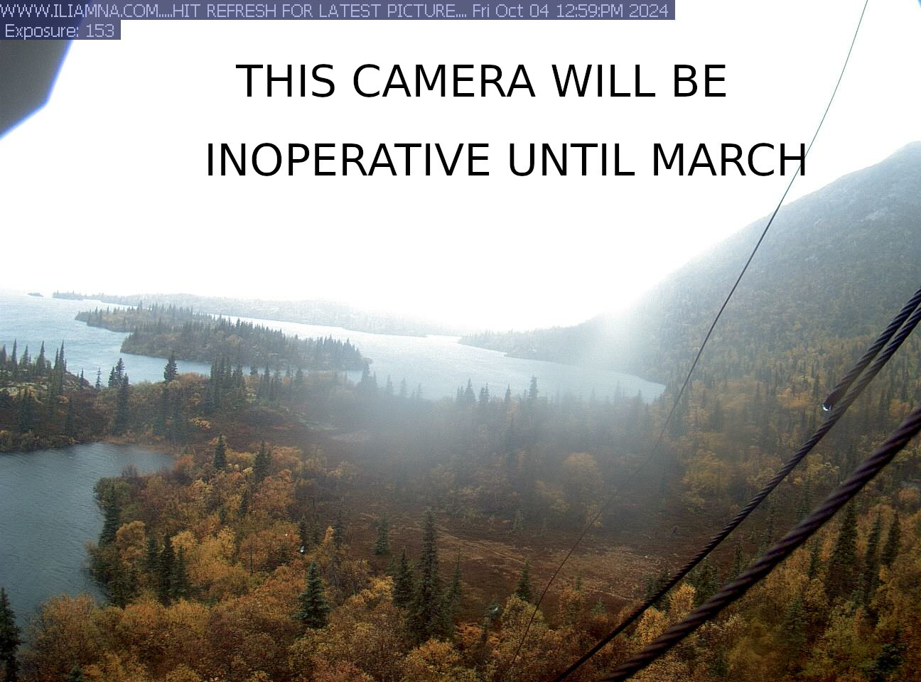
Iliamna, on the north shore of Iliamna Lake, looking east (FAA)
![]()
Elevation: 148 ft
|
Pedro Bay WebCam, on the north shore of Iliamna Lake, looking south
Elevation: 200 ft
|
North shore of Lake Clark, in Lake Clark National Park, looking SW (FAA)
![]()
Elevation: 261 ft
|
North shore of Lake Clark, in Lake Clark National Park, looking NE (FAA)
![]()
Elevation: 261 ft
|
North shore of Lake Clark, in Lake Clark National Park, looking east (FAA)
![]()
Elevation: 261 ft
|
Lake Clark Pass, in Lake Clark National Park, looking SW (FAA)
![]()
Elevation: 973 ft
|
Lake Clark Pass, in Lake Clark National Park, looking SE (FAA)
![]()
Elevation: 973 ft
|
East flank of Double Peak, in Lake Clark National Park, looking NE (FAA)
![]()
Elevation: 2559 ft
|
Alaska Volcano Observatory: Redoubt Hut Cam, looking SSE from nearby ridge

Elevation: 5000 ??? ft
|
Alaska Volcano Observatory: Redoubt DFR Cam, looking SSW from nearby ridge

Elevation: 5000 ??? ft
|
Alaska Volcano Observatory: Redoubt CI Cam, looking SW from oil platform in Cook Inlet

Elevation: 100 ft
|
|
Merrill Pass, in northern Lake Clark National Park, looking west (FAA)
![]()
Elevation: 4524 ft
|
Merrill Pass, in northern Lake Clark National Park, looking east (FAA)
![]()
Elevation: 4524 ft
|
Merrill Pass, in northern Lake Clark National Park, looking west (FAA)
![]()
Elevation: 3045 ft
|
Merrill Pass, in northern Lake Clark National Park, looking SE (FAA)
![]()
Elevation: 3045 ft
|
Alaska Volcano Observatory: Mount Spurr Cam, looking NW from oil platform in Cook Inlet

Elevation: 100 ft
|
Alaska Volcano Observatory: Mount Spurr CKT Cam, looking north from nearby ridge

Elevation: 3200 ft
|
|
Puntilla Lake, along the Iditarod Trail in the southern Alaska Range, looking NW (FAA)
![]()
Elevation: 1930 ft
|
Puntilla Lake, along the Iditarod Trail in the southern Alaska Range, looking north (FAA)
![]()
Elevation: 1930 ft
|
Puntilla Lake, along the Iditarod Trail in the southern Alaska Range, looking SE (FAA)
![]()
Elevation: 1930 ft
|
Rohn, along the Iditarod Trail in the southern Alaska Range, looking NW (FAA)
![]()
Elevation: 1403 ft
|
Rohn, along the Iditarod Trail in the southern Alaska Range, looking east (FAA)
![]()
Elevation: 1403 ft
|
Rohn, along the Iditarod Trail in the southern Alaska Range, looking south (FAA)
![]()
Elevation: 1403 ft
|
South-Central Alaska: Anchorage and Vicinity, Knik Arm, Turnagain Arm, Seward Hwy 1, Whittier Hwy Corridor ..
|
Glenn Hwy 1 Weigh Station @ MP 10, NE of Anchorage, looking west

Elevation: 500 ft
|
Anchorage Weathercam, looking east (FAA)
![]()
Elevation: 106 ft
|
Anchorage Weathercam, looking SE (FAA)
![]()
Elevation: 106 ft
|
View of Mt McKinley from downtown Anchorage, ACS Yellow Pages Webcam

Elevation: 300 ft
|
View looking SE from downtown Anchorage at Chugach Mtns, ACS Yellow Pages Webcam

Elevation: 300 ft
|
View looking NW at Mt Susitna across Cook Inlet from Anchorage

Elevation: 200 ft
|
View of Mt McKinley across downtown Anchorage

Elevation: 300 ft
|
View looking SE from downtown Anchorage at Chugach Mtns

Elevation: 300 ft
|
View looking east from downtown Anchorage at Chugach Mtns

Elevation: 300 ft
|
Lake Otis Parkway looking south toward the Tudor Road intersection, Anchorage

Elevation: 200 ft
|
Potter Marsh Weigh Station, Seward Hwy 1 @ MP 115, south of Anchorage, looking east

Elevation: 50 ft
|
Seward Hwy 1 @ McHugh Creek MP 111.8, SE of Anchorage, looking SE (AKDOT)
![]()
Elevation: 50 ft
|
Alyeska Resort, Base of Chair 3 Webcam, Girdwood, SE of Anchorage off Hwy 1 @ MP 90

Elevation: 300 ft
|
Alyeska Resort, Base of Chair 3 Webcam, Girdwood, SE of Anchorage off Hwy 1 @ MP 90

Elevation: 300 ft
|
Alyeska Resort, Base of Chair 4 Webcam, Girdwood, SE of Anchorage off Hwy 1 @ MP 90

Elevation: 300 ft
|
Alyeska Resort, Base of Chair 4 Webcam, Girdwood, SE of Anchorage off Hwy 1 @ MP 90

Elevation: 300 ft
|
Alyeska Resort, Hotel Rooftop Superpipe Webcam, Girdwood, SE of Anchorage off Hwy 1 @ MP 90

Elevation: 400 ft
|
Alyeska Resort, Hotel Rooftop Tram Terminal Webcam, Girdwood, SE of Anchorage off Hwy 1 @ MP 90

Elevation: 400 ft
|
Alyeska Resort, Upper Tram Webcam, Girdwood, SE of Anchorage off Hwy 1 @ MP 90

Elevation: 2300 ft
|
Alyeska Resort, Top of Chair 6 Webcam, Girdwood, SE of Anchorage off Hwy 1 @ MP 90

Elevation: 2750 ft
|
Alyeska Resort, Top of Chair 6 Webcam, Girdwood, SE of Anchorage off Hwy 1 @ MP 90

Elevation: 2750 ft
|
Alyeska Resort, Top of Chair 6 Webcam, Girdwood, SE of Anchorage off Hwy 1 @ MP 90

Elevation: 2750 ft
|
Portage Glacier, on Whittier Access Road MP 6, east of Seward Hwy 1 @ MP 79, looking SE (FAA)
![]()
Elevation: 166 ft
|
Portage Glacier, on Whittier Access Road MP 6, east of Seward Hwy 1 @ MP 79, looking NW (FAA)
![]()
Elevation: 166 ft
|
Whittier Access Road MP 7 @ Bear Valley Tunnel, east of Sterling Hwy 1 @ MP 79, looking east (AKDOT)
![]()
Elevation: 200 ft
|
Whittier Access Road MP 7 @ Bear Valley Tunnel, east of Sterling Hwy 1 @ MP 79, looking south (AKDOT)
![]()
Elevation: 200 ft
|
Whittier Access Road MP 7 @ Bear Valley Tunnel, east of Sterling Hwy 1 @ MP 79, looking west (AKDOT)
![]()
Elevation: 200 ft
|
Whittier Loading Dock, Alaska Marine Lines Webcam

Elevation: 50 ft
|
Whittier Loading Dock, Alaska Marine Lines Webcam

Elevation: 50 ft
|
View from 14th floor of Begich Towers in Whittier, looking north

Elevation: 150 ft
|
Whittier, at the western end of Prince William Sound, looking NE (FAA)
![]()
Elevation: 52 ft
|
Whittier, at the western end of Prince William Sound, looking SW (FAA)
![]()
Elevation: 52 ft
|
South-Central Alaska: Southern Cook Inlet and Kenai Peninsula, Sterling Hwy 1, Seward Hwy 9 Corridor ..
|
Alaska Volcano Observatory: Augustine Lagoon Cam, looking east

Elevation: 100 ft
|
Alaska Volcano Observatory: Augustine Island Cam, looking west

Elevation: 100 ft
|
Alaska Volcano Observatory: Augustine Homer Cam, looking SW from Homer

Elevation: 100 ft
|
Alaska Volcano Observatory: Augustine Low-Light Cam, looking SW from Homer

Elevation: 100 ft
|
Hallo Bay Webcam, on West Hill near Homer, looking SE at Homer Spit and Kenai Mtns

Elevation: 800 ft
|
Homer, at the southern end of Sterling Hwy 1 @ MP 175, looking NE (FAA)
![]()
Elevation: 139 ft
|
Homer, at the southern end of Sterling Hwy 1 @ MP 175, looking SE (FAA)
![]()
Elevation: 139 ft
|
Homer, at the southern end of Sterling Hwy 1 @ MP 175, looking SW (FAA)
![]()
Elevation: 139 ft
|
Argus Beach Monitoring Station, Homer, at the southern end of Sterling Hwy 1 @ MP 175, looking east at Kenai Mtns

Elevation: 50 ft
|
Seldovia Airport Cam, on Kenai Peninsula across Kachemak Bay from Homer, looking south from airport

Elevation: 50 ft
|
Seldovia Airport Cam, on Kenai Peninsula across Kachemak Bay from Homer, looking east at airport

Elevation: 50 ft
|
Seldovia Harbor Cam, on Kenai Peninsula across Kachemak Bay from Homer

Elevation: 50 ft
|
|
Alaska Log Haven B&B Cam, Clam Gulch on Sterling Hwy 1 @ MP 119, looking west at Iliamna and Redoubt Volcanoes

Elevation: 200 ft
|
Soldotna, on Sterling Hwy 1 @ MP 95, looking east toward distant mountains (FAA)
![]()
Elevation: 256 ft
|
Sterling Hwy 1 @ Jean Lake Hill MP 62.3, looking east (AKDOT)
![]()
Elevation: 600 ft
|
Sterling Hwy 1 @ Russian River Ferry MP 54.8, looking east (AKDOT)
![]()
Elevation: 350 ft
|
Sterling Hwy 1 @ Russian River Ferry MP 54.8, looking south (AKDOT)
![]()
Elevation: 350 ft
|
|
Seattle Ridge, 2 miles NNE of Turnagain Pass on Seward Hwy 1 @ MP 69, looking south (CNFAIC)

Elevation: 2600 ft
|
Seattle Ridge, 2 miles NNE of Turnagain Pass on Seward Hwy 1 @ MP 69, looking west (CNFAIC)

Elevation: 2600 ft
|
Sunburst Ridge, 4 miles south of Turnagain Pass on Seward Hwy 1 @ MP 69, looking north (CNFAIC)

Elevation: 2600 ft
|
Seward Hwy 1 @ Summit Lake Lodge MP 45.8, looking north (AKDOT)
![]()
Elevation: 1400 ft
|
Seward Hwy 1 @ Summit Lake Lodge MP 45.8, looking south (AKDOT)
![]()
Elevation: 1400 ft
|
Seward Hwy 9 @ Tern Lake MP 37, junction with Sterling Hwy 1, looking south at Tern Lake (AKDOT)
![]()
Elevation: 700 ft
|
Seward Hwy 9 @ Tern Lake MP 37, junction with Sterling Hwy 1, looking east (AKDOT)
![]()
Elevation: 700 ft
|
Seward Hwy 9 @ MP 12 Hill, 12 miles north of Seward, looking north (AKDOT)
![]()
Elevation: 800 ft
|
Seward Airport on Hwy 9, looking SE (FAA)
![]()
Elevation: 61 ft
|
Seward Airport on Hwy 9, looking south (FAA)
![]()
Elevation: 61 ft
|
Major Marine Tours, Seward Harbor on Hwy 9

Elevation: 50 ft
|
Kenai Fjords Tours, Seward Harbor on Hwy 9

Elevation: 50 ft
|
South-Central Alaska: Prince William Sound, Chugach Mtns, Eastern Coast, Richardson Hwy 4, Hwy 10 Corridor ..
|
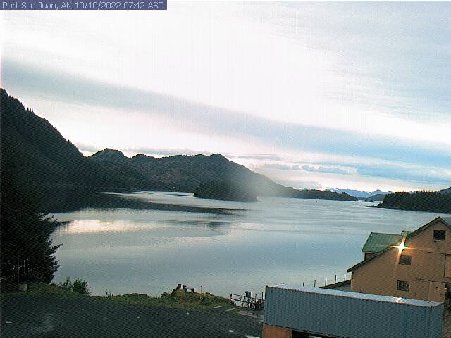
Prince William Sound Weather Camera, Port San Juan on Evans Island, looking east
Elevation: 100 ft
|
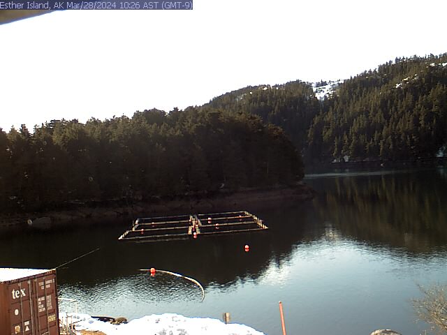
Prince William Sound Weather Camera, Esther Island, looking west
Elevation: 50 ft
|
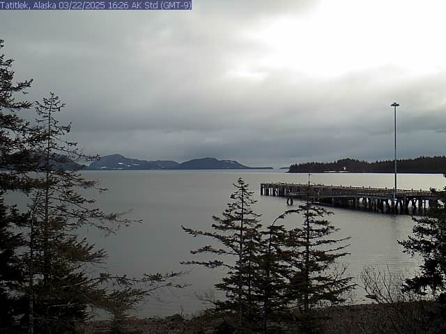
Prince William Sound Weather Camera, Tatitlek south of Valdez, looking south
Elevation: 50 ft
|
Potato Point, west of Valdez, looking NE (FAA)
![]()
Elevation: 42 ft
|
Potato Point, west of Valdez, looking south (FAA)
![]()
Elevation: 42 ft
|
Valdez National Weather Service Webcam, looking east

Elevation: 100 ft
|
Valdez National Weather Service Webcam, looking south

Elevation: 100 ft
|
Valdez National Weather Service Webcam, looking west

Elevation: 100 ft
|
Valdez Airport on Richardson Hwy 4, looking east (FAA)
![]()
Elevation: 40 ft
|
Valdez Airport on Richardson Hwy 4, looking SE (FAA)
![]()
Elevation: 40 ft
|
Valdez Airport on Richardson Hwy 4, looking SW (FAA)
![]()
Elevation: 40 ft
|
Valdez Airport on Richardson Hwy 4, looking west (FAA)
![]()
Elevation: 40 ft
|
Richardson Hwy 4 @ Keystone Canyon MP 12.3, east of Valdez, looking south (AKDOT)
![]()
Elevation: 300 ft
|
Richardson Hwy 4 @ Keystone Canyon MP 12.3, east of Valdez, looking north (AKDOT)
![]()
Elevation: 300 ft
|
Richardson Hwy 4 @ Sheep Creek Bridge MP 18.6, east of Valdez, looking north (AKDOT)
![]()
Elevation: 700 ft
|
Richardson Hwy 4 @ Thompson Pass MP 25.7, east of Valdez, looking south (AKDOT)
![]()
Elevation: 2800 ft
|
Richardson Hwy 4 @ Thompson Pass MP 25.7, east of Valdez, looking north (AKDOT)
![]()
Elevation: 2800 ft
|
|
Prince William Sound Weather Camera, Nuchek on Hichinbrook Island, looking west
Elevation: 50 ft
|
Johnstone Point, north end of Hichinbrook Island in Prince William Sound, looking NE (FAA)
![]()
Elevation: 10 ft
|
Johnstone Point, north end of Hichinbrook Island in Prince William Sound, looking SE (FAA)
![]()
Elevation: 22 ft
|
Johnstone Point, north end of Hichinbrook Island in Prince William Sound, looking SW (FAA)
![]()
Elevation: 22 ft
|
Cordova Harbor Cam, looking north

Elevation: 50 ft
|
Mt Eyak Ski Hill Cam, NE of Cordova, looking north

Elevation: 1250 ft
|
|
Cape Yakataga, on Gulf of Alaska south of Bagley Ice Field, looking NW (FAA)
![]()
Elevation: 10 ft
|
|
Yakutat, on Gulf of Alaska, looking NW towards St Elias Mtns (FAA)
![]()
Elevation: 16 ft
|
Yakutat, on Gulf of Alaska, looking north towards St Elias Mtns (FAA)
![]()
Elevation: 16 ft
|
Southwestern Alaska: Aleutian Islands, Alaska Peninsula, Kodiak Island ..
|
Alaska Volcano Observatory: Cleveland Cam, looking west from High Hill on Umnak Island

Elevation: 600 ft
|
Dutch Harbor, on northern Unalaska Island, looking NW (FAA)
![]()
Elevation: 284 ft
|
Dutch Harbor, on northern Unalaska Island, looking north (FAA)
![]()
Elevation: 284 ft
|
Dutch Harbor, on northern Unalaska Island, looking NE (FAA)
![]()
Elevation: 284 ft
|
Dutch Harbor, on northern Unalaska Island, looking north (FAA)
![]()
Elevation: 250 ft
|
Dutch Harbor, on northern Unalaska Island, looking south (FAA)
![]()
Elevation: 250 ft
|
Dutch Harbor, on northern Unalaska Island, looking NE (FAA)
![]()
Elevation: 901 ft
|
Dutch Harbor, on northern Unalaska Island, looking SW (FAA)
![]()
Elevation: 901 ft
|
Alaska Volcano Observatory: Akutan Cam, looking NE from Eider Point on Unalaska Island

Elevation: 600 ft
|
Alaska Volcano Observatory: Shishaldin Cam, looking west along Unimak Island

Elevation: 2000 ? ft
|
False Pass, on eastern Unimak Island, looking NE (FAA)
![]()
Elevation: 16 ft
|
False Pass, on eastern Unimak Island, looking SE (FAA)
![]()
Elevation: 16 ft
|
Cold Bay, on the Alaska Peninsula, looking SW (FAA)
![]()
Elevation: 68 ft
|
Cold Bay, on the Alaska Peninsula, looking NE (FAA)
![]()
Elevation: 68 ft
|
Alaska Volcano Observatory: Pavlof Cam, looking NE from Cold Bay on the Alaska Peninsula

Elevation: 100 ft
|
King Cove, on the Alaska Peninsula, looking west (FAA)
![]()
Elevation: 159 ft
|
King Cove, on the Alaska Peninsula, looking east (FAA)
![]()
Elevation: 159 ft
|
Alaska Volcano Observatory: Veniaminof Cam, looking north from Perryville

Elevation: 200 ft
|
Chignik Bay, on the Alaska Peninsula, looking SW (FAA)
![]()
Elevation: 29 ft
|
Chignik Bay, on the Alaska Peninsula, looking NW (FAA)
![]()
Elevation: 29 ft
|
Chignik Bay, on the Alaska Peninsula, looking NE (FAA)
![]()
Elevation: 29 ft
|
Alaska Volcano Observatory: Peulik Cam, looking south from Whale Mtn near Becharof Lake

Elevation: 1900 ft
|
Alaska Volcano Observatory: Katmai Cam, looking south from the Buttress Range

Elevation: 3500 ft
|
Alaska Volcano Observatory: Fourpeaked Cam, looking south from nearby ridge

Elevation: 2500 ? ft
|
|
Akhiok in southwestern Kodiak Island, looking east (FAA)
![]()
Elevation: 43 ft
|
Akhiok in southwestern Kodiak Island, looking SW (FAA)
![]()
Elevation: 43 ft
|
Pasagshak Road @ MP 2.1, on eastern Kodiak Island south of Kodiak, looking north (AKDOT)
![]()
Elevation: 200 ft
|
Pasagshak Road @ MP 2.1, on eastern Kodiak Island south of Kodiak, looking south (AKDOT)
![]()
Elevation: 200 ft
|
Kodiak in northeastern Kodiak Island, looking SW (FAA)
![]()
Elevation: 61 ft
|
Kodiak in northeastern Kodiak Island, looking NW (FAA)
![]()
Elevation: 61 ft
|
Kodiak in northeastern Kodiak Island, looking NE (FAA)
![]()
Elevation: 61 ft
|
|
 |
Map of Camera Sites: (each corridor is enclosed in a gray box)
NOTE: Webcams in Southeastern Alaska are shown on the adjacent
Southeastern Alaska, Yukon, & Northern British Columbia Mountain WebCams page.
| Northern Alaska: Seward Peninsula, Brooks Range, North Slope, Dalton Hwy 11 Corridor |
|
|
|
|
![]() |
![]() |
|
|
![]() |
![]() |
|
![]() |
|
|
|
![]() |
![]() |
![]() |
![]() |
|
|
![]() |
![]() |
![]() |
![]() |
![]() |
![]() |
|
|
|
|
22 |
|
| Central and Eastern Alaska: Alaska Range, Fairbanks, Parks Hwy 3, Steese Hwy 6, Richardson Hwy 2, Alaska Hwy 2, Taylor Hwy 5 Corridor |
![]() |
|
![]() |
![]() |
|
![]() |
![]() |
![]() |
|
![]() |
![]() |
![]() |
![]() |
![]() |
|
|
|
|
|
|
![]() |
![]() |
|
![]() |
![]() |
![]() |
![]() |
![]() |
|
![]() |
![]() |
28 |
|
| South-Central Alaska: Interior East of Anchorage to Yukon Border, Eastern Alaska Range, Wrangell Mtns, Glenn Hwy 1, Richardson Hwy 4, Tok Cutoff Hwy 1, Alaska Hwy 2 Corridor |
![]() |
![]() |
![]() |
![]() |
![]() |
![]() |
![]() |
![]() |
![]() |
![]() |
![]() |
![]() |
![]() |
![]() |
![]() |
![]() |
![]() |
|
![]() |
![]() |
|
|
|
![]() |
![]() |
![]() |
![]() |
![]() |
![]() |
![]() |
![]() |
![]() |
31 |
| South-Central Alaska: West of Cook Inlet, Southern Alaska Range, Iditarod Trail Corridor |
![]() |
|
![]() |
![]() |
|
|
![]() |
|
![]() |
![]() |
![]() |
![]() |
![]() |
![]() |
|
|
|
|
![]() |
![]() |
![]() |
![]() |
|
|
|
![]() |
![]() |
![]() |
![]() |
![]() |
![]() |
27 |
| South-Central Alaska: Anchorage and Vicinity, Knik Arm, Turnagain Arm, Seward Hwy 1, Whittier Hwy Corridor |
|
![]() |
![]() |
|
|
|
|
|
|
|
|
![]() |
|
|
|
|
|
|
|
|
|
|
![]() |
![]() |
![]() |
![]() |
![]() |
|
|
|
![]() |
![]() |
32 |
| South-Central Alaska: Southern Cook Inlet and Kenai Peninsula, Sterling Hwy 1, Seward Hwy 9 Corridor |
|
|
|
|
|
![]() |
![]() |
![]() |
|
|
|
|
|
|
![]() |
![]() |
![]() |
![]() |
|
|
|
|
![]() |
![]() |
![]() |
![]() |
![]() |
![]() |
![]() |
|
|
29 |
| South-Central Alaska: Prince William Sound, Chugach Mtns, Eastern Coast, Richardson Hwy 4, Hwy 10 Corridor |
|
|
|
![]() |
![]() |
|
|
|
![]() |
![]() |
![]() |
![]() |
![]() |
![]() |
![]() |
![]() |
![]() |
|
|
![]() |
![]() |
![]() |
|
|
|
![]() |
|
![]() |
![]() |
26 |
|
| Southwestern Alaska: Aleutian Islands, Alaska Peninsula, Kodiak Island |
|
![]() |
![]() |
![]() |
![]() |
![]() |
![]() |
![]() |
|
|
![]() |
![]() |
![]() |
![]() |
|
![]() |
![]() |
|
![]() |
![]() |
![]() |
|
|
|
|
![]() |
![]() |
![]() |
![]() |
![]() |
![]() |
![]() |
31 |
|
|
|
| Page History: |
|
|
|
Page Statistics: |
| November 2008 | Original version with 176 camera views in 8 corridors (rows), based on the
Washington Mountain WebCams webpage; includes a PHP script to allow changing the image size
Also includes a regional map with a table of mini camera images (including row counts),
and the option to show pixel rulers along the bottom and right edges of the page
Note that some of these images are multiple directional views from a single camera
Later added "Page Statistics" to the right
|
Page loaded at 7:44 AM PST on Tuesday, February 25, 2025
Total camera images: 226
FAA Weather Cams: 107
Alaska DOT Highway Cams: 40
National Park Service: 1
National Weather Service / NOAA: 4
Alaska Volcano Observatory: 17
Alyeska Resort: 10
Borealis Broadband: 8
Approximate page width: 11400 pixels 11328
Approximate page height: 4300 pixels 4212
|
| December 2008 | Expanded to 190 camera views, rearranged numerous cameras and swapped two rows, plus other minor fixes
Optimized and improved the PHP code which extracts FAA Weathercam image URLs
Partially completed map by adding locations of most camera sites and corridors
|
| January 2009 | Expanded to 194 camera views, rearranged several cameras and swapped two more rows
Completed map by adding locations of remaining camera sites and corridors
|
| February 2009 | Expanded to 196 camera views |
| April 2009 | Expanded to 197 camera views |
| November 2009 |
Expanded to 204 camera views, fixed some camera links which had changed, other minor fixes
|
| January 2010 |
Expanded to 226 camera views, including removal of some long-defunct webcams;
rearranged several cameras, fixed several camera links which had changed
Updated the site navigation bars to include the various other Mountain WebCams pages
Added direct links to camera pages for all FAA Weather Cams,
since "Site Page Bookmarking" was enabled at long last in October 2009
|
|