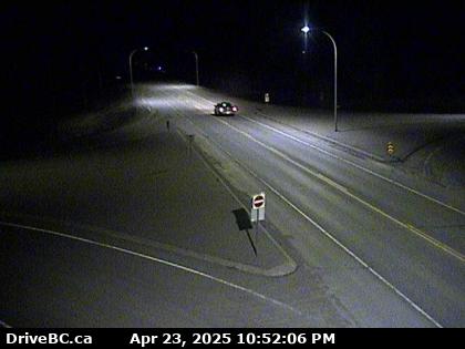
Yukon and Far Northwestern British Columbia: Alaska Hwy 1, Klondike Hwy 2, Cassiar Hwy 37 Corridor ..
|
Dawson City Front Street Webcam, on Hwy 2 in central Yukon
Elevation: 320 m / 1050 ft
|
|
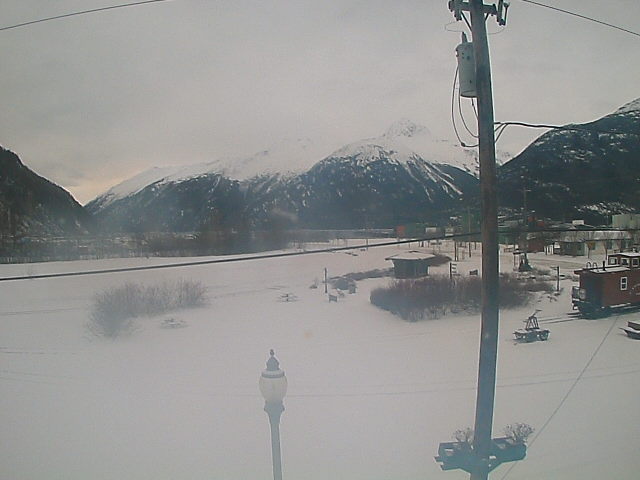
Lake Laberge, north of Whitehorse, Yukon, on Hwy 2

Elevation: 660 m / 2170 ft
|
Main Street in Whitehorse, Yukon, on Hwy 1

Elevation: 660 m / 2170 ft
|
White Pass & Yukon Route Railroad Depot in Whitehorse, Yukon, on Hwy 1

Elevation: 660 m / 2170 ft
|
CBC Cam in Whitehorse, Yukon, on Hwy 1

Elevation: 660 m / 2170 ft
|
|
White Pass & Yukon Route Railroad Depot in Carcross, Yukon, on Hwy 2

Elevation: 660 m / 2170 ft
|
Carcross Cam, on Hwy 2 in Yukon, looking north

Elevation: 660 m / 2170 ft
|
Fraser Camp WeatherCam, on Hwy 2 in BC, looking north

Elevation: 850 m / 2800 ft
|
Fraser Camp WeatherCam, on Hwy 2 in BC, looking south

Elevation: 850 m / 2800 ft
|
|
Watson Lake, Yukon, on Hwy 1, looking ?

Elevation: 700 m / 2300 ft
|
Watson Lake, Yukon, on Hwy 1, looking west

Elevation: 700 m / 2300 ft
|
Watson Lake, Yukon, on Hwy 1, looking northeast

Elevation: 700 m / 2300 ft
|
Watson Lake, Yukon, on Hwy 1, looking southeast

Elevation: 700 m / 2300 ft
|
|
Junction of Hwy 37 and Commercial Drive in Dease Lake, BC, looking north on Hwy 37 (BCMOT)

Elevation: 800 m / 2600 ft
|
Alaska Panhandle: Northern Portion, Haines Hwy 7, Klondike Hwy 98, and Inside Passage Corridor ..
|
Cape Spencer, at the southern tip of Glacier Bay National Park, looking north (FAA)
![]()
Elevation: 24 ft
|
Cape Spencer, at the southern tip of Glacier Bay National Park, looking NE (FAA)
![]()
Elevation: 24 ft
|
Cape Spencer, at the southern tip of Glacier Bay National Park, looking SE (FAA)
![]()
Elevation: 24 ft
|
Gustavus, in Glacier Bay National Park, looking SW (FAA)
![]()
Elevation: 30 ft
|
Gustavus, in Glacier Bay National Park, looking NW (FAA)
![]()
Elevation: 30 ft
|
Hoonah, on Chichagof Isalnd, 20 miles SE of Gustavus across Icy Strait, looking west (FAA)
![]()
Elevation: 9 ft
|
Sisters Island, 6 miles NE of Hoonah in Icy Strait, looking SW (FAA)
![]()
Elevation: 53 ft
|
Sisters Island, 6 miles NE of Hoonah in Icy Strait, looking NW (FAA)
![]()
Elevation: 53 ft
|
Sisters Island, 6 miles NE of Hoonah in Icy Strait, looking NE (FAA)
![]()
Elevation: 53 ft
|
|
Haines Hwy 7 @ Klehini MP 36.6, northwest of Haines, looking west (AKDOT)
![]()
Elevation: 600 ft
|
Haines Hwy 7 @ Klehini MP 36.6, northwest of Haines, looking east (AKDOT)
![]()
Elevation: 600 ft
|
Haines Hwy 7 @ Chilkat River Bridge MP 23.8, northwest of Haines, looking NW (AKDOT)
![]()
Elevation: 150 ft
|
Haines Hwy 7 @ Chilkat River Bridge MP 23.8, northwest of Haines, looking west (AKDOT)
![]()
Elevation: 150 ft
|
Haines Hwy 7 @ Chilkat River Bridge MP 23.8, northwest of Haines, looking SW (AKDOT)
![]()
Elevation: 150 ft
|
Haines FAA Weathercam, looking south
![]()
Elevation: 265 ft
|
Haines FAA Weathercam, looking west
![]()
Elevation: 265 ft
|
Haines FAA Weathercam, looking north
![]()
Elevation: 265 ft
|
|
Skagway FAA Weathercam, looking NE
![]()
Elevation: 16 ft
|
Skagway FAA Weathercam, looking south
![]()
Elevation: 16 ft
|
Skagway FAA Weathercam, looking SW
![]()
Elevation: 16 ft
|
White Pass & Yukon Route Railroad Cam in Skagway, AK
Elevation: 50 ft
|
Skagway Loading Dock, Alaska Marine Lines Webcam

Elevation: 50 ft
|
|
Alaska Panhandle: Central Portion, north of Juneau along Glacier Hwy 7 Corridor ..
|
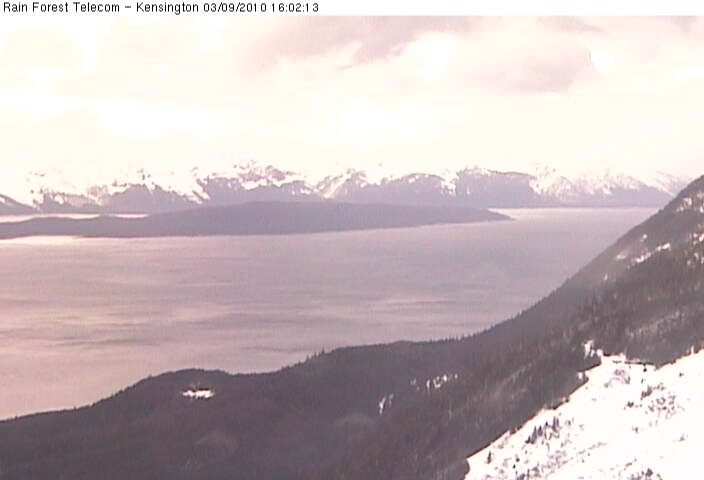
Kensington Ridge Webcam, NW of Berners Bay, looking SE at Berners Bay
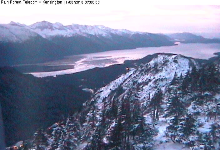
Elevation: 2800 ft
|
Kensington Ridge Webcam, NW of Berners Bay, looking south
Elevation: 2800 ft
|
Kensington Ridge Webcam, NW of Berners Bay, looking SW at Lynn Canal

Elevation: 2800 ft
|
Kensington Ridge Webcam, NW of Berners Bay, looking west at Point Sherman

Elevation: 2800 ft
|
Kensington Ridge Webcam, NW of Berners Bay, looking NW at Lynn Canal
Elevation: 2800 ft
|
Berners Bay, north of Juneau on Glacier Hwy 7 @ MP 40, looking west (FAA)
![]()
Elevation: 29 ft
|
Berners Bay, north of Juneau on Glacier Hwy 7 @ MP 40, looking NW (FAA)
![]()
Elevation: 29 ft
|
Berners Bay, north of Juneau on Glacier Hwy 7 @ MP 40, looking north (FAA)
![]()
Elevation: 29 ft
|
Glacier Hwy 7 @ Cohen Drive MP 21, north of Juneau, looking south (AKDOT)
![]()
Elevation: 200 ft
|
Lena Point, north of Juneau on Glacier Hwy 7 @ MP 17, looking south (FAA)
![]()
Elevation: 170 ft
|
Lena Point, north of Juneau on Glacier Hwy 7 @ MP 17, looking SW (FAA)
![]()
Elevation: 170 ft
|
Lena Point, north of Juneau on Glacier Hwy 7 @ MP 17, looking NW (FAA)
![]()
Elevation: 170 ft
|
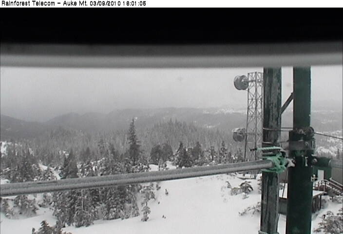
Auke Mountain Webcam, NW of Juneau on Glacier Hwy 7 @ MP 16, looking east at Mendenhall Glacier
Elevation: 1900 ft
|
Auke Mountain Webcam, NW of Juneau on Glacier Hwy 7 @ MP 16, looking SE towards Juneau
Elevation: 1900 ft
|
Auke Mountain Webcam, NW of Juneau on Glacier Hwy 7 @ MP 16, looking SE towards Fritz Cove
Elevation: 1900 ft
|
Auke Mountain Webcam, NW of Juneau on Glacier Hwy 7 @ MP 16, looking south towards Outer Point
Elevation: 1900 ft
|
Auke Mountain Webcam, NW of Juneau on Glacier Hwy 7 @ MP 16, looking SW
Elevation: 1900 ft
|
Auke Mountain Webcam, NW of Juneau on Glacier Hwy 7 @ MP 16, looking west towards Lynn Canal
Elevation: 1900 ft
|
Pedersen Hill, north of Juneau on Glacier Hwy 7 @ MP 11, looking NE (FAA)
![]()
Elevation: 189 ft
|
Pedersen Hill, north of Juneau on Glacier Hwy 7 @ MP 11, looking SW (FAA)
![]()
Elevation: 189 ft
|
Pedersen Hill, north of Juneau on Glacier Hwy 7 @ MP 11, looking SW (FAA)
![]()
Elevation: 189 ft
|
Pedersen Hill, north of Juneau on Glacier Hwy 7 @ MP 11, looking west (FAA)
![]()
Elevation: 189 ft
|
Mendenhall Glacier Visitor Center, north of Juneau, east of Glacier Hwy 7 @ MP 10

Elevation: 200 ft
|
Alaska Panhandle: Central Portion, Juneau and Vicinity, Glacier Hwy 7 Corridor ..
|
Glacier Highway/Egan Drive @ MP 3, in Juneau, looking NW towards airport (AKDOT)
![]()
Elevation: 50 ft
|
Glacier Highway/Egan Drive @ MP 3, in Juneau, looking SE (AKDOT)
![]()
Elevation: 50 ft
|
Glacier Highway/Egan Drive @ MP 3, in Juneau, looking SE at bridge (AKDOT)
![]()
Elevation: 50 ft
|
Juneau National Weather Service Webcam, looking NW

Elevation: 100 ft
|
Juneau National Weather Service Webcam, looking NE

Elevation: 100 ft
|
Juneau National Weather Service Webcam, looking SE

Elevation: 100 ft
|
City and Borough Of Juneau Cams, looking north from library

Elevation: 100 ft
|
City and Borough Of Juneau Cams, looking south from library

Elevation: 100 ft
|
City and Borough Of Juneau Cams, looking at roundabout

Elevation: 100 ft
|
Juneau Loading Dock, Alaska Marine Lines Webcam

Elevation: 50 ft
|
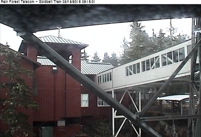
Goldbelt Mt Roberts Tram Webcam, just south of Juneau, looking NW up-valley from aerial tramway top station
Elevation: 1800 ft
|
Goldbelt Mt Roberts Tram Webcam, just south of Juneau, looking down at Juneau from aerial tramway top station

Elevation: 1800 ft
|
Goldbelt Mt Roberts Tram Webcam, just south of Juneau, looking down at aerial tramway base station

Elevation: 1800 ft
|
Goldbelt Mt Roberts Tram Webcam, just south of Juneau, looking at aerial tramway top station
Elevation: 1800 ft
|
|
The Highlands, south of Juneau on Douglas Island, looking towards Juneau

Elevation: 200 ? ft
|
Eaglecrest Ski Area Platter Cam (base), south of Juneau on Douglas Island

Elevation: 1200 ft
|
Eaglecrest Ski Area Ptarmigan Cam (top), south of Juneau on Douglas Island

Elevation: 2600 ft
|
|
Taku Inlet, 10 miles east of Juneau, looking NE (FAA)
![]()
Elevation: 42 ft
|
Taku Inlet, 10 miles east of Juneau, looking east (FAA)
![]()
Elevation: 42 ft
|
Taku Inlet, 10 miles east of Juneau, looking south (FAA)
![]()
Elevation: 42 ft
|
Alaska Panhandle: Southern Portion, Mitkof Hwy 7, Tongass Hwy 7 and Inside Passage Corridor ..
|
Sitka Airport, just west of the City of Sitka, looking south (FAA)
![]()
Elevation: 3 ft
|
Sitka Airport, just west of the City of Sitka, looking NW (FAA)
![]()
Elevation: 3 ft
|
City of Sitka South Cam, looking south

Elevation: 100 ft
|
City of Sitka West Cam, looking west at Mt Edgecumbe

Elevation: 100 ft
|
Sitka Loading Dock, Alaska Marine Lines Webcam

Elevation: 50 ft
|
Angoon, on the west coast of Admiralty Island, looking SE (FAA)
![]()
Elevation: 34 ft
|
|
Petersburg Loading Dock, Alaska Marine Lines Webcam, at north end of Mitkof Island

Elevation: 50 ft
|
Lindenberg Peak, Kupreanof Island west of Petersburg, looking west over Duncan Canal

Elevation: 2600 ft
|
Level Island, in Sumner Strait SE of Kupreanof Island, looking NE (FAA)
![]()
Elevation: 85 ft
|
Mitkof Hwy 7 @ Blaquiere Point MP 33, on the southeast tip of Mitkof Island, looking SE towards Wrangell (AKDOT)
![]()
Elevation: 50 ft
|
Wrangell, at the northern tip of Wrangell Island, looking NW (FAA)
![]()
Elevation: 167 ft
|
Wrangell, at the northern tip of Wrangell Island, looking north (FAA)
![]()
Elevation: 167 ft
|
Wrangell, at the northern tip of Wrangell Island, looking east (FAA)
![]()
Elevation: 167 ft
|
Etolin Island communication site, looking north from 18 miles south of Wrangell

Elevation: 3600 ft
|
|
Klawock, north of Craig on Prince of Wales Island, looking NW (FAA)
![]()
Elevation: 53 ft
|
View looking NW at Sunnahae (Sunny Hay) Mtn, east of Craig on Prince of Wales Island

Elevation: 500 ? ft
|
|
High Mountain, on Gravina Island west of Ketchikan, looking west

Elevation: 1000 ft
|
Ketchikan Airport, on Gravina Island west of Ketchikan, looking NW (FAA)
![]()
Elevation: 32 ft
|
Ketchikan Airport, on Gravina Island west of Ketchikan, looking NE (FAA)
![]()
Elevation: 32 ft
|
Ketchikan Airport, on Gravina Island west of Ketchikan, looking SE (FAA)
![]()
Elevation: 32 ft
|
Ketchikan Airport, on Gravina Island west of Ketchikan, looking south (FAA)
![]()
Elevation: 32 ft
|
Ketchikan Loading Dock, Alaska Marine Lines Webcam

Elevation: 50 ft
|
Metlakatla, on Annette Island, looking NE (FAA)
![]()
Elevation: 32 ft
|
Northeastern British Columbia: Alaska Hwy 97, John Hart Hwy 97 Corridor ..
|
|
|
Hwy 97 at Fort Nelson weigh scale, looking north (BCMOT)
Elevation: 350 m / 1150 ft
|
|
Hwy 97 at Beatton Airport Rd, 44 km north of Fort St. John, looking north (BCMOT)

Elevation: 850 m / 2800 ft
|
City of Fort St. John on Hwy 97, Enerplex Webcam

Elevation: 700 m / 2300 ft
|
Hwy 97 at South Taylor Hill, 20 km south of Fort St John, looking north (BCMOT)

Elevation: 630 m / 2070 ft
|
Dawson Creek Airport WeatherCam, on Hwy 2, looking west

Elevation: 655 m / 2150 ft
|
Dawson Creek Airport WeatherCam, on Hwy 2, looking east

Elevation: 655 m / 2150 ft
|
Hwy 2 south of Dawson Creek, 2 km west of BC/Alberta border, facing east (BCMOT)

Elevation: 850 m / 2800 ft
|
Tumbler Ridge, Hwy 29 at Hwy 52, looking west on Hwy 29 (BCMOT)

Elevation: 850 m / 2800 ft
|
Hwy 97 at Wabi Estates Road, east of Chetwynd, looking east (BCMOT)

Elevation: 760 m / 2500 ft
|
|
Pine Pass, Hwy 97, north of Mackenzie Junction at Powder King access road, looking north (BCMOT)

Elevation: 935 m / 3070 ft
|
Mackenzie Airport WeatherCam, on Hwy 39 north of Hwy 97, looking north

Elevation: 690 m / 2265 ft
|
Mackenzie Airport WeatherCam, on Hwy 39 north of Hwy 97, looking SE

Elevation: 690 m / 2265 ft
|
Hwy 97 at Summit Lake Rd, about 33 km north of Prince George, looking north (BCMOT)

Elevation: 716 m / 2350 ft
|
Peden Hill, Hwy 16 at Vance Rd in Prince George, looking westbound (BCMOT)
Elevation: 585 m / 1920 ft
|
Peden Hill, Hwy 16 at Davis Rd in Prince George, looking eastbound (BCMOT)

Elevation: 640 m / 2100 ft
|
University of Northern British Columbia in Prince George

Elevation: 760 m / 2500 ft
|
Northwestern British Columbia: Yellowhead Hwy 16, Hwy 35, Hwy 37 Corridor ..
|
Prince Rupert Airport WeatherCam, looking east

Elevation: 35 m / 120 ft
|
Prince Rupert Airport WeatherCam, looking SW

Elevation: 35 m / 120 ft
|
Prince Rupert Airport WeatherCam, looking NW

Elevation: 35 m / 120 ft
|
Prince Rupert, Seal Cove, looking north

Elevation: 10 m / 30 ft
|
Hwy 16 at Port Edward arterial road, looking west (BCMOT)

Elevation: 30 ? m / 100 ? ft
|
Hwy 16, at Kasiks resort area, 60 km west of Terrace, looking west (BCMOT)

Elevation: 12 m / 40 ft
|
Hwy 37 at Hwy 16 near Terrace, looking east (BCMOT)

Elevation: 100 ? m / 300 ? ft
|
Terrace on Hwy 16, looking east

Elevation: 100 ? m / 300 ? ft
|
Terrace on Hwy 16, looking SE

Elevation: 100 ? m / 300 ? ft
|
Terrace on Hwy 16, looking ?

Elevation: 100 ? m / 300 ? ft
|
Lakelse Lake, on Hwy 37, about 10 km south of Terrace, looking west?

Elevation: 100 ? m / 300 ? ft
|
Onion Lake on Hwy 37, about 28 km south of Terrace, looking north (BCMOT)

Elevation: 220 m / 700 ft
|
Hwy 37 at Oolichan Avenue, 5 km north of Kitimat, looking north (BCMOT)

Elevation: 30 ? m / 100 ? ft
|
Junction of Hwy 16 and Hwy 37, near Kitwanga, looking west on Hwy 16 (BCMOT)

Elevation: 180 m / 600 ft
|
Smithers, Hwy 16 at Main Street, looking west (BCMOT)

Elevation: 500 m / 1650 ft
|
Hudson Bay Mtn, west of Smithers on Hwy 16, looking SE from Panorama Lodge

Elevation: 1430 m / 4700 ft
|
Hudson Bay Mtn, west of Smithers on Hwy 16, looking SE

Elevation: 1520 m / 5000 ft
|
Hudson Bay Mtn, west of Smithers on Hwy 16, looking SW

Elevation: 1520 m / 5000 ft
|
Hwy 16 at Anderson Road, 14 km NW of Houston, looking east (BCMOT)
Elevation: 790 m / 2600 ft
|
Hwy 35 at Southbank ferry landing on Francois Lake, looking north (BCMOT)

Elevation: 715 m / 2350 ft
|
Savory Rest Area, Hwy 16, 48 km east of Burns Lake, looking west (BCMOT)
Elevation: 700 m / 2300 ft
|
Looking over the south end of Stuart Lake, Fort St James, on Hwy 27

Elevation: 700 m / 2300 ft
|
Hwy 16 at Bednesti between Prince George and Vanderhoof, looking west (BCMOT)
Elevation: 780 m / 2560 ft
|
West-Central British Columbia: Queen Charlotte Islands, Coastal Islands and Hwy 20, Cariboo Hwy 97 Corridor ..
|
Sandspit Airport WeatherCam, Queen Charlotte Islands, looking west

Elevation: 10 m / 30 ft
|
Sandspit Airport WeatherCam, Queen Charlotte Islands, looking south

Elevation: 10 m / 30 ft
|
South Moresby Air Charters, Queen Charlotte Islands

Elevation: 10 m / 30 ft
|
Hartley Bay School in Hartley Bay, 145 km south of Prince Rupert

Elevation: 30 m / 100 ft
|
Boat Bluff Lightstation, Sarah Island 5 km north of Klemtu, looking south

Elevation: 30 m / 100 ft
|
Bella Bella (Campbell Island) Airport WeatherCam, looking north

Elevation: 45 m / 150 ft
|
Bella Bella (Campbell Island) Airport WeatherCam, looking SE

Elevation: 45 m / 150 ft
|
Addenbroke Island WeatherCam, looking NW

Elevation: 50 ? m / 150 ? ft
|
Addenbroke Island WeatherCam, looking south

Elevation: 50 ? m / 150 ? ft
|
|
Hwy 20, near Anahim Lake, about 140 km east of Bella Coola, looking west (BCMOT)
Elevation: 1100 m / 3600 ft
|
Tatla Lake, on Hwy 20, southeast of Anahim Lake

Elevation: 920 m / 3000 ft
|
|
Quesnel Airport WeatherCam, looking NW

Elevation: 550 m / 1800 ft
|
Quesnel Airport WeatherCam, looking west

Elevation: 550 m / 1800 ft
|
Quesnel Airport WeatherCam, looking SE

Elevation: 550 m / 1800 ft
|
Dragon Lake, Hwy 97, 10.5km south of Quesnel, looking south (BCMOT)

Elevation: 660 m / 2170 ft
|
Williams Lake Golf and Tennis Club, on Hwy 20 west of Williams Lake

Elevation: 640 m / 2100 ft
|
Enterprise, Hwy 97, 37km south of Williams Lake, looking north (BCMOT)
Elevation: 730 m / 2400 ft
|
South Cariboo Regional Airport, 108 Mile Ranch on Hwy 97, looking north

Elevation: 960 m / 3150 ft
|
100 Mile House on Hwy 97, view from 100 Mile Netshop

Elevation: 950 m / 3100 ft
|
100 Mile House on Hwy 97, view from 100 Mile Netshop

Elevation: 950 m / 3100 ft
|
Begbie Summit, Hwy 97 south of 100 Mile House, looking north (BCMOT)

Elevation: 1240 m / 4070 ft
|
Sheridan Lake, Hwy 24, 63 km west of Little Fort, looking west (BCMOT)

Elevation: 1130 m / 3700 ft
|
Lookout Tower in Bridge Lake, on Hwy 24 east of Hwy 97

Elevation: 1200 m / 4000 ft
|
Lookout Tower in Bridge Lake, on Hwy 24 east of Hwy 97

Elevation: 1200 m / 4000 ft
|
|
| Map of Camera Sites: (each corridor is enclosed in a gray box) |
NOTE: Webcams in the rest of Alaska are shown on the adjacent
Alaska Mountain WebCams page.
|
 |
| Yukon and Far Northwestern British Columbia: Alaska Hwy 1, Klondike Hwy 2, Cassiar Hwy 37 Corridor |
|
|
|
|
|
|
|
|
|
|
|
|
|
|
|
|
|
|
14 |
|
| Alaska Panhandle: Northern Portion, Haines Hwy 7, Klondike Hwy 98, and Inside Passage Corridor |
![]() |
![]() |
![]() |
![]() |
![]() |
![]() |
![]() |
![]() |
![]() |
|
![]() |
![]() |
![]() |
![]() |
![]() |
![]() |
![]() |
![]() |
|
![]() |
![]() |
![]() |
|
|
|
22 |
| Alaska Panhandle: Central Portion, north of Juneau along Glacier Hwy 7 Corridor |
|
|
|
|
|
![]() |
![]() |
![]() |
![]() |
![]() |
![]() |
![]() |
|
|
|
|
|
|
![]() |
![]() |
![]() |
![]() |
|
23 |
| Alaska Panhandle: Central Portion, Juneau and Vicinity, Glacier Hwy 7 Corridor |
![]() |
![]() |
![]() |
|
|
|
|
|
|
|
|
|
|
|
|
|
|
|
|
![]() |
![]() |
![]() |
20 |
| Alaska Panhandle: Southern Portion, Mitkof Hwy 7, Tongass Hwy 7 and Inside Passage Corridor |
![]() |
![]() |
|
|
|
![]() |
|
|
|
![]() |
![]() |
![]() |
![]() |
![]() |
|
|
![]() |
|
|
|
![]() |
![]() |
![]() |
![]() |
|
![]() |
23 |
|
| Northeastern British Columbia: Alaska Hwy 97, John Hart Hwy 97 Corridor |
|
|
|
|
|
|
|
|
|
|
|
|
|
|
|
|
|
|
|
|
16 |
| Northwestern British Columbia: Yellowhead Hwy 16, Hwy 35, Hwy 37 Corridor |
|
|
|
|
|
|
|
|
|
|
|
|
|
|
|
|
|
|
|
|
|
|
|
23 |
| West-Central British Columbia: Queen Charlotte Islands, Coastal Islands and Hwy 20, Cariboo Hwy 97 Corridor |
|
|
|
|
|
|
|
|
|
|
|
|
|
|
|
|
|
|
|
|
| | |