Yukon and Far Northwestern British Columbia: Alaska Hwy 1, Klondike Hwy 2, Cassiar Hwy 37 Corridor ..
|
Dawson City Front Street Webcam, on Hwy 2 in central Yukon
Elevation: 320 m / 1050 ft
|
|
Lake Laberge, north of Whitehorse, Yukon, on Hwy 2

Elevation: 660 m / 2170 ft
|
Main Street in Whitehorse, Yukon, on Hwy 1

Elevation: 660 m / 2170 ft
|
White Pass & Yukon Route Railroad Depot in Whitehorse, Yukon, on Hwy 1

Elevation: 660 m / 2170 ft
|
CBC Cam in Whitehorse, Yukon, on Hwy 1

Elevation: 660 m / 2170 ft
|
|
White Pass & Yukon Route Railroad Depot in Carcross, Yukon, on Hwy 2

Elevation: 660 m / 2170 ft
|
Carcross Cam, on Hwy 2 in Yukon, looking north

Elevation: 660 m / 2170 ft
|
Fraser Camp WeatherCam, on Hwy 2 in BC, looking north

Elevation: 850 m / 2800 ft
|
Fraser Camp WeatherCam, on Hwy 2 in BC, looking south

Elevation: 850 m / 2800 ft
|
|
Watson Lake, Yukon, on Hwy 1, looking ?

Elevation: 700 m / 2300 ft
|
Watson Lake, Yukon, on Hwy 1, looking west

Elevation: 700 m / 2300 ft
|
Watson Lake, Yukon, on Hwy 1, looking northeast

Elevation: 700 m / 2300 ft
|
Watson Lake, Yukon, on Hwy 1, looking southeast

Elevation: 700 m / 2300 ft
|
|
Junction of Hwy 37 and Commercial Drive in Dease Lake, BC, looking north on Hwy 37 (BCMOT)

Elevation: 800 m / 2600 ft
|
Alaska Panhandle: Northern Portion, Haines Hwy 7, Klondike Hwy 98, and Inside Passage Corridor ..
|
Cape Spencer, at the southern tip of Glacier Bay National Park, looking north (FAA)
![]()
Elevation: 24 ft
|
Cape Spencer, at the southern tip of Glacier Bay National Park, looking NE (FAA)
![]()
Elevation: 24 ft
|
Cape Spencer, at the southern tip of Glacier Bay National Park, looking SE (FAA)
![]()
Elevation: 24 ft
|
Gustavus, in Glacier Bay National Park, looking SW (FAA)
![]()
Elevation: 30 ft
|
Gustavus, in Glacier Bay National Park, looking NW (FAA)
![]()
Elevation: 30 ft
|
Hoonah, on Chichagof Isalnd, 20 miles SE of Gustavus across Icy Strait, looking west (FAA)
![]()
Elevation: 9 ft
|
Sisters Island, 6 miles NE of Hoonah in Icy Strait, looking SW (FAA)
![]()
Elevation: 53 ft
|
Sisters Island, 6 miles NE of Hoonah in Icy Strait, looking NW (FAA)
![]()
Elevation: 53 ft
|
Sisters Island, 6 miles NE of Hoonah in Icy Strait, looking NE (FAA)
![]()
Elevation: 53 ft
|
|
Haines Hwy 7 @ Klehini MP 36.6, northwest of Haines, looking west (AKDOT)

Elevation: 600 ft
|
Haines Hwy 7 @ Klehini MP 36.6, northwest of Haines, looking east (AKDOT)
Elevation: 600 ft
|
Haines Hwy 7 @ Chilkat River Bridge MP 23.8, northwest of Haines, looking NW (AKDOT)
![]()
Elevation: 150 ft
|
Haines Hwy 7 @ Chilkat River Bridge MP 23.8, northwest of Haines, looking west (AKDOT)
![]()
Elevation: 150 ft
|
Haines Hwy 7 @ Chilkat River Bridge MP 23.8, northwest of Haines, looking SW (AKDOT)
![]()
Elevation: 150 ft
|
Haines FAA Weathercam, looking south
![]()
Elevation: 265 ft
|
Haines FAA Weathercam, looking west
![]()
Elevation: 265 ft
|
Haines FAA Weathercam, looking north
![]()
Elevation: 265 ft
|
|
Skagway FAA Weathercam, looking NE
![]()
Elevation: 16 ft
|
Skagway FAA Weathercam, looking south
![]()
Elevation: 16 ft
|
Skagway FAA Weathercam, looking SW
![]()
Elevation: 16 ft
|
White Pass & Yukon Route Railroad Cam in Skagway, AK
Elevation: 50 ft
|
Skagway Loading Dock, Alaska Marine Lines Webcam

Elevation: 50 ft
|
|
Alaska Panhandle: Central Portion, north of Juneau along Glacier Hwy 7 Corridor ..
|
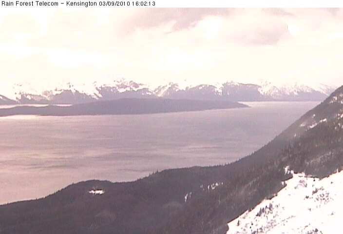
Kensington Ridge Webcam, NW of Berners Bay, looking SE at Berners Bay
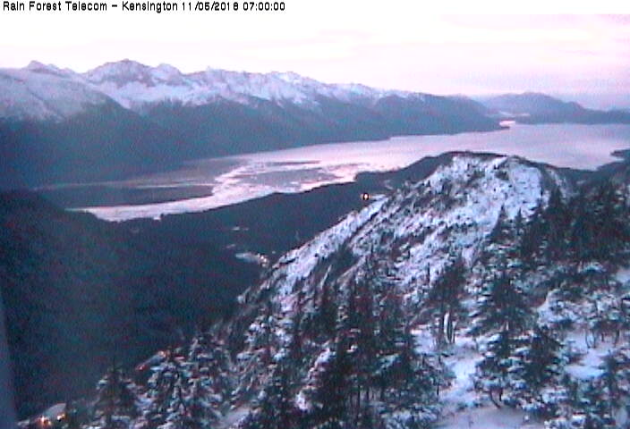
Elevation: 2800 ft
|
Kensington Ridge Webcam, NW of Berners Bay, looking south
Elevation: 2800 ft
|
Kensington Ridge Webcam, NW of Berners Bay, looking SW at Lynn Canal

Elevation: 2800 ft
|
Kensington Ridge Webcam, NW of Berners Bay, looking west at Point Sherman

Elevation: 2800 ft
|
Kensington Ridge Webcam, NW of Berners Bay, looking NW at Lynn Canal
Elevation: 2800 ft
|
Berners Bay, north of Juneau on Glacier Hwy 7 @ MP 40, looking west (FAA)
![]()
Elevation: 29 ft
|
Berners Bay, north of Juneau on Glacier Hwy 7 @ MP 40, looking NW (FAA)
![]()
Elevation: 29 ft
|
Berners Bay, north of Juneau on Glacier Hwy 7 @ MP 40, looking north (FAA)
![]()
Elevation: 29 ft
|
Glacier Hwy 7 @ Cohen Drive MP 21, north of Juneau, looking south (AKDOT)
![]()
Elevation: 200 ft
|
Lena Point, north of Juneau on Glacier Hwy 7 @ MP 17, looking south (FAA)
![]()
Elevation: 170 ft
|
Lena Point, north of Juneau on Glacier Hwy 7 @ MP 17, looking SW (FAA)
![]()
Elevation: 170 ft
|
Lena Point, north of Juneau on Glacier Hwy 7 @ MP 17, looking NW (FAA)
![]()
Elevation: 170 ft
|
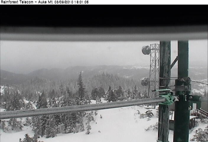
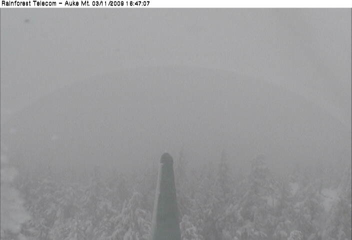
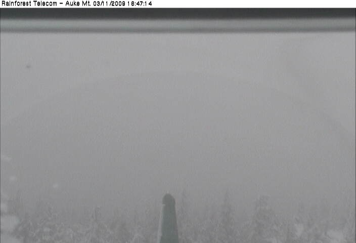
Auke Mountain Webcam, NW of Juneau on Glacier Hwy 7 @ MP 16, looking east at Mendenhall Glacier
Elevation: 1900 ft
|
Auke Mountain Webcam, NW of Juneau on Glacier Hwy 7 @ MP 16, looking SE towards Juneau
Elevation: 1900 ft
|
Auke Mountain Webcam, NW of Juneau on Glacier Hwy 7 @ MP 16, looking SE towards Fritz Cove
Elevation: 1900 ft
|
Auke Mountain Webcam, NW of Juneau on Glacier Hwy 7 @ MP 16, looking south towards Outer Point
Elevation: 1900 ft
|
Auke Mountain Webcam, NW of Juneau on Glacier Hwy 7 @ MP 16, looking SW
Elevation: 1900 ft
|
Auke Mountain Webcam, NW of Juneau on Glacier Hwy 7 @ MP 16, looking west towards Lynn Canal
Elevation: 1900 ft
|
Pedersen Hill, north of Juneau on Glacier Hwy 7 @ MP 11, looking NE (FAA)
![]()
Elevation: 189 ft
|
Pedersen Hill, north of Juneau on Glacier Hwy 7 @ MP 11, looking SW (FAA)
![]()
Elevation: 189 ft
|
Pedersen Hill, north of Juneau on Glacier Hwy 7 @ MP 11, looking SW (FAA)
![]()
Elevation: 189 ft
|
Pedersen Hill, north of Juneau on Glacier Hwy 7 @ MP 11, looking west (FAA)
![]()
Elevation: 189 ft
|
Mendenhall Glacier Visitor Center, north of Juneau, east of Glacier Hwy 7 @ MP 10

Elevation: 200 ft
|
Alaska Panhandle: Central Portion, Juneau and Vicinity, Glacier Hwy 7 Corridor ..
|
Glacier Highway/Egan Drive @ MP 3, in Juneau, looking NW towards airport (AKDOT)
![]()
Elevation: 50 ft
|
Glacier Highway/Egan Drive @ MP 3, in Juneau, looking SE (AKDOT)
![]()
Elevation: 50 ft
|
Glacier Highway/Egan Drive @ MP 3, in Juneau, looking SE at bridge (AKDOT)
![]()
Elevation: 50 ft
|
Juneau National Weather Service Webcam, looking NW

Elevation: 100 ft
|
Juneau National Weather Service Webcam, looking NE

Elevation: 100 ft
|
Juneau National Weather Service Webcam, looking SE

Elevation: 100 ft
|
City and Borough Of Juneau Cams, looking north from library

Elevation: 100 ft
|
City and Borough Of Juneau Cams, looking south from library

Elevation: 100 ft
|
City and Borough Of Juneau Cams, looking at roundabout

Elevation: 100 ft
|
Juneau Loading Dock, Alaska Marine Lines Webcam

Elevation: 50 ft
|
Goldbelt Mt Roberts Tram Webcam, just south of Juneau, looking NW up-valley from aerial tramway top station
Elevation: 1800 ft
|
Goldbelt Mt Roberts Tram Webcam, just south of Juneau, looking down at Juneau from aerial tramway top station
 |